17.7 miles, via Huby, Almscliff Crag, Briscoe Ridge, Stainburn Forest, Scargill Reservoir,
Beaver Dyke, Knabs Ridge, Kettlesing Bottom, Cinder Hills, Darley Moke Hill, Hartwith,
Burtree Hill, Brimham Moor, Brimham Rocks, Hartwith Bank, and Summerbridge.
Last week's trip felt like it came to a bit of an abrupt end, feeling like it ought to have an extra hour or so to it as it dropped us in Summerbridge at the bottom of the hill on which Brimham Rocks stand, not to be seen on that occasion as the walk up Hartwith Bank was not something to be attempted after 13+ miles on the trail, and thus we have a target already set for this weekend, as it would be profoundly foolish to both holiday in Nidderdale and have half a summer of making trails over there without attempting to visit the locality's most famous attraction. So we pick our start line by moving downstream on the Wharfe, and we won't quite be able to see if Brimham Rocks really are accessible directly from West Yorkshire as there is no crossing point on the river between Arthington and Castley, and even if there were it might prove to be just that bit too far to be viable on a single day's trek, especially when the route we have plotted, from Weeton station on the Harrogate line, is going to be close on the year's longest, even with being a mile or so into North Yorkshire already. Rail travel at least gives us the option on an early start for a trail that will absorb most of the day, dropping us off at 8.50am, where the surviving station houses have already been noted, though the period coal yard is something I hadn't noticed before, and we set out onto the A658, through the outer edge of Huby village, where Weeton station is inexplicably located, pacing the edge of the Dudley Hill, Harrogate & Killinghall road past the Almscliff Village hall and on to our rising path up Holly Park, where various vintages of suburbia have landed deep in the Yorkshire countryside. Having gained some altitude we meet the tracks around Holly Hill farm, and sight of our first destination is met as we hit the rising field boundaries that elevate us above Wharfedale and point us in the direction of Almscliff Crag, looming high above, but before we get there we'll have to negotiate a path among the cows, thankfully docile in the field below Crag House, before we can get a firm footing on Crag Lane. Pass on around the low skirt around the Crag, passing Cliff House and Crag farm, to show the Grotstone outcrop really is the only feature of note in these parts, taking views of the rock as it looms high above Wharfedale, and enjoy the evolving views around as we meet the track pioneered in June and leave the Crag behind us we hit Long Lane and find it reveals a completely different aspect on the valley when descended, like that should come as a surprise.
 |
| Huby village on the Dudley Hill, Killinghall & Harrogate turnpike. |
 |
| Cliff House, with docile cows. |
 |
| Almscliff Crag, from a completely unfamiliar angle. |
Gindhill / Greenmires Lane take us on into the elevated fields to the north, featuring more resurfacing work that seems to a feature in these parts having noted it around Norwood Edge last week, and we can look over the receding Crag and over the headwaters of the Crimple Valley as we rise to meet the bridleway that leads over the moorland edge of Rigton High Moor and up to Briscoe Ridge, and that means lots of rough grass and sheep up around the 200m contour, as we press on up the perimeter of the viable farmland. Not a huge amount of interest on this hillside, aside from evidence of logging on the nearby plantation, as we look east over Harrogate, largely hidden from view and focus attention on just how much marginal land there is in this quarter, and looking forward to the gas offlake station up on the top of Briscoe Ridge, still having no idea as to its purpose (storage well away from civilisation is my best guess), but its many pipes certainly have an aesthetic appeal among these high fields by the B6161. Crossing the familiar road, we can hit the long path that leads to Lanshaw Farm, tending the fields around Lindley Moor, with the woodlands of Stainburn Forest surrounding them, and we can get our first proper looks to the north as we hit the crest of the ridge, and to also feel the full force of the persistent Nor'-Wester that has now entered its third weekend of blowing over these hills, which seems to be dumping some unseasonal looking rain over Wharfedale as we stay just about dry. Pass the farm that has mastery of these marginal lands and hit the woodland edge, meeting the high plateau of Stainburn Moor and the 245m trig point that sits at it eastern end, hopeful that a promised right of way still exists through Stainburn Forest, and it does, as a wide passage through the trees offers us some shelter, and we get a sun-dappled trek among the trees that still proves to be tough going thanks to the moist and carved up surface, which proves that moorland ground conditions endure even when covered in conifers. Both tall old trees ands squat young ones are met before we emerge into the sunlight in the carpark on the corner of Norwood Lane, just a short way along from Little Alms Cliff, and we have to pace along the re-done surface of the lane for a while to meet the permissive path that leads us down through the blasted fields of Scargill Pasture, home to more sheep and random huts on the way down to Scargill Reservoir, a fine trek that offers many views to the highlights of Upper Wharfedale and Nidderdale, which has our destination feeling close even when it isn't, receding from view as we meet another of Harrogate's water stores, well concealed in its side valley above Oak Dale, or Beaver Dyke, or whatever...
 |
| Rigton High moor and the way to Briscoe Ridge. |
 |
| Distant Stainburn Forest and Lanshaw Farm. |
 |
| Clear passage through Stainburn Forest, with soft going. |
 |
| Scargill Reservoir, in the midst of Scargill Pasture. |
The sunshine disappears and it gets chillier as we pace along the perimeter path by the side of the run off channel down to the valve tower, seeing the high lands of Stainburn Moor recede and passing the reservoir house has us finding an ideal fantasy country retreat before we pace down the water board's access road down the side of the embankment dam, and down into the wooded cleft of Scar Gill, which has us feeling warm again as the wind eases off. It's a lovely and peaceful track, winding down among the trees and over the beck multiple times before the day brightens again and we move out into the valley of Beaver Dyke and we leave the hard track that leads on below the now-breached dam of Beaver Dyke Lower reservoir, joining the grassy track as it rises up towards Long Liberty farm and looking back to observe nature reclaiming the body of the reservoir, something that I'm pretty sure I haven't seen on any of my travels. Meeting the track and the farm has us at the top of our experience field in the Wharfedale - Harrogate bracket, and the rising farm track beyond has us heading into the unknown for a few miles, though we get a panorama of great views across the path travelled over Stainburn Moor before we can focus our attention on Knabs Ridge and its windfarm on the other side of the tree-lined Penny Pot Lane. I've already stated on many occasions just how much I love wind turbines, and its quite an experience to have six of them whirling away above me as we traverse across the 210m high fields in which they stand, finally getting a firm fix on their location after seeing them from afar from so many angles over the last three months, and this high pasture introduces us to the closer view of Nidderdale, rolling up to the A59 to see that this is the best spot to see RAF Menwith Hill as its radomes are far more visible from this side. A farm track leads us downhill, again, with a local man being met to wonder about my destination and to warn me that Siddle Lane gets somewhat overgrown before it emerges as the driveway to a rather swanky property by Kettlesing Lane, which leads us down into this outer part of Nidderdale that has many scattered farms and cottages but few obvious villages, and we meet maybe the heart of this district at Kettlesing Bottom. This seems to be the heart of Felliscliffe parish, where school, pub, stocks and war memorial can all be found clustered on the banks of Tang Beck, the major watercourse in these parts, and previously seen on The Way betwixt Birstwith and Hampsthwaite, a remotely picturesque spot, with a bench conveniently located by the old chapel, ideally placed for lunch as if they knew someone might come this way when walking to Brimham Rocks.
 |
| Lower Beaver Dyke Reservoir (former). |
 |
| Knabs Ridge Wind Farm. |
 |
| Menwith Hill show many more Radomes when viewed from the A59. |
 |
| Kettlesing Bottom, at the heart of Felliscliffe parish. |
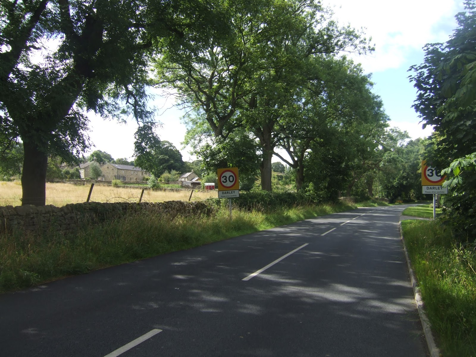
Post feeding, it becomes clear that the day will not make up its mind about whether it will be overcast or sunny, so we steel ourselves for changeability as we move on up Sleights Lane, among the company of farms and cottages to get views back to the windfarm in the early going and across to the radomes in the later as the latest ridge is crossed beyond Crow Trees and Springfield farms as we get a feeling of elevation at over 200m before we get our next reveal of Nidderdale, finally above the valley-side proper as we hit Back Road, right at the edge of Birstwith Parish. The rising cleft of the Nidd valley is clear, rising up past Darley and Summerbridge, with Heyshaw Moor showing up its best high profile to the west, and after a short shift along the lane, we get Brimham Moor rising beyond Hartwith Hill and our passage across the valley of the Nidd is set, as Langer Hill Lane starts us off downhill, with the elevated views gradually devolvoing as we descend down to the farm cluster of Cinder Hills, with the road degenerating to a rough track beyond. Still get some fine views to east and west through the shade of the trees on the trip down the valley side, especially to the wooded banks of Swarcliff that hid so well from view whilst on The Way by the riverside, and soon we drop out on Darley's Main Street, just to the east of the main settlementand passing between the Southfields and Moke Hill farm complexes to once again draw agonisingly close to the village, but leaving it's long ribbon of building unseen as Nidd Lane invites us further downhill by its first terrace. The country lane directs us down towards the river, moving around the local sewage farm, and on down below the former Nidd Valley line to have us on a familiar waterside path, passing over it and inside the Nidderdale Way to cross over the Nidd via the footbridge previously seen, arriving on the north bank and heading on over the surprisingly wide and flat flood plain on the old lane that once serviced the ford that has since been surpassed. The path leads us between the pair of farms that dominate the valley bottom, White Oak and Brichfield, and we can then join the lane up through Willie's Wood to start regaining all the altitude lost since we made our arrival in the valley, arriving by the Birchfield Dairy that has grown from a small ice cream parlour to being a feature farm park with a maize maze and an adventure playground on the high side of the Nidd. It's a place sure to attract the tourists, which it did for me and the family back in May, and the driveway can be followed all the way up to the B6165, not least because the permissive route of the bridleway is only visible from above, and we'll have to brave a few more paces on the main road before we continue our ascent of Hartwith Hill.
 |
| Nidderdale revealed from Back Lane, our destination on the right. |
 |
| Darley draws close, Moke Hill farm at left. |
 |
| Darley footbridge and the passage over the Nidd. |
 |
| Birchfield Dairy (and farm park), for all your Ice Cream needs. |
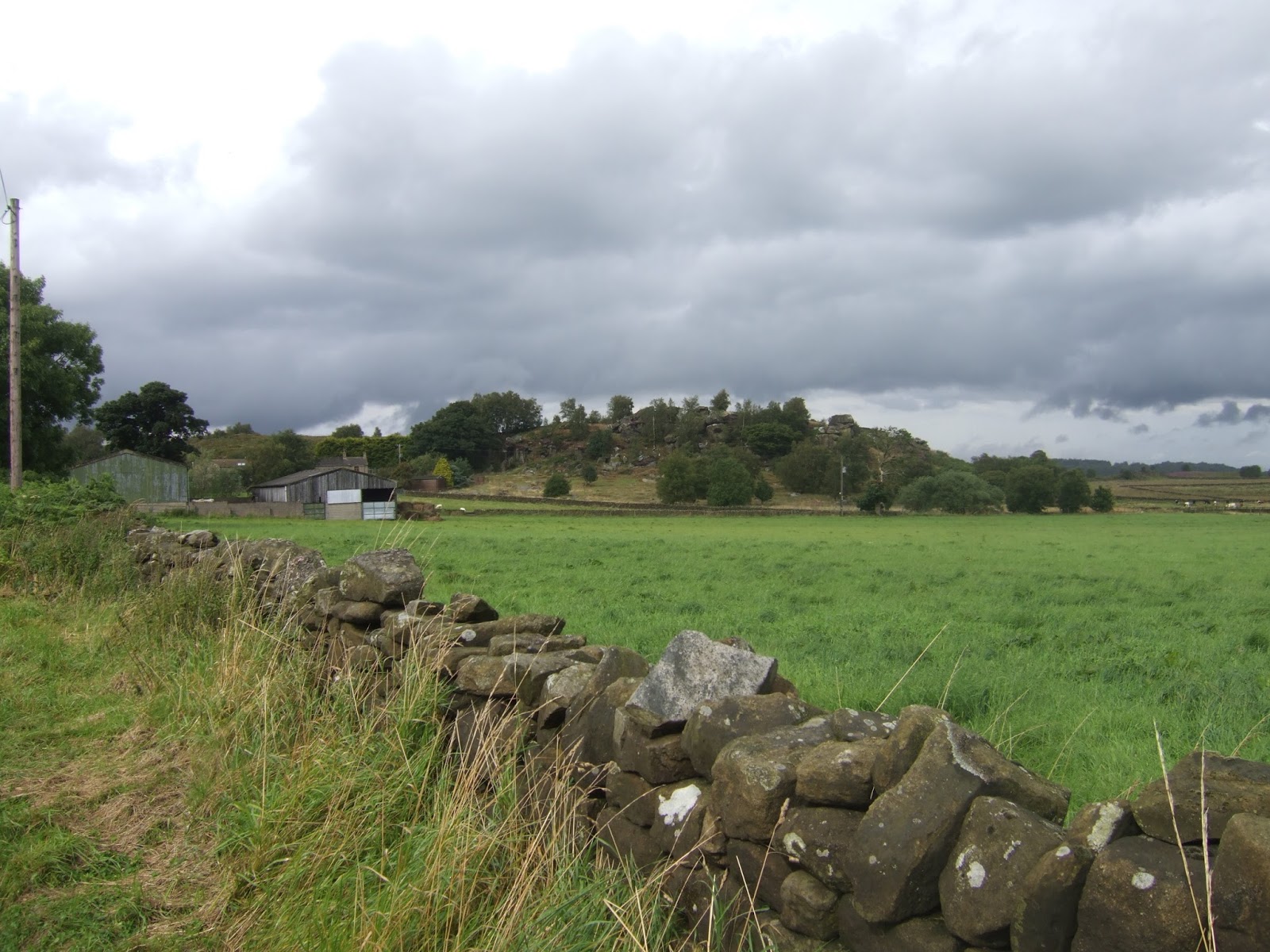
Good elevated views return as we stand 140m up, across to Darley and down the valley for an aspect not previously seen on the trail, with Swarcliff still prominent, joining the rising lane up to Parson's Stoop farm, which isn't on my E298 as it was only established in 2005, and we get more expansive views across to the descending clefts of Darley Beck and down the valley towards Birstwith, feeling grateful as we go that there are plenty of fences along this track as some of these local cows are far too excitable about having a visitor in their midst. Sunshine clings on over the valley, but gloominess looms ahead as pass through the farm's yard and on to the field boundary for a long walk among recently mown grass that does the eyes no favours at all, rising up towards the hamlet of Hartwith, which seems quite prominent thanks to the presence of St Jude's church, but amounts to little more than the vicarage, the church school and a single farm beyond that, and a close look at the church is worth a detour as the paths get a bit tangled as we finally arrive around the 200m contour. The views into the Nidd valley recede as the Moor Road is traced across the high fields, past Edge Nook and Highfields farms, giving a fresh view across the Vale of York to the high perimeter of the distant North York Moors, whilst any sights from my first day on the Nidderdale Way seem elusive as we get views back across the passage of Thornton Beck. Focus forward then, past Prospect house, and another fixer-upper dream house to see the wide expanse of Brimham Moor revealing itself, with the Beacon presenting our first rock formation on the horizon, pass the oddly specific Give Way in 142 yards sign to find the way forwards would have been much easier if the right of way still existed through the yard of Fiddler's Green farm, itself fancying itself as having a bit of a family farm makeover. So our path has to dog leg a bit along Rocks Road, past the Acorn 'Wellness' Retreat, in the direction of the vegetation clad lump of Burtree Hill, and a footpath shortcut apparently exists from the lane, but an impenetrable wall of bracken ensures that we have to sneak a walk up the driveway to Shepherd's Lodge instead before we join the field path that leads on to the very south-east corner of the National Trust's Brimham Moor estate. Unfortunately, there seems to be no obvious route from one field into the other, so we might have met another case of two paths that don't actually meet where the map suggests they might, so some flexibility is needed to clamber under the wire fence and over the stone wall to gain entrance to the estate, feeling saddened that this moorland of purple heather is rendered drab by the gloomy skies that prevail.
 |
| Down Nidderdale from Hartwith Hill, Swarcliff on the right. |
 |
| St Jude's Hartwith. |
 |
| Brimham Moor and the Beacon, dream house at centre. |
 |
| Burtree Hill and so much bracken. |
The path might be tenuous in usage and purpose, its direction is at least clear, as it has been recently mown to give us an obvious route to follow as it wanders its way northwards around the rocky and bracken clad edge of Riva Hill as we meet the passage of the Nidderdale Way again, crossing it to start a establishing new northern border on the experience field and feel more disappointment that the expanse of the moor hides from view behind the many clumps of trees that litter its southern portion. At the eastern edge, we wander through the banks of trees to find some particularly boggy going in the shade around the headwaters of Shaw Beck, emerging from under the birches to rise on the moorland path towards the upper half of the moor, where all the interesting rocks reside, with just about all of the moor hidden by the low undulations of the landscape, and for a moment, the sun taunts us by coming out to light up the scene before a wall of cloud comes over to bring an altogether more ominous hue to the skies. We are just about on Rocks Road when the drizzle starts to come on and the disappointment of having come all this way on apparently sunny day when primed for the Summer's centrepiece occasion only to get rained on is felt particularly hard, so as we meet the hard surface, by some of the best rocks on the edge of the high moor, all that is felt is gloom, as we will be getting lots of drab pictures of grey stones and greyer skies, pacing on around the loop of the road below the high moor edge before deciding that the waterproof will have to be donned. The rocks of Hare heads provide a few distractions but this isn't the best part of the moor, and the fields to the immediate north are rather flat and dull as if to offer an immediate contrast, but there's still hope of a first view of the landscape of moorlands above Nidderdale as we approach the road junction, but our look at Pateley Moor is nothing more than a wall of grey coming on hard, so we will be getting wet for quite a while as the full force of this North Atlantic weather sweeps in from the north-west. The very worst of the weather falls on this most exposed section, tracking along the boundary of the NT grounds, having to keep my E298 in my hands so that the rough path up to the moor top can be located, so once we're done with this journey it will look like its had 14 years worth of usage in three months, but we find the landscape grove elevating us up towards the high plateau of the moor, rising us below some bold blocks of sculpted rock and offering a good surface to clamber on, though the persistent rain and waterlogged heather and bracken ensure that most of me feels wet once we've risen up above 280m, whilst my leaky boots feel like their last days must surely be due soon.
 |
| Brimham Moor, lower half, with gloom hiding the heather's colour. |
 |
| Brimhan Moor, upper half, with the sunshine teasing us. |
 |
| Rocks Road, and the rain comes on. |
 |
| Pateley Moor revealed, and it's all rain. |
The moor top looks deserted, as if only the hardiest tourists might make it out here in these kinds of weather conditions, and the view to the east looks familiar at long last, which means that we are upon the upper edge of the main part of the Brimham Rocks site that was last seen in 2011 when I brought My Parents up here during a long weekend away, a decision that was a great on at the time and an excellent one in retrospect, and that means that my choice of path will lead us in the direction of the most interesting rocks. We soon arrive above the crags which loom above the northern edge of the moor, where the cracks between them conceal startling drops, and there are more bulky rocks to admire if rock strata and the patterns of cross-bedding are your thing, and indeed the formation of these layers of Millstone Grit over 320 million years ago is probably essential to the ultimate development of these rocks, sculpted by glaciation and the powers of wind and water in the subsequent ages. It's still not something I could honestly say I understood, even with years of geological curiosity in my past, but the Idol stone is probably the purest illustration of the forces at work, with a smoothed mass created by the grinding of ice, with the stratifications and ridiculously narrow base being scoured by the force of wind and sand, one to admire for as long as it endures, still a slightly surreal sight as it sits among the other looming rocks, shaped by freeze-thaw fracturing and centuries of weathering by the elements. The Druid's Writing desk is also a favourite, exactly resembling its name, sat on the very edge of the rocks, and not too far further along, we arrive at the heart of the estate, where the Dancing Bear is a prime illustration of how the human brain can resolve the most random of shapes into something familiar, and it seems that the tourist throng has not been driven from the moor, and most of them have been hiding in the Rocks House and the refreshment rooms, as they emerge again as the worst of the weather passes. So it feels much drier again as we take a detour up to the 301m trig point to see a Nidderdale panorama that is a lot more recognisable than it was back in 2011, and the Druid's Castle at the heart of the rocks estate can be admired from this elevated viewpoint, and it can hurt the head a little to know that there used to be many more formations like these ones on the many gritstone uplands around Yorkshire, but so many were destroyed by quarrying as recently as the 19th century. At the very least we still have this one, and our passage away must start as we will have to start the trail homewards, having walked too many miles to tour the site fully, and so we move on, past the Lover' Leap on one side and the Eagle on the other, where natural forces have somehow created an exact replica of Sam Eagle from The Muppets.
 |
| Ascending to Brimham Moor's high plateau. |
 |
| Brimham Rocks: The Idol. |
 |
| Brimham Rocks: The Dancing Bear. |
 |
| Brimham Rocks: The Druid's Castle. |
 |
| Brimham Rocks: The Eagle. |
Follow the rougher path down through the woodlands at the southern end of the estate, where some of the rocks at the path side give the feeling of being in an underwater grotto, whilst others invite exploration by those ambitious enough to climb, and I regret not having printed a proper map to identify all these other formations, but on a day like this it would have rapidly become sodden beyond use, and so we follow our instincts to run us down to the car park, and despite being in good time, it doesn't feel like the sort of day to stop for ice cream. Depart the estate and return to Rock Road, and I'd love to bag a bus ride from here, but the Nidderdale Rambler is not a service designed to be useful and so we'll have to hot foot it down to Summerbridge under our own power as we meet The Way once more and roll on down to the limits of the National Trust's land, and start the path downhill getting a good look over the Brimham Beacon once again, and taking my own cloud of flies with me as we set course for Hartwith Bank, clearly hungry and drawn to this exceptionally sweaty man. The further risks of rain are thankfully gone as we pass over the crossroads and move on downhill, to get Menwith Hill and Stainburn Forest on the horizon again, thankfully losing the flies as we pass High Pasture farm, where we might be able to buy raw milk, if we had an adequate method of keeping in cool on the long trip home, with the road soon settling into a groove among the high fields as the bank approaches. The 1 in 5, Z and /\ signage all indicate why walking up this road was never going to be an option, and even with modest amounts of traffic on Hartwith Bank have it feeling dangerous as we descend steeply under the cover of the trees of Old Spring Wood with plenty of concealed corners, and the slick post-rain surface does not aid a speedy descent either, to run into Summerbridge as it arrives earlier than anticipated. Not that the road slackens off as we meet the suburban growth that has attached itself to the village away from the main road, a place that offers desirable views across the valley for certain, and in no time at all we are on the B6165 once more, not needing to shelter in the Flying Dutchman, and being able to conclude the trip at 4.15pm, well within my target time, on what was almost the longest walking day of the year. As there's plenty of time until the long ride on the #24 starts so a seat can be taken in the bus shelter on the inbound and wrong side of the road where lunch can be finished as early tea, and I can turn over the relative success or failure of the day, as in the instant I feel rather gloomy, tired and damp, in retrospect, I think this day will be reflected as one of the really good ones.
 |
| Brimham Rocks: An underwater grotto. |
 |
| Brimham Rocks: For Climbing! |
 |
| Brimham Beacon, closer up this time. |
 |
| Hartwith Bank brings a horrible descent. |
 |
| Summerbridge's suburban living with a fine view. |
5,000 Miles Cumulative Total: 2952.6 miles
2017 Total: 387.6 miles
Up Country Total: 2693.1 miles
Solo Total: 2696.3 miles
Next Up: Wharfe to Nidd for the last time for the Summer, with Three Model Villages!


No comments:
Post a Comment