13.2 miles, via Leathley Bridge, Farnley, Lindley Wood reservoir, Norwood Edge,
Bland Hill, 'Dangerous Corner', RAF Menwith Hill, Darley Head, Dacre, & Dacre Banks.
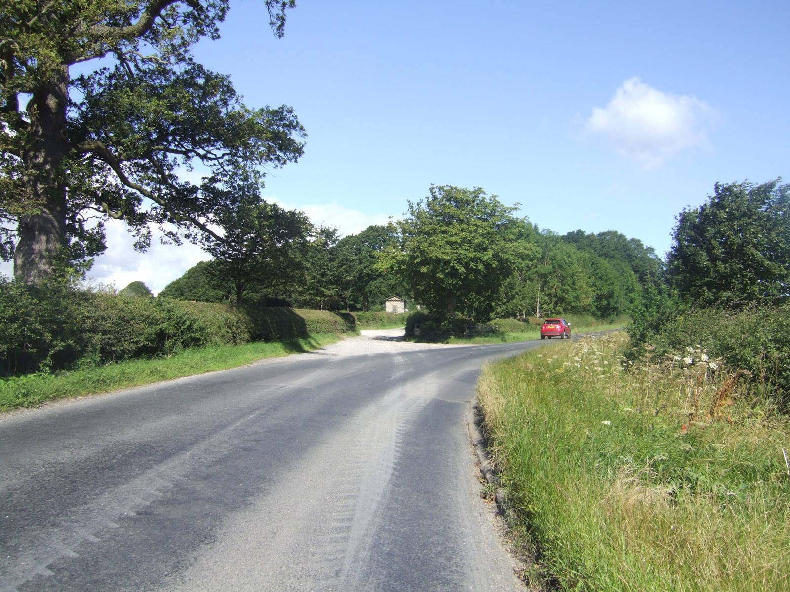
For my Wharfe to Nidd trails, it makes sense to progressively head downstream with my start points as we aim at a west to east exploration of the terrain of these new lands, and the next place down the river to start out from is obviously Pool in Wharfedale, which seems to be one of those places designed to be as hard as possible to access by public transport, so some thinking has to be done to land the bus changes and avoid an unwanted walk down either of the Pool Banks. Happily, departing the X84 and catching the #967 at the Dyneley Arms proves way easier than expected, and we can descend to the town, hiding below its high embankment, for a start at 9.20am from the Pool Bank Road - Arthington Lane corner below the village fingerpost, illustrating the idea that the name of the village might be a test of whether you are local or not, as the local might call it just 'Pool' whilst the clueless visitor might add 'in Wharfedale' without knowing any better. We press on to the river, away from the White Hart, St Wilfred's church, the Half Moon and away from this place that really has no alternative routes away from the main roads to make our rapid transition into North Yorkshire, over Pool Bridge and the Wharfe and along the side of the A658 to the B6161 corner and move on to Leathley Lane as this trip is again going to be all roads as we seek the easiest routes into Nidderdale. Push west, below the looming mass of the Pool Bank - Caley Park - Otley Chevin hill to the south, looking forward beyond Leathley to the high sides of the Washburn, and back to the wooded lumps of Riffa wood and Rawden hill, past the collection of farms in the low flat fields around the Wharfe riverside before taking the turn north to shadow the low outspill of the Washburn. Switch roads, at Leathley Lodge, which seems to be too small to practically live in, passing over the narrow Leathley bridge to the west side of the Washburn, dodging too much traffic as we go, before settling onto the rising road as it rises around the boundary of Farnley Park, with Hasling Hall farm occupying most of the lands to the south, over seeing the view to Rombalds Moor, and gaining 50m of elevation on the way up the East Lodge gives us some fine views over the Lower Wharfe and Lowest Washburn to Almscliffe Crag and a lot of sun-blessed greenery, bidding it a farewell as the lane hits the park's northern perimeter, but certain it will reappear again when we least expect it.
 |
| Pool in Wharfedale, the Fingerpost and Stocks. |
 |
| Caley Park and Otley Chevin, from Leathley Lane. |
 |
| Leathley Lodge, too small to live in? |
 |
| Farnley Park, eastern gatehouses. |
Beyond the Wilderness plantation we soon run up on Farnley Home Farm, already noted for its residential makeover but also enduring as a small business park developed in its yard and stable block, and here we can join the B6451 Farnley Lane, which will in its many guises take us all the way to Summerbridge and the Nidd, and we trace it north, shadowing the route from weeks ago, but this time with our mind focussed to the distant north, rather than to Knaresborough, which is actually much further away. Sunnier weather has Farnley looking even more appealing, but no less scattered, as we take the western turn by the school to approach the corner where All Saints church sits prominently, looking like an old chapel from a distance but displaying all the appearance of a Victorian facsimile when up close, and beyond we've some more altitude to gain, as the lane passes the last sentinels of the village, Yewtree and Peartree farms to land us about 100m above the Washburn, 150m above sea level, when we know a decent and sharper ascent are still to come. The road ahead isn't downhill all the way as it makes its turn into the Washburn, finding plenty of reasons to undulate as it settles on a north-westerly course above the waters of Lindley Wood reservoir, whilst looking across to the many woods, plantations and forests on the high eastern bank, with the way over Norwood Edge still to come, whilst the rising field to the south do not obviously offer the way walked previously, when we ought to be close enough for it to be obvious. We meet the Crag Farm driveway and the corner where Rose Tree farm resides, and the way already travelled is paced again, downhill against the traffic, pondering why the Washburn has no significant road running up its valley, to meet the heel of the reservoir which looks bizarrely low when we haven't exactly been in the grip of drought conditions recently, passing over the viaduct for the third time and psyching myself up for the climb to come. Having assaulted the hell that is Norwood Bank before at least has me prepared for it, but the sunshine makes it a bit more challenging this time around, but no real sweat is to be had as the legs are feeling well tuned and we are soon up past the chapel at Norwood Bottom and the desirable house that is Norwood Hall, this time flowing the long loop of the ascending road to get some fine views over the Lower Washburn before we hit the edge of Stainburn forest and find there's still quite a lot more ascent to come beyond the carpark, and if the views through the trees to Weston and Askwith moors are not enough to sustain you, a roadside marker has been placed there to encourage all on the ascent, 'You've Got This!'.
 |
| All Saints church, Farmley. |
 |
| Norwood Edge, and Lindley Wood reservoir. |
 |
| The chapel and company, Norwood Bottom. |
 |
| Norwood Edge plantation, 'You've Got This!' |
Not much further to go beyond there to reach the 266m road summit, having ascended about 170m from the reservoir, passing below the mast, still well shrouded, to emerge from the top of Stainburn Forest, and despite having seen this view before, the way it evolves as we arrive on the high edge is still something to see as the panorama reveals itself from east to west, North York Moors, Knab Ridge wind farm, RAF Menwith Hill, Brimham Moor, the Upper Washburn Reservoirs, the upper Nidderdale moors, the upper Wharfedale moors, and the bulk of Blubberhouses moor all emerging in short order. It's a downhill press over the high fields that we share with Sandwith Moor, taking plenty of views down into the upper Washburn, with Swinsty and Fewston Reservoirs in full view, taking care to keep away from the crowds of bikers who are having their weekend burn on the B6451, and allowing Stainburn forest to retreat as we descend past Brand farm and skirt the small plantation at the roadside. The evolving view to the west lets the eye trace last week's path, only a few miles way to the west, and this is the first viewpoint that we've found that makes Askwith moor appear large and formidable, its impressive length being on full view from over here, something to see while the views to the east reveal little, and we approach the road junction on which the hamlet of Bland Hill sits, the heart of Norwood parish at 200m elevation. Like Stonehouse crossroads, it's an odd place to find a suburban enclave between a few farmsteads, but it does have all the views and provides a bench where lunch can be taken and the signage can reveal that we are already at the half way point of the day, and past the best portion of the weather too, sadly. Push on post-feed, to pass the old school house and the bespoke furniture manufactory, to find that's not too far along Brame Lane that we run into The Sun Inn again, and the road can skirt its way around the headwaters of Beaver Dyke with the valley of the Washburn falling away to the west, convincing me further of the post glacial origins of this particular landscape. The road twists and turns plenty, among farms that sit really not that far away from Fewston village, well concealed below, and attention feel like it should be drawn to the north as we roll on towards the A59, but the moors to the north of the Wharfe linger on the horizon for quite a while as we head on along rough field edges and startle the young cows in an open enclosure, eventually rolling up the Dangerous Corner, where the two main roads cross between a pair of farmhouses, probably noted for its accident probability, it's an unofficial name that makes me chuckle every time I read it on my OS map.
 |
| The way to come, RAF Menwith Hill and Co, from Sandwith Moor. |
 |
| Bland Hill, dull name, excellent views. |
 |
| Twisting the day away on Brame Lane. |
 |
| 'Dangerous Corner', where the A59 crosses the B6451. |
Attention now comes around to the feature of the day as we approach the extensive plot that contains RAF Menwith Hill, observed so many times from a distance, and soon located hidden away behind a deep ditch, a thick wall of vegetation and an intimidating looking fence, and having observed its radomes so many times from a distance, it's rather disappointing that they should be so hard to see when up close, their white geodesic surfaces being well concealed by a background of clouds. So push on with the rising lane, wondering if the CCTV cameras are watching my passage, and seeing it the westward view reveals anything of interest beyond the few farms in the landscape, which turns out to be a negative, so views are take past the service entrances to Menwith Hill to get our radome fix, with three revealed by the blocked off entrance, and another by the main visitor processing entrance, which all looks rather paranoid at this remove. Altogether a rather disappointing spot to visit for landscape interest, who'dve thought that an intelligence base, whose operations are shrouded in so much secrecy, would offer so little to the casual visitor, this is clearly a place to look at from far away or to personally have an objection to because it is of virtually no interest when viewed from the adjoining road. Meet Menwith Hill Road, running over the elevated land that actual forms the hill so obscured by the base, and last looks are taken by to its residential blocks and water tower before we shift attention forwards, and the great viewpoint emerges as Heyshaw and Brimham moors rise above the horizon, and we finally take our obvious steps towards our destination as we approach Prospect Farm and pass the signs formally welcoming us to Nidderdale (the AONB having been met way back in Farnley. The weather has turned, and brings us an unwelcome lashing of rain as we enjoy our late steps on the high lands, and it feels a lot more like a decent day in October than a day at the heart of August, and thus a damp haze hangs over the Valley of Nidderdale as we start to descend from the high plateau that we've been on since Norwood Edge, slipping down from over 200m elevation to follow Hardgroves Hill downhill. Around Egmont House Farm and down another steep and challenging section of the B6451 we go, losing 50m of altitude but gaining more sightlines over Nidderdale to the north and east, to the sweep of the Nidd around Hartwith Hill's promontory, and up to the woods that hang on the hillside above Summerbridge, as well as getting a fresh perspective up the wide and wooded cleft of Darley Beck and to the high fringe of Heyshaw moor as we arrive in this oddly residential corner of the dale.
 |
| RAF Menwith Hill, its Radomes are as well hidden as you might expect. |
 |
| RAF Menwith Hill, a very disappointing landscape for the walker. |
 |
| Prospect Farm welcomes you to Nidderdale. |
 |
| From Hardgroves Farm, the descent into the valley. |
Beyond Crake Lane, the road gains a footway as we run into the western end of Darley, where a suburban ribbon has stretched out over quite a distance above the river, a village that we can only catch sight of to the east as we pass the cluster of cottages at its Head around the Wellington Inn, heading downhill further to meet the Darley Mill Centre, where the shopping and restaurant complex closed last year, leaving this substantial mill building looking in need of TLC and revival, as major industrial buildings are rare in this valley. Bottom out at Darley Beck, and lose the footway as we hit the ascent up to Mill Hurst farm and the business park and admiring the views to east and west whilst feeling aware of the clock starting to tick now we are on the route of the #24 bus as we rise on to meet Dacre, sat on a prominent knob of land above the valley, with the inevitable suburban bungalows filling in the gaps between the older cottages. A place that would surely look nicer if the sun were to reappear, as we admire the view over the valley from the Providence chapel, soon left behind as the road runs on, shadowing the descending course of the Nidd far below, passing the entrance to Low Hall and hitting another steep decline as we get a straight line view to Summerbridge and conviction that our target time can be achieved as we start our final decent to the bottom of the river valley, as the Italianate villas at the top of Dacre Banks catch my eye, hiding among the suburban growth. It's odd that the offshoot of the village up the hill should have grown so much larger down here, but the presence of the NER Nidd Valley branch might have had something to do with that, the cutting of which is passed over on the road, and find that the station house, and perhaps the goods shed, have endured since closure in 1964, but the village is still substantial without it, and the village green surrounded by stone cottages and the Royal Oak inn suggest that it's much older. We can now meet the path of the Nidderdale Way again, and we can trace these familiar pavements past the old garages, Holy Trinity church and the local sports fields to meet the Nidd Valley Sawmills and the way across the Nidd via the Summer Bridge as we approach our destination at the top of the rise where the B6451 ends, on Summerbridge's Main Street, the B6165, which renders this small town familiar even though this is our first walked visit here. This is all we shall see of it on this occasion, with no time to take drinks in the Flying Dutchman or to see that much of the dressings still in place in the wake of the Tour de Yorkshire beyond the bottom of Hartwith Bank, as we've landed at 2.30pm with the bus only 10 minutes distant, and we find another conclusion to this walking day, as now Nidderdale has revealed itself to be only
5 hours away on foot!
 |
| Darley Mill Centre, in need of redemption. |
 |
| Dacre, high above the Nidd |
 |
| Dacre Bank, the village green. |
 |
The Flying Dutchman, Summerbridge, at the heart of Lower Nidderdale,
only 5 hours from West Yorkshire |
5,000 Miles Cumulative Total: 2934.9 miles
2017 Total: 369.9 miles
Up Country Total: 2675.4 miles
Solo Total: 2678.6 miles
Next Up: We have to walk to Brimham Rocks, don't we?


No comments:
Post a Comment