16.9 miles, via Middleton, Bow Beck, Denton Moor, Timble Ings woods, Timble village,
Fewston Dam, Fewston village, Swinsty reservoir, Beaver Dyke, Haverah Park, Pot Bank,
RHS Harlow Carr, The Pinewood, and Village Gardens.
Back up country having had too short a week with My Parents back in Leicester, but having lost one weekend at the start of me week off, I cannot afford to lose another when I still have six walks planned for summer in the Wharfedale, Washburn and Beyond bracket, with a limited amount of available to get them in before the seasons make their inevitable shift, and so we get back onto the local trails after two whole weeks away, despite the weather not looking at all promising. To Ilkley we head, for its first appearance in 2017, and it is absolutely persisting it down with rain as we alight the train at 9am, and I'll be hopeful for this weather to not have too firm a grip on the day as more than a couple of hours of this might destroy the spirits on along trail that doesn't have any obvious escape route, and so we return to familiar pavements, striking north along Brook Street and leaving my planned exploration of the 1888 portion of the station for a less inclement day. Familiar sights come along quickly as we pass the Crescent hotel and the parish church, while a dense wall of mist obscures the moor from view, and it's odd that despite burning many trail around this town, I have never struck off to the north, so now the time to rectify that, pounding my way across the Wharfe vis the New bridge, and carrying on over East Holmes Fields, home to the Rugby, Football and Crickets clubs of varying stature, as well as the famous lido that still endures to this day. Early 20th century, and leafy, suburbia rules the day along the rising Middleton Avenue, convincing me further that every edge of Ilkley looks like the sort of place I could never afford to live, noting a very old Victorian post box along the way, with the vintage of houses getting progressively more recent as we join Curly Hill to pass up through Middleton Woods, which look a lot like they could be the outer boundary of the town until we meet still more suburbia above. This part of town, all looking rather achingly contemporary, would have an excellent view on a better day than this one, as we meet the town edge and the road up Hunger Hill to the modest collection of farmsteads and cottages which form the actual Middleton village (a settlement that names virtually everything on this side of the Wharfe above Ilkley), some 100m up from the river, which affords some fine aspects across Wharfedale, revealed pretty quickly as the rain eases off to less than a drizzle after 45 minutes of pounding down on the walking day.
 |
| Ilkley Station, half the size it should be, but still loved. |
 |
| Middleton Woods, suburbia above, suburbia below. |
 |
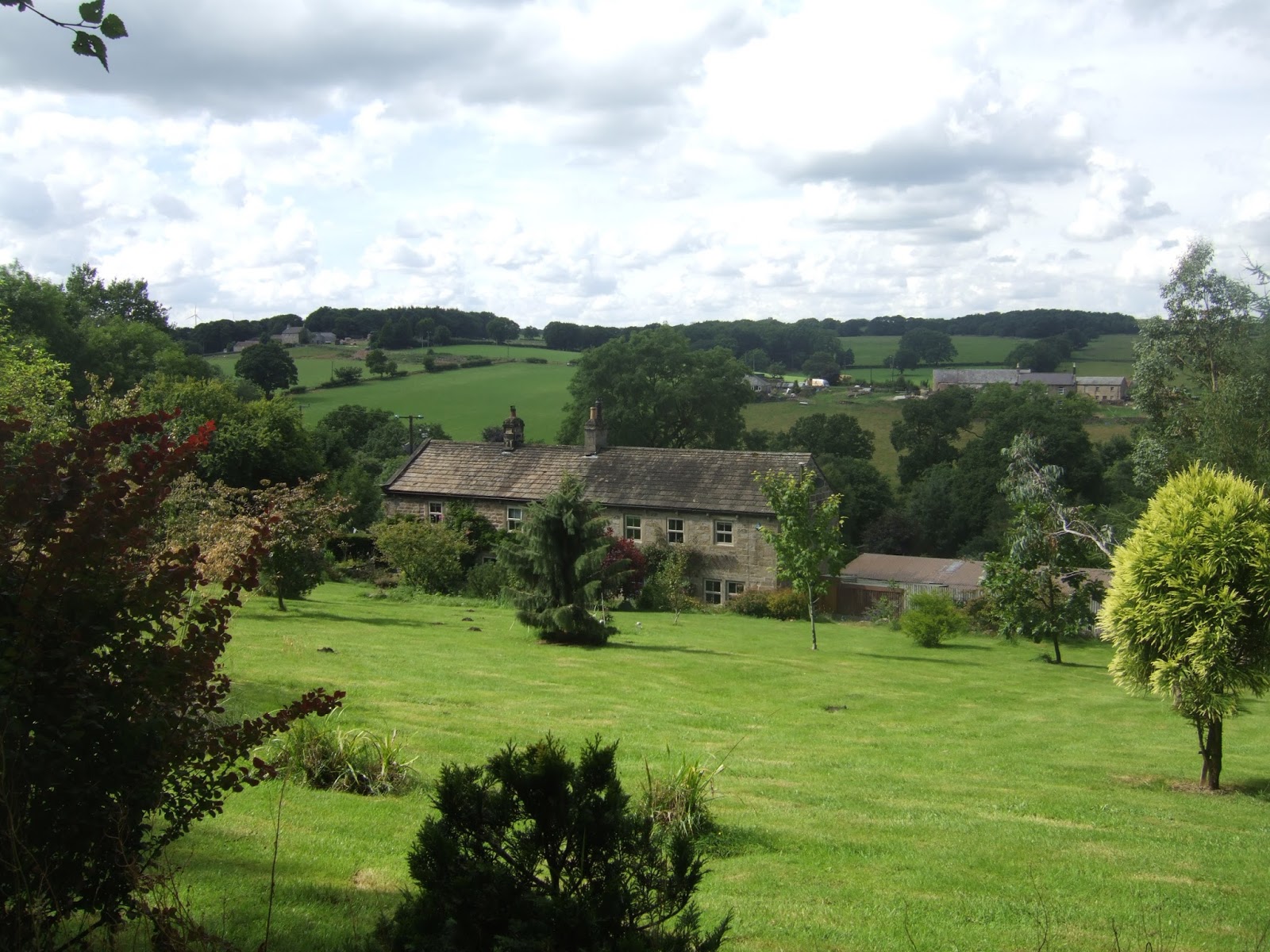
| Middleton village. |
So uphill we continue, loosening the waterproofs as the rise up to Hill Top farm, which offers a café for brighter days than this, and the gradual reveal of the uplands to come starts to become much more apparent after we join the track beyond, as Denton Moor and Round Hill rise at the centre of the moorland bulk that spreads all the way around to Beamsley Beacon and Askwith Moor at its extremities, perhaps forming the most forgotten moorland in all of Yorkshire. Still a ways away as we rise on to West Moor House farm, where the hard surfaces end and we start an eastwards tack through the rough grass behind East Moor House and downhill to startle the sheep as we are forced to make a passage through the wooded cleft of Bow Beck Gill, over it's little footbridge and then up the snaking track on the other side, where the path forward seem vague but soon located in the direction of Hollingley Farm, which also has a fine view over Wharfedale, now almost fully revealed as the rain vanishes and the clouds rise. An upill slog is in order to get onto Denton Moor, three large fields distant, and the wet ground reveals just how badly my boots have gotten leaky, so this might be their last hurrah as we rise to get views over March Ghyll reservoir, sat on the beck we just traversed, and up to the Beacon, and failing to trace the path we blazed from up there a few years ago on a path only a mile or so distant from this one, finally getting a great Wharfedale valley profile as we hit the 260m contour and the moorland edge.Various paths offer themselves on this infamously trackless moorland, and the one we will take is the one that rises highest, hanging close to the depression containing Dearncombe Beck and keeping an eye on the shooting hut off to the east, as we will be soon heading that way, soon rising away from the green and grassy track to find a clearer gap beyond the fields of heather, so less water gets in the boots, for which I'm grateful. Peel eastwards towards the shooting hut, but not actually approaching it, instead peeling northwards on a rising track that gets vague pretty rapidly, but once a sightline in gained towards Lippersley ridge, the high rise on Denton Moor, our route in that direction is not in doubt, and we can press on up to the cairn and boundary stone, at 330m+ elevation, to get a full view out over Blubberstones Moor to the north, and Round Hill to the west, plainly illustrating that there's a lot more moorland up here than you'd acknowledge, a fine place to break for elevenses as the first hint of sunshine breaks through.
 |
| The way to Denton Moor. |
 |
| Bow Beck Gill. |
 |
| Denton Moor Shooting Hut, with Askwith Moor beyond. |
 |
Lippersley Ridge cairn and boundary stone,
Beamsley Beacon and Great Hill beyond. |
The silence and stillness up here on this remote promontory is something to cherish and the view north view might reveal more of Upper Wharfedale and Nidderdale if it wasn't for the cloud cover, and the way east gives us the long profile of Askwith Moor, and a view across the Washburn to Almscliffe Crag and Norwood Edge, both very far from where we are, and I'll tag the route west for next year before we trace the ridge top onwards, following the boundary markers to the path that drops us down from the High Moor towards the massive plantation of Timble Ings, which dominates the view to the north east. Our path slips inside its perimeter and soon offers a tarmacked track along the woodland periphery and along the edge of a drainage channel that bisects the enclosures of conifers, a path that sees the usage of regular folks too, it seems, as these woodlands, operated by Yorkshire Water, offer more than just a path for those trekking the Dales Way Link, with ponds, nature trails and a cycling circuit up in this rather remote corner. I'm all in favour of there being other signs of life in these woods, as forest walking isn't may favourite thing, and the long access road takes us on to enter the Washburn valley again, soon getting a view to Norwood Edge again through the open fields to the south, but taking longer to get the Menwith Hill view to the north, pacing on past Sourby farms, and on to the high road crossing at Four Lane Ends farm, the lane north being the red route to Nidderdale. Push on to get views that give a fresh profile of Askwith Moor and the lower Washburn, and look north to see nothing of Fewston reservoir, despite its proximity, but do see the distant dam of Thruscross Reservoir hiding away, below the rising bulk of the Lower Wharfedale moors, taking further note of RAF Menwith Hill, its domes looking large on the nearby horizon as the lane is followed to descend into the village of Timble, the only enduring village in this quarter. Not a huge place by any stretch, a few clusters of farms and stone cottages on the edge of the high ridge that separates the upper and lower halves of the Washburn, but certainly looking rather pretty on its prime vantage point, complete with its Millennium Oak, its village hall and library, and pub, The Timble Inn, which was a walking target for a group of us when we walked this way many years ago, but ultimately missed when we did the reservoir circuit instead, so it's nice to finally make its acquaintance, even if it doesn't seem to be doing much trade on a grey day like this.
 |
| Exit Denton Moor, Enter Timble Ings plantation. |
 |
| Ponds, Timble Ings plantation. |
 |
| The Upper Washburn, with Thruscross dam at centre. |
 |
| The Timble Inn, Timble. |
Too early to stop for lunch we follow North Lane as it wanders its way off the ridge from 220m elevation (having not noticed the 100m lost since the moorland walk), getting views in both directions down the dramatic valley of the lower Washburn, and upstream to the much less exciting half as the upper watershed rolls down off the moorlands, meeting the edges of Swinsty Moor plantation and meeting the path previously seen as we meet the Millennium Stone at the southern end of Fewston Dam. So after making the highest ascent on all of my crossings of the Washburn, this descent has been the most gentle, perhaps obviously as we are much higher up the valley, but the 70m since Timble seems to have gone without being noticed at all as we move out across the embankment, observing numerous anglers in the waters of Fewston Reservoir and also remembering to look downstream to see the channel of the Washburn spilling out to the south. Pass the reservoir house and move on to meet Fewston village, or at least what's left of it as much of it was lost during the construction of Swinsty Reservoir, though I'm not certain if it was due to demolition of flooding, but it has a few newish houses in its imprint, as well as its Millennium Oak and an undulating road which appears to have had a lot of remedial work done on it in the wake of the rains of 18 months ago, I'd wager. It does have an enduring church though, St Michael & St Lawrence, which could be the cathedral of the Washburn as well as hosting the local heritage centre, and the lane beyond feels damp with all the tree cover above, but a change in the light quality indicates that we are seeing the day take a dynamic shift for the better as we arrive at the Stack Point picnic site on the reservoir shore, a good place to stop to shed the waterproofs and enjoy a sun-kissed lunch, whilst trying to get my boots dry. Move on over the embankment over Swinsty Lagoon and meet the Link path at its southern edge, pushing through the plantation on a particularly damp path, one which appears to be shared with a stream that has been swollen by the rains of the last night on its ascending stretch, so feet are soon wet again and the going beyond gets tough due to recent tree-felling and the subsequent surface carve up caused by the heavy machinery. Happy to meet the fields and the modest ascent beyond, quite a change from the heavy uphill pulls up Norwood Edge, distant off to the south, only getting to about 190m elevation as we meet the B6451 Brame Lane, where refreshment in the Sun Inn could be in order before our long push through Haverah Park.
 |
| Fewston Embankment. |
 |
| St Michael & St Lawrence's, Fewston. |
 |
| Swinsty Lagoon. |
 |
| The Sun Inn, Brame Lane. |
Beyond Bramelane farm, the way across the headlands of Beaver Dyke is not obvious as long marshland grass covers most of the fields to be traversed as we start off down the river valley that will take us all the way to Harrogate, spotting the gates to give us our best shot at route finding and trying to not startle the sheep as we go, reaching the northern edge below Bank End farm and rising to a sounder track, with the correct route still inobvious as we look back. Rise above the beck and the surrounding woodlands to meet the old track of Bank Slack, a path enclosed by stone walls and embankments which is suggestive of an ancient track of some kind, hanging above the valley and offering grand views downstream, though it's not in the best of conditions, frequently blocked by fallen trees and choked with undergrowth, and the wandering walker approves of the opportunity the rise to higher tracks occasionally. We soon get sight of the Upper Beaver Dyke reservoir, and the motte which sits above it at Haverah Park Top, home to a hunting lodge dated to the 14th century and once amongst the many holdings of John of Gaunt, whose name is still attached to it and proof that that man really did find titles in every corner of this country. Our path takes a high circuit around the northern shore of the reservoir, offering many perspectives south before rolling downhill to meet the perimeter wall and the dam, providing access to the motte if we had the time to visit, but eastwards we must go, into the woods above the Lower reservoir, rising to the upper perimeter of the plantation and getting no sight at all of the lake below, so attention instead turns to the Knab's Ridge windfarm, just beyond the rise to the north. Approaching Long Liberty farm, we finally get a view to the south and confirm my suspicions about the apparent invisibility of the Lower Beaver Dyke reservoir, as it appears to have vanished from the landscape, its dam breached and decommissioned at some point since my new E297 was printed, but there's still excitement to be had in the landscape, looking south across Stainburn Moor to the promontory at Little Alms Cliff, its yellowing grasses nicely framed by the dark trees of Stainburn Forest. Onwards past the farm, and onto a long track at the field boundaries, hanging high above the valley floor, where Beaver Dyke / Oak Beck hides from view, in a channel that seems far too large for it, wondering if the post glacial era had some hand in its formation, like the more dramatic Lower Washburn, and there's peace to be had up here too, the sound mostly coming from the many streams rapidly discharging their waters down the valley in the wake of last nights rain.
 |
| The head of Beaver Dyke. |
 |
| Beaver Dyke reservoir & John O' Gaunt's Motte. |
 |
| Across the valley to Stainburn Moor and Little Alms Cliff. |
 |
| Beaver Dyke or Oak Dale? A post glacial channel? |
Haverah Park, this parish which we travel through, must be one of the oddest in the county, as it has no villages in it and no major roads, another illustration of this odd and underpopulated hinterland between Wharfedale and Harrogate, so when a cluster of farms is met, you start wondering if all the farming that has gone on around here has been livestock only for the last few centuries, thus requiring the absolute minimum number of additional workers. So pass through the yards of Central House, Prospect House and Whin Hill farms, all showing up evidence of dealing solely in cows, sheep and pigs, whilst the dogs at the latter are especially displeased to meet someone passing through their domain, and the odd feeling of isolation is enhanced by the apparent absence of an access road to north of south, as this latitudinal path would be no use at all for any heavy traffic. Still high above the beck, we have declined only some 40m or so since we joined the channel several miles back, and the rising woods off to the east illustrate that we are not too far from greater Harrogate, finally getting ourselves a location context as the barracks blocks are spotted off to the north, and the track paces its last couple of fields before taking a turn southwards around the plantation above Oatlands Farm, which seems to have attracted so much random wood and detritus in its yard that it puts me immediately in mind of my Dad's garage. Pace their driveway down to Pot Bridge farm and then out onto the B6161 Pot Bank, which has to be paced particularly carefully among the lunatic traffic that is negotiating the steep approaches to Pot Bridge, where a peer over the side to Oak Beck can show it looking particularly busy after so much rain, and thankfully there's a field path to walk uphill to keep us off the road as we look to make our way into Pot bank wood. The owners of Pot Bank cottage do not want in it their garden though, and so a detour has to be made around in on a permissive path to enter the woodlands proper, where the tree cover is so dense that no views can be had across Oak Dale, but the way ahead remains obvious as we tack east with birch on the slopes below us and conifers on the rise above, and the turn towards the town is not obvious at all, so it's a surprise to suddenly meet the Ringway signage that has us back on familiar territory. It's looking a bit different only a month on, as the peaceful glade around Harlow Beck is filled with the sound of the swollen stream charging through it, and that's a roar that will keep us company as we pace along the other perimeter fence of RHS gardens Harlow Carr, which sounds as busy as ever from our perspective underneath the trees.
 |
| Haverah Park's farm cluster. |
 |
| Oatlands farm, with wood and detritus! |
 |
| Pot Bank cottage. |
 |
| Harlow Beck, looking busy. |
Emerge from the woods to pass through the yard of the Harrogate Arms pub, which seems to be closed down, which seems baffling as it ought to be impossible to fail when you have a tourist attraction like Harlow Carr gardens on the doorstep, and we move on up its northern edge to Crag Lane where its carparks have recently been expanded to meet the path, tarmacked and populated, at the edge of the Pinewood, the local wild plantation. Passing Oakdale farm and sitting at about 160m elevation, above Birk Crag, we get a fine panorama off to the north, so the locals might look across Lower Nidderdale without having to travel too far, and it's always good to see the local citizenry coming out on a warm afternoon to enjoy a stretch in this wild wood, or too chase a ball around on the enclosed playing field, now dry after soo much rain in the early morning. On through the woods to meet the passage across Harlow Moor road before the woodlands continue and we get the feeling that we might arrive in Harrogate town centre without having seen any suburbia at all, soon dropping out in the Village Gardens, which has doubled as the WW1 memorial garden and the home to numerous spas for a century, and has much history from the preceding centuries. The town has come out to play here, and we pace through the crowds, keeping the suburban terraces at a remove as we move from the memorial park to the spa park, and note the Old and New Magnesian well heads, preserve or doing business as refreshment rooms depending on their vintage, and follow the ornamental stream on among the many other garden features to meet the town at the end of Royal Parade. Here we meet Harrogate's most famous building, the Royal Pump Rooms of 1842, and pass on to meet the Crown Hotel, seriously huge in keeping with the town's spa heritage, and get the direction sensors going as we pass up Montpellier Hill to note that this really is a town of parklands and proud 19th century terraces, thinking that it might be a bit late in the day to join the queue at Betty's tearooms. On over the A61 to the square that's home to the War Memorial and St Peter's church, and then its on down among the smart façades of the shops on James Street to drop us out on Victoria Square, right opposite the station to prove that my homing instinct functions even in a town I do not know well, and that brings us to a slightly delayed end to phase one of the high season trails, having seen every type of weather come and go through the day and to pin down a 17 mile day at 4.35 pm, which is exactly where I'd wanted to be, back on the trail and loving it!
 |
| A Nidderdale view, from The Pinewood. |
 |
| The Old Magnesian Well, Valley Gardens. |
 |
| The Royal Pump Room, Harrogate. |
 |
Refreshment available at Betty's Tearooms, Harrogate
(if time and funds are not an object). |
5,000 Miles Cumulative Total: 2906.5 miles
2017 Total: 341.5 miles
Up Country Total: 2647 miles
Solo Total: 2650.2 miles
Next Up: Summer's Phase Two: Does One Simply Walk into Nidderdale?


No comments:
Post a Comment