15.2 miles, from Humberstone, via Netherhall, Scraptoft, Beeby, Hungarton, Quenby Hall,
Coplow Hill, Houghton on the Hill, Thurnby & Bushby, and Thurnby Lodge.
We're down country again, for my customary week off work in July, mildly frustrated that my first weekend got scratched from the schedule as my legs really needed a rest, despite having had a couple of days out from my usual routine at the hospital, and so to the Old Country we return, having travelled without a concrete plan, and so when my walking day comes free, we are as close as possible to heading out with a completely improvised plan. A village circuit seems in order, starting from close to home as I think that the Parental taxi deserves a rest, having aleady done a year's worth of driving in May, to give myself plenty of walking time whilst allowing My Parents to do their own thing while My Dad is not in the best of conditions, sadly, so onwards to walking in circles once more, not getting out too early to burn my way around some familiar territory in East Leicestershire, more filling in some un-walked paths than venturing far afield. So we commence in Humberstone, just after 10am, with a 6 hour circuit in mind, commencing from the corner in front of Abbots Road URC, a mile of so distant from my weekly base, starting out north and clockwise, to Hungarton Boulevard, where the Leicester eastern relief road was somehow squeezed between the houses, up to the corner of Netherhall Road, where the Moat Inn still dwells in my mind, despite having been replaced by a suburban branch of McDonalds more than decade ago. Onwards into the Netherhall estate, still showing a façade of many 1950s vintage council houses coated in a layer of off-whitewashing, followed in great quantity up the shopping parade that has a much more singular character and on past the open park with Scraptoft Brook running through it, having gained enough altitude to be able to look back the various tower blocks in Leicester's city centre. Pass the school locally known as Scrappy Valley, which appears to have been half shut down and forgotten about, and roll on to the newer part of the estate, 70s vintage below Hamilton College, and sweeping around the curve of New Romney Crescent, which leads us to the edge of the city, where Scraptoft's Nether Hall farm still endures as an equestrian establishment, and lending its name to the estate below.
 |
| Nethehall Road, Netherhall Estate. |
 |
| Nether Hall, Scraptoft, above Netherhall. |
Hamilton Lane offers the way on towards Scraptoft Village, one of those odd bits of local road that rarely got travelled along, to draw us into the oldest and most interesting part of the village, which after a phase of suburban growth some four decades back seems to be having a bit of a renaissance these days, with a whole nother settlement having grown on the grounds of Scraptoft Hall in recent years, covering the former Polytechnic campus pretty thoroughly. We hit the country lane of Beeby to head out into the fields, and development has arrived here two, claiming several enclosure as the city continues to expand, well beyond the city boundary, with some green separation space enduring in the form of the golf course and the rough fields that I was always told had once been a POW camp in the 1940s. Countryside comes on properly beyond Hall farm and the Keyham Lane (east) junction, pressing on north with a lot of thick Hawthorn hedges for company, keeping the wits sharp to avoid the rural traffic and getting occasional views to east and west to see Coplow Hill, our remote target for the day, and to the high Granite hills of Charnwood Forest, the oft-seen sentinels of the county. Descend as the road crosses Melton Brook, and then rises again, to give sight towards the Hamilton Estate which has finally had its expansion halted after reaching the city boundary, before the hedges resume and we pound on, past the other Keyham lane junction, and descend on to meet the slightly incongruous half-weatherboarded council houses on the edge of Beeby village. It would be much more of a hamlet if it wasn't for the presence of All Saints church with its stump spire and upside-down clock numbers, and it's got a fixer-uppers dream in Home Farm, fenced off and looking in need of a revival, and this is a place I'll always hold in affectionate and nostalgic regard as we take an unnecessary circuit around the large village green with the Redwood tree at its centre and Beeby brook running through it before joining Hungarton Lane and the rising road away. This leads us off past Cottage Farm and the hidden farm cluster at Little Beeby, as the track rises to reveal rather more industrial noise than you might expect from the extensive site at Manor farm off the south, whilst a look to the north will show up Beeby Grange, once the heart of a pick-your-own fruit farm that got a couple of visits in each of my childhood summers, the lane eventually twisting to reveal Village Farm above Hungarton, whilst not offering any sight at all of Keyham, very well concealed among the folds of East Leicestershire's fields and streams.
 |
| Scraptoft village, the non-suburban part. |
 |
| Coplow Hill, East Leicestershire's High Hill. |
 |
| All Saints church, and Home Farm. |
 |
| Beeby Grange, hiding in the haze. |
Colbaulk Lane offers the way forward in Hungarton, the latter part of which as already been seen multiple times, but it's the best way to come into this village, which still retains so much of its rural charm despite the suburban additions filling in every available space within its ancient footprint, getting the reveal of the Manor House at the main junction and up the hill to St John the Baptist's church at the hill top, and we won't be getting any closer than this today as we pass on down Barley Leas to exit the village by the Village hall and old school house. Pass over the local brook and head up the lane, soon getting sight of the clumps of trees which conceal Quenby Hall, and getting a good elevated view of the village just seen, revealing that this might be the best approach to Hungarton as it reveals itself scattered on the rising land, a view to savour and at the entrance to the neighbouring estate off to the south, we have well placed staring bench, ideally placed for lunch, below skies that look like they aren't going to get any less gloomy as the day progresses. Up the driveway we proceed, to the gates and the lodge house, continuing on down the tree-lined avenue with the estate fields filled with sheep, rough grass and the remnants of the former ridges and furrows of medieval farming, and it looks like Quenby Hall has had been investing in having new paths built, keeping the passing bridleway traffic away from the proud Jacobean era house, but as they don't seem to be finished yet, I'll stick to the mapped route, getting a close look at the house despite the weather and light being worse than it was the last time we were here. Pass on down the driveway to the back of the hall, taking a peruse of the view over to the plantations to the south and to Coplow Hill beyond, looming much larger in this landscape, certain where the bridleway leaves this track, but uncertain exactly where it goes from there, downhill through the long grass to a passage through the embankment of the former GNR Leicester Belgrave Road branch, a gap very well hidden, and sadly lacking its underbridge nowadays, but we can still ascend to both sides and dream of creating a new passage along this line. It's a field walk beyond, uphill and guided by the yellow gate posts in the direction of Cold Newton Lodge, well removed from the lost village that named it, among many diverging paths and sitting below the rising fields that sit around Coplow Hill, not offering as good a vista as might be expected, though it does have a good hard surface on its tree lined access road, which sets us on the track homewards as we turn west in the direction of Tilton Lane.
 |
| Hungarton Village, exposed or concealed? |
 |
| Quenby Hall, reverse angle. |
 |
| The lost GNR Leicester branch, crossing the Quenby Hall estate. |
 |
| Cold Newton Lodge, not too close to its lost village. |
If the bulk and 220+m top of Coplow Hill, rising high above the lane was well concealed by trees when visited in March, it's pretty much invisible beneath the foliage of July, and walking the road proves to be challenging as it provides on of the major rat runs on this side of the city, passing the few upscale country retreat below the hill and navigating a couple of nasty corners before a field walk resumes. The way across to the A47 Uppingham Road is pretty obvious as the eye can trace the exit point via the hedge line leading that way and the yellow markers are well enough placed to guide a way across the pathless fields, startling the sheep in the large fields above Woodlands farm and not finding a good route onto the shortcut route on a farm track adjacent. The next pair of field are less welcoming, the going still sound, but full of too many cows for my tastes, and featuring a rather unwelcome electric fence limbo mid way across, not what you need in an enclosure full of bovines, but we emerge unscathed at the roadside, figuring that it's only going to be a short dash into Leicester from here, when I know that even the stretch from Gaulby Lane to the Main Street junction is longer than you'd expect. Anyway, onwards to Houghton on the Hill, where Main Street has already seen far too much action on my visits, so detour into the suburban growth of Home Close Road, following a right of way that has been partially obscured, eventually slipping down a passageway and into a host of parking garages, to get a brief flavour of the village on Weir Lane before slipping onto the field edges behind the gardens and yards of the villages house and farms, as well as the Black Horse pub. The path leads into the back of the churchyard of St Catherine's revealing the best profile of the building, hard to gain from the street facing side, which is seen again as we return to Main Street, past the 1710 house and the village school to retrace a previous path out of the village via Freer Close, finding the residential development that I had predicted would appear here has not transpired. Strike on to the field walk toward the city, running parallel to the A47 without getting any audible trace of it, watching the mist come on, along with a light rain, as we look out towards Stoughton and Leicester airfield, passing across the ruts of some remaining ridge and furrow, and on through wheat and around oats to give the hope that it will be arable walking all the way to the outer edge of Thurnby, known as Bushby for no reason that is immediately apparent.
 |
| The best up-close view of Coplow Hill. |
 |
| Field Walking to Houghton on the Hill. |
 |
| St Catherine's church, Houghton, the best up-close view. |
 |
| Field walking to Thurnby (and Bushby). |
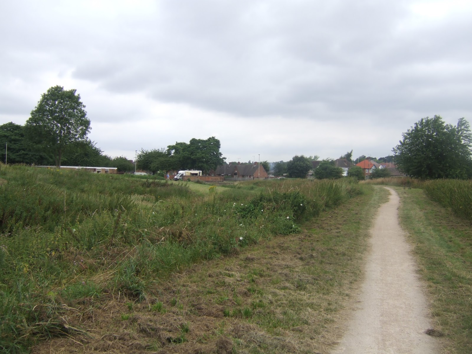
Sadly, we've got three enclosure of cattle fields to traverse, with far too many of the damned animals bunched up at the top of the second of them, as well as lots of calves in third and they are not at all happy to see me, and get easily agitated, not quite forcing me to run for my life, but as dozens start to follow me at faster than walking pace, I'm forced to wield my stick as a weapon and get up a hurry over some rough ground to escape with life and limbs intact. Roll into Bushby, or Thurnby, via the made over yard of Home Farm, and crash on the pavement for emergency watering and to listen to the disturbed sounds of cattle, leaving it far behind but still ringing in my head as these two villages within a single settlement, or single settlement with two names is traversed, offering a few desirable corners before we roll past the Rose & Crown, proudly displaying its thatch. Pass more cottages, the sort of fascinating and irregular shapes that would give a fine flavour of ancient rural living on the very edge of the city, which had me disappointed that every one that I knew who lived out here, back in the day lived in the 70s suburbia, passing on past St Luke's Church and school, and out of the end of the village to pace the edge of A47 again. I'm amazed that the garden centre and nurseries have endured here, just on the city's edge, and that the taste for incorporation has passed, keeping these suburban villages outside the city, soon entered as an overgrown path into the 1930s suburbia of Wintersdale Road, is followed. This leads to a path through the embankment of the GNR Leicester branch again, possibly the only major remnant of it in this part of the city, and on into the edge of Willow Brook park, with the alignment followed down Gelert Avenue before being consumed by the Thurnby Lodge estate, in many ways it feel like Netherhall's younger brother, of early 70s vintage with a park and brook in its heart. Though this one still has its coaching inn styled pub, The Stirrup Cup, as well as the Bushby Brook flood management scheme, a large depression and overflow to contain water when the rain comes on hard east of Leicester, which it really does sometimes. Then on, down the green sides of Bushby (or Willow) brook, between the two halves on the estate, on new cycle paths and among much wild growth that wasn't here when this used to be our cycling playground, way back when, and this leads us to Ocean Road, and then it's on to cross Scraptoft Lane and on to Abbott's Road to close the circle for the day at 4.40pm, some 40 minutes overschedule, having failed to get my speed up when in the Old Country, and after 4 days of rest.
 |
| Have I mentioned that I Hate Cows? Because I HATE COWS. |
 |
| St Luke's church, Thurnby (not Bushby) |
 |
| Gelert Avenue, Thurnby Lodge estate, |
 |
| Willow (or Bushby) Brook, Thurnby Lodge. |
5,000 Miles Cumulative Total: 2889.6 miles 2017 Total: 324.6 miles
Up Country Total: 2630.1 miles
Solo Total: 2633.3 miles
Next Up: Back Up Country to get back on the Washburn & Wharfedale schedule?


No comments:
Post a Comment