14.1 miles, via Upper Batley, Howden Clough, Birstall Retail Park, Adwalton, Drighlington,
Tong, Scholebrook, Pudsey (Fartown & Waterloo), Woodhall Hills, Calverley & the Woods.
It's true that Batley is a bit far out of the way from my area of walking focus for this year, being several miles deep in Kirklees district but it's a good spot to start to make a good day's distance when trekking across the Leeds and Bradford hinterland whilst mostly avoiding both cities, and it also has the added bonus of being only a short ride away from Morley so a lie in can be had on a Saturday morning, with the start of the day's trail coming only 20 minutes after leaving the house. So open a six hour window to get to the Aire Valley, departing the utterly charming Batley station at 9.40am, setting off with the intent of seeking out the one local railway that hasn't appeared on my radar so far, the GNR line between Batley and Adwalton junction (open from 1864 to 1972), once one of the seven (!) directions that trains once travelled from this now vanished hub. The double width cutting below Soothill Lane might still be there with only the L&NWR's metals remaining below them, but nought can now be seen of the GNR's platforms to or lines from Ossett and Dewsbury to the south, lost beneath overgrowth and industrial redevelopment. We go north, on Lady Ann Road, but keep the path interesting by dropping down through the foot tunnel that leads under the railway to the back of Batley Mills, located down a steep path, and the high retaining walls and the stream of Howley Beck are followed to meet the long and low foot tunnel that leads below Batley junction, thankfully lit up well as it passes deep below the embankment at natural ground level below the point where the lines split off to the L&NWR Birstall branch and the GNR lines to Ardsley and Beeston, the impressive abutments of the latter can be seen when we finally emerge into daylight on the other side. Primrose Hill forms a long terrace that rises as the Adwalton line's embankments rise alongside the extant railway, passing one cattle creep with no obvious purpose and dropping us off at Lady Ann Crossing on Howley Street, below the massive and often seen abutments of the bridge that once took the old railway overhead, still operated by the local signal box and taking us over the contemporary line into Upper Batley.
 |
Batley Station, L&NWR present on the right,
GNR absent on the left. |
 |
| Batley Junction foot tunnel, longer than it looks. |
 |
| Lady Ann Crossing and the GNR bridge abutments. |
Suburban sprawl rules out here, looking mostly like a mix of Victorian villas and the least inspired styles of the 1970s as we follow the footpath up to Sunny Bank Road, detouring to pass over the railway alignment on the path to Howley Mill to confirm that an overbridge is still in situ, along with the cutting below it, but aggressive fencing off ensures that there is no obvious way to get into it. It would be a very short trackbed walk of we could get down there anyway, so steps are taken back to the old path that leads between the gardens of Lamplands and York Drive, leading us to the B6123 Batley Field Hill, which sends us downhill to meet the embankments on either side of Timothy Lane, where a large bridge used to take the railway above, the north of which has a modern dwelling atop it, and Old Hall Road takes us on a northward track. We drift around the site of Batley Hall, now a residential care home, and look out across the equestrian fields and the many scattered farmsteads around the valley of Howley Beck, slipping back across the railway at the site of Upper Batley station, where original lampposts and an old crossing gate post are still in place, and then returning to the rural suburban mix as we follow Upper Batley Low Lane to the north, alongside the railway and the valley. No access can be made to the alignment here either, though a pair of missing cattle creeps are clearly in evidence as we follow the lane up to Still House farm, and soon we meet the suburban edge of Greater Birstall at Howden Clough, where the remaining embankment that led to the railway bridge is mostly hidden by houses and the alignment beyond has been completely devoured by development in the 1970s and 80s. Roll on to cross the A643 Leeds Road and continue onto Nab Lane, keenly spotting a short stretch of cutting that has endured among the suburbs, and taking note of the alignment continuing north through the Kirklees council recycling site, whilst the major railway relic is the bridge over the L&NWR's New Leeds Line, already noted and loved before we pass on into the industrial district to the south of Birstall Retail Park, where I misread the name of Pheasant Drive again. Meet the A62 Gelderd Road and follow it to just shy of where the railway once passed below the car park of Currys PC World, taking the path beside High Wood Road to Holden Ing Way, to find the footpath that leads around the edge of IKEA's car park, wondering if any of the shoppers present are aware that the railway used to run below their feet.
 |
| Sunny Bank Road bridge, with alignment below. |
 |
| Upper Batley station site, the lamppost and gatepost are original! |
 |
| Howden Clough Viaduct site, swallowed by suburbia. |
 |
| L&NWR line below Nab Lane, GNR line through the Recycling site. |
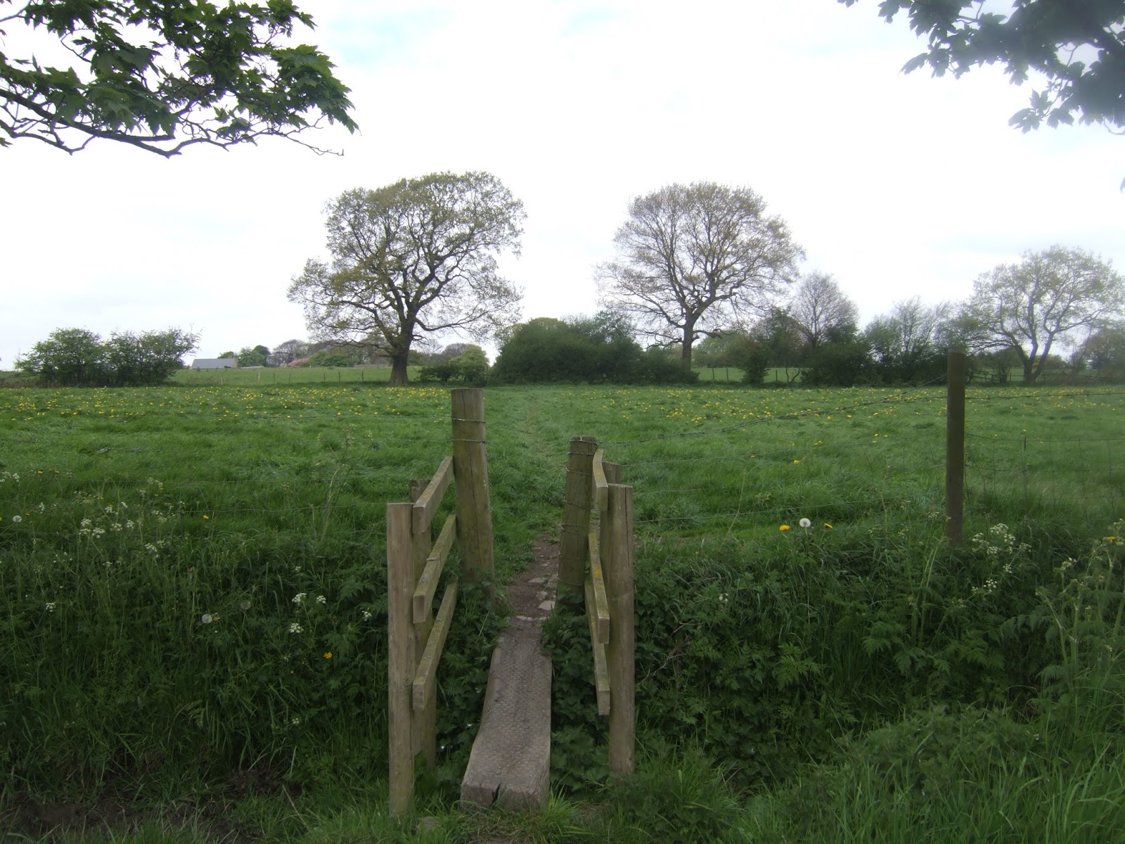
This leads us to the footbridge over the M62, surely one of the longest in the country at eleven lanes wide as it passes over the point where the M621 merges in, and probably not all that used either, and this brings us up through the fields to the site of Adwalton junction, where the alignment is still visible in the field boundaries, rising to meet the higher metals of the Ardsley - Laisterdyke line so steeply that the metals didn't join until beyond Field Head Lane, now buried by the A650. Thankfully the bypass has a wide enough verge to pace as we make our way into Adwalton (and Leeds district), where suburbia has spread all the way to Birstall Lane, and the Railway still exists in the form of the pub that served Drighlington & Adwalton station, the site of which is now the pub's car park, whilst a nursery school now sits on the footprint of the goods shed, a good place to pause for morning watering now the sun has come out on what had started as a breezy and chilly day. Station Road is the completely misnamed road that tracks us across Adwalton Moor, the rough side of which entertains the dog walkers whilst the kids and many parents enjoy the rugby matches ongoing on the playing fields, and this takes us past the large mill conversion and transitions us over to Drighlington, meeting the A58 Whitehall Road by the non-conformist chapels and the Co-operative society store that makes wish I'd taken more of interest in such things on my travels. Preparing to cross the old Wakefield and Bradford road, I get stopped by a police car, where the constable has to rather apologetically tell me that a man was spotted apparently carrying an ice pick alongside the A650, which turns out to have been me with my walking stick, and he seems rather embarrassed as he has to go through the formalities and inform me that any report of weapons being carried publically has to be investigated. We part with a handshake as I return to my course, and he to more important business, as the A58 is followed north past the Spotted Cow, the former board school and St Paul's church, all worthy of being seen up close, following Back Lane away from the main road to see how suburbia will fill every available space in any village, going as far as Lumb Hall to see Drighlington's oldest house. Pace back to find the footpath out across the Manor Golf course, not clearly marked but easy enough to trace as the fairway boundaries send us downhill and through the trees in the direction of Ringshaw Beck, sending us into Bradford district as the long uphill haul towards Tong starts, giving plenty of views of this greenest of spaces in the Leeds & Bradford hinterlands, just as the warmth passes from the air and the sun disappears.
 |
| Over the M62 via the IKEA footpath and bridge. |
 |
| The Railway, Drighlington & Adwalton station (former). |
 |
| St Paul's, Drighlington. |
 |
| Between Leeds and Bradford, between Drighlington and Tong. |
Meet Tong by the village hall, and trace steps from a couple of weeks ago back to the bench outside St James's church, where I will settle to consume most of my lunch and snacks, as this day starts to feel like one of trails that I'd rather underestimated, provind more distance, and up and down than expected, though a 12.30pm arrival means we are no way behind schedule. The shortest route to from Tong to Pudsey has already been walked, and the ideal alternative would be to make tracks through Tong Park, but that's not an option unless you wish to drive an off road vehicle, so we won't be entering the grounds of Tong Hall, which can still be admired down its driveway, instead pacing the path previously seen past the Holiday Inn and almost as far as the garden centre before we turn north onto New Lane. This is a very narrow country lane that still seems to attract traffic coming from somewhere, tracing the boundary of Tong Park, cresting to offer views to Pudsey and Holme Wood before heading down to the beck crossing in Shackleton wood, not offering any sight lines to the hall, and finally entering a bucolic landscape that endures between these two cities thanks to the many sharp undulations in the terrain. It wasn't always all green around here though, as a keen eye will spot the spoil heap remains of Charles Pit and the embankments of its former mineral tramways which ran out to both Tong Street and Tong Road in the 19th century, still enduring despite closing a century ago, and the drop to cross Holme Beck on a field shortcut reveals it to be literally choked with fly-tipped debris, which fills me with the intensest of disgust. The rise of Raikes Lane beyond leads us to the rather lovely cluster of farms at Scholebrook, almost regarded as a hamlet in its own right, and then the bridleway rises and drops down to the valley of Pudsey Beck, offering views of greenery that wouldn't have you believing you were between two major conurbations, and once over the stream, Scholebrook Lane provides a very sharp and rain gouged path uphill, that at least offers a good look at Tong Hall and Park, which gives fine distinction to its location. A better surface is gained past the Ayranbrau kennels and Bank House farm, hauling uphill to the Bankhouse Inn and the road into Fulneck, and we press on along the lane through the meadows in the direction of Fartown, gaining sufficient altitude to get clear sight lines to Emley Moor mast and to the now distinctive chimney and masts at Queensbury.
 |
| Tong Hall, where the Park remains inaccessible to those on foot. |
 |
| Charles Pit and tramway remnants, plus rubbish choked Holme Beck. |
 |
| Scholebrook Lane, in the green between the cities, |
 |
| The Bankhouse Inn, Pudsey. |
Onwards then, into Pudsey, this land of suburbia consuming a once distinctive small town, where all the streets have only one name, as our track to the northwest takes us along Fartown, Greenside and Uppermoor, gradually becoming less stone cottage-y and more suburban as we go, and as I observed before if my E288 shows the presence of a mill, it has probably been replaced by suburban growth by now. Waterloo Road finally gives us a street with two names, and shows up Pudsey's main facets as we go, with stone terraces facing the crescents of council houses, and also impressively scaled villas that have vistas down to Tyersal Beck, which I'd thought might be more visible from this road that traces its path from up high, but only one clear look is gained before suburbia takes over, meeting Galloway Lane by the last obvious farm building in this quarter, oddly disused at a prime location. Push on past the late 20th century church of St James Woodhall, to arrive at the A647 Bradford Road, taking great care even with the crossings to get safely to the northern side by Thornbury Barracks, complete with its former locomotive nameplate celebrating the Parachute Regiment, and then we head north, for what feels like it ought to be the last stretch of the day, uphill on Woodhall Lane. Pass the Bradford University playing fields and the woodland nature trails around Woodhall Grange fish pond on one side, and some of Leeds's smartest outer suburbia on the other, on a steady rise to meet the open spaces of Calverley Golf course, which offers an elevated view to the east beyond its clubhouse, and then its on to the hamlet of Woodhall Hills, 200+ metres up and showing off how to do an upscale conversion of an old manor house and its associated farms and other buildings. Reaching the crest and crossing over Priesthorpe Road we finally catch sight of the Aire valley, and the vista to the east opens up impressively, with all the views of Leeds being available up here, but there's little to see in the direction of Bradford as the road tacks to the northeast and the landscaping of Woodhall Hills golf course offers very few sight lines. Eventually Baildon Moor and Idle Hill can be seen, through the gaps in the trees, but once again Bradford's ability to hide itself in the landscape is revealed, even at this close proximity, and so attention turns to Airedale, focussing on the Burley and Hawksworth end of Rombalds Moor, the Wharfedale gap and Otley Chevin, and the familiar trio of sentinel hills above Rawdon and Horsforth.
 |
| Pudsey Greenside, a rural town in the suburbs. |
 |
| Pudsey Waterloo, a farmstead abandoned in the city. |
 |
| Woodhall Hills, the right way to make over a rural hamlet. |
 |
| Holly Park Mills and the descent to Airedale. |
Calverley's suburban edge is soon met, way higher up than it needs to be, and the lane takes a steepling descent down to the actual village edge, with Holly Park Mills still enduring in commercial use among the suburbia, looking like it was grown between the 1930s and the 1980s, soon meeting the stone heart of this town, where we can pace along Thornhill Road among some of the more modest terraced houses in this Victorian satellite town. We're not short of interest points though, for the Mechanics institute could easily be mistaken for a Methodist chapel, and there are nice little side streets of rustic cottages along the way, as well as hidden courtyards that come as a complete surprise, so it's good to see that every visit to Calverley reveals something new before we meet and cross the A657 Carr Road and press on down Wood Lane to the south Lodge of Calverley Woods. So back on a track last seen in February and looking a bit greener this time, branching off to the northern path to hit the declining path through the former quarry workings, sticking to the well marked bridleway and enjoying the bluebell carpet with all the dog walkers, and even with all the other foot traffic it's a lovely and peaceful spot with many gnarly and fascinating trees. It's also larger than expected as one eye drifts to the clock and the other spots the canal running beyond the perimeter, and even once the gated exit is met, there's still a walk to get to the path northward, as a pair of outsize Victorian townhouses, part of that long abandoned development (?) sit on the tarmacked stub of Thornhill Drive. Eventually roll out to the Parkin Lane bridge, over the Leeds & Liverpool Canal, and through that odd little rural idyll next to Harrogate Road, before joining the A658 to pass over the River Aire on the new Apperley Bridge and ponder the archery going on on Rawdon Meadows, just like it was five years ago (not all that improbable as it is home to an archery club, it seems). So on to the finish line, tramping past the Stansfield Arms without beveraging again, and joining the station approach at the hurry up as the minutes start to drift away, but fortunately there's time to take the other path around the car park to get a sightline to the plate girder Apperley viaduct, or at least on of them, before coming back around to the other skewed platform of Apperley Bridge station on the far side of The Avenue's former bridge. All done at 3.40pm, bang on schedule and full of hopeful feelings that my body is finally coming around after my issues with respiratory ailments and aching limbs, and also for Spring to soon re-emerge after a day of weather that has felt much more wintery than the last weekend of April should ever feel.
 |
| Calverley is full of fascinating hidden corners. |
 |
| Calverley woods and the Bluebell season is upon us. |
 |
| Parkin Lane bridge over the L&LC. |
 |
| Apperley Viaduct, or one of them at least, the currently one in use is obscured. |
5,000 Miles Cumulative Total: 2723 miles
2017 Total: 158 miles
Up Country Total: 2478.7 miles
Solo Total: 2467.7 miles
Next Up: One last Bradford trail for the Spring, and a change of regional focus.


No comments:
Post a Comment