12 miles, via Belmont, Spitlers Edge, Great Hill, White Coppice & Knowley.
Time for a jaunt to the other side of the Pennines to see My Sister and her family, and travelling without a plan for where we might travel in the West Pennines, so it's always a refreshing idea to set out without a clear destination, on a route improvised as we go. Dr G will be taking care of my nieces needs for the morning, so My Sister and I can set out at 9.25am, departing Egerton by a familiar path, heading out to the track up Longworth Clough, previously traced in late summer 2012, and showing a different face this time around. I'd favoured a trip over the more elevated paths to Belmont, but too much road walking on dubiously narrow and poorly sighted lanes has that track nixed, instead travlling along the beck, past the gradually diminishing former paper mill, and up to the farm tracks that lead over to the A675 Belmont Road. Not heading up onto Winter Hill today, where I'd thought about attacking some of the lateral paths on the Rivington side, instead pushing along the main road into Belmont, one of those villages that clings to the last bit of cultivatable land on the moorland edge, whilst showing signs of Victorian prosperity via its ridiculously over-sized parish church. Moorland walking follows, and I think all of this years High Moors wandering will go on in the West Pennines, following the rough track up Sharples Higher End, crossing the 300m contour without to much effort thanks to the gentle rise of the terrain, my legs not feeling punished after so much action in Yorkshire's low lands. From the Rivington Road junction, trackless walking starts in earnest, rising to Horden Pasture on the access land, and even though no recognised right of way sits here, it's clearly a well used trail, though the bogginess isn't welcome above Anshaw Clough, but rewards are the views that emerge across the yellowed grass as we rise to Spitlers Edge. A paved path comes into use as we descend to cross Redmonds Edge, which makes crossing the higher reaches of Anglezarke Moor a whole lot less challenging, and the final rise of our walk leads to Great Hill, which hides its 381m elevation well from this angle, but reveals much as it is crowned.
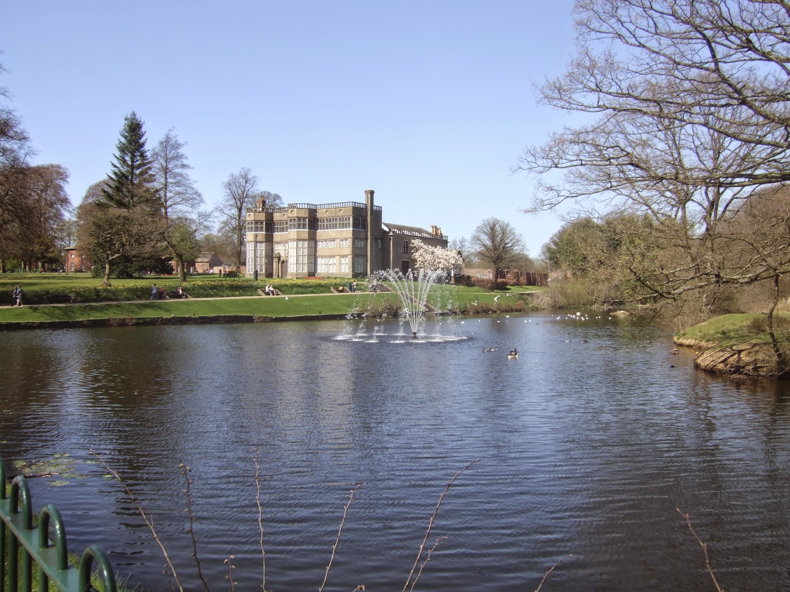
All of North Lancashire is revealed below, Blackpool clearly identifaiable in the middle, whilst a look back show the way to Manchester and the Southern Pennine edge, also we have clear views to Pendle Hill and the summits of Ribblesdale, as well as the edges of Lakeland and Black Combe in one direction, and the Clwydian Hills and the faintest suggestion of Snowdonia in the other, only Winter hill's bulk prevents a 360 degree panorama. No loitering after lunch and selfies though, the declining path to Great Hill farm (former) needs to be hit, finally showing up the moor top's profile, whilst My Sister plots a fresh route, away from our originally planned end point in Brinscall or Withnell, instead choosing to head to Chorley, way off on the other side of the valley. The long walk down off the moor takes us in the direction of White Coppice, coming to a rapid end on the last 50m as we are dropped by the reservoir feeder channel and the idyllically placed cricket field. Hitting the country lanes and fields of green grass suddenly has it feeling a lot warmer than it did on the moor top, so the pace slackens a bit as we trace the edges of the Knowley reservoirs, modest bodies compared to some in this area, before rising Heaney Road up into Knowley itself, a modest collection of terraces with the mass of Chorley beyond. Urban walking starts in earnest once we are across the Leeds & Liverpool canal and the M62, letting my Sister take the lead as we head along Botany Brow and the B6229 to cross the railway and dodge traffic on the way over the A6, then to Park Road, which reveals many large Georgian houses, the Medieval parish church and the imposing Victorian Town Hall. For some reason, I'd tagged Chorley as a much more recent establishment, even though I've never been here before, and the history, and crowds, come on thicker as we enter Astley Park, over 600 years old and donated to the town in the wake of the First World War, and where we'll find Dr G and the girls, walking them on to the café in the stable block of Astley Hall, for a 2.30pm finished and well earned piece of cake, and a big Yay! for improvisation and a longer walking day than I was anticipating.
5,000 Miles Cumulative Total: 1579.1 miles
2015 Cumulative Total: 176.9 miles
Up Country Total: 1452.7 miles
Solo Total: 1340.1 miles
 |
| Longworth Clough, again. |
 |
| Belmont, from the A675. |
 |
| Belmont in Reverse, from Sharples Higher End. |
 |
| Spitlers Edge, Anglezarke Moor. |
 |
| Great Hill, from the south. |
 |
| The Summit, and My Sister. |
 |
| Great Hill from the West. |
 |
| The descent off Anglezarke Moor. |
 |
| White Coppice, one of the most idyllic cricket fields in this land. |
 |
| Knowley no.2 Reservoir. |
 |
| Knowley, the prettiest house in the village by far. |
 |
| The Leeds & Liverpool canal, hello Old Friend. |
 |
| Chorley, way more Georgian than I would ever have credited it. |
 |
| Astley Hall, Astley Park, best municipal park in the West Pennines? |
Next Up: Blazing a fresh trail out of Leeds, once again.


No comments:
Post a Comment