13.4 miles, via Valley Mills, White Rose, Beeston Park Side, Cross Flatts Park, Hunslet Carr,
Pottery Fields, Crown Point, Leeds (St Peter's), The Leylands, Sheepscarr, Buslingthorpe,
Scott Hall, Chapel Allerton, Moortown, Moor Allerton, Alwoodley, Alwoodley Gates,
Sturdy Bridge, Cote Hill, and Wall Side.
The first weekend of Autumn is spent away from the trail, as we've got a reunion to do celebrating (almost) 30 years since we first came to Leeds to attend University, reuniting five of the original ten members of our first student residence, seven (7!) years after our last meetup and feeling a lot more like a reunion of old guys this time around, as we ate and drank an afternoon and evening together, also presenting pretty nice day for it as well as we trolled ourselves from town to Hyde Park and back along the way of it, and experience that I'll probably have more to say about at the year's summation, but for now it's just good to take a break and catch up with some old heads before we resume another push into the Late Season. When that does come around, the weather hasn't travelled and we've got both a tight window ahead of rain and a total lack of trains to play with as our route chooses itself, having intended to approach if for much f the Summer, and as we descend to Morley Station for our 9am jump off, noting proper construction finally having started around the lift towers at the new station, we find our early going is all very familiar, down Valley Road past the old gasworks and mills, and onto the muddy avoiding path and thence down the railway-side, mostly undercover of overgrown foliage as we travel towards the White Rose Centre and its own woodland walk. This leads us out to the Dewsury Roads, amidst the tangling of the main road with the access way and the petrol stations, crossing over by the island in sight of the culverting Millshaw Beck and hitting the surprisingly long drag uphill on the A653 Dewsbury Road towards the greater city, with the railway bridge at the urban edge, beyond Stank Hall always being further along than expected, and running into Beeston Park Side, you become very much aware that we've already set two tracks in this direction, as we merge in with Ring Road Middleton, past the old St David's church and up to the Tommy Wass junction. The Dewsbury Road will be our obvious red route into the city, taking the left-side pavements along the dual carriageway to mix things up from our last trek this way in 2014, passing the long stretches of terraced ends of South Beeston around the shopping parade, across from the suburban semis that run down to the Broadway Inn and the Harrison Sparks plant, before we touch base with Cross Flatts Park, astonishingly less than an hour away from home, and pass the Dewsbury Road social club and the corner where we dwelled very briefly back in 1998, carrying on as industry bumps up to the lane, as the terraces return to the roadside, displaying a fine ghost sign before we pass the former cinema (and 'health club') on the Parkside Lane corner.
 |
| Lift Towers finally under construction, Morley station. |
 |
| The Woodland Walk, White Rose Centre. |
 |
| Tangling with the Ring Road and Dewsbury Road. |
 |
| Welcome to Beeston Park Side. |
 |
| Dewsbury Road and the Broadway Inn. |
 |
| The Ghost Sign and the 'Health Club', Dewsbury Road. |
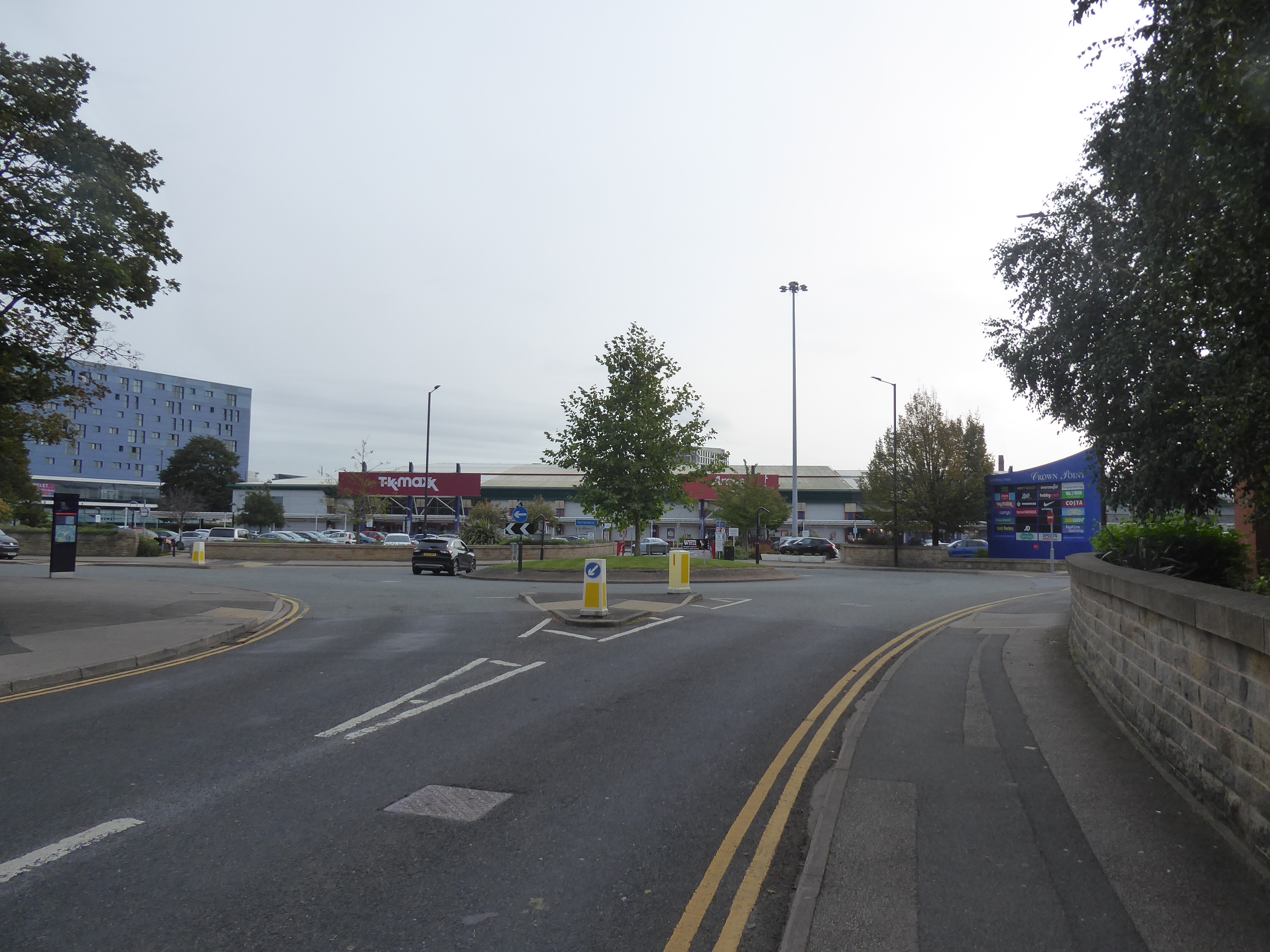
Then we are deep into the terraced urban landscape, of North Beeston or Hunslet Carr depending on what map you're reading, passing north among the terrace ends and runs, mostly across the way from the array of stores and takeaways that service the diverse neighbourhood of the lands to the west, noting the other fine, through sadly obscured ghost sign by the old New Inn before we press on, past the New Bewerley Community School, the site of St Peter's church and the Spinning Wheel Inn as we split off the Dewsbury Road and join the unlit path that leads us by the playing fields and up to the footbridges and raised walkways that elevate us over the M621, the Wakefield and Castleford bound railway line and the tangle at the top of the A653. We then drop down to the roadside once more, by the ranks of car dealerships adjacent to the Leeds Gasworks site, pressing on alongside the vast traffic island until we meet the Civica House - Union mill site at its apex and split off to change our passage trajectory into the city of Leeds away from the A653, thusly down Holmes Street to Kidacre Street and into the Crown Point Retail Park, on the Midland Railway goods station site, and then on to passage over the dual carriageway of Great Wilson Street and up Crown Point Road, beside the Tetley Brewery site which is finally getting redeveloped after a decade of lying fallow, as we are draw up to meet Brewery Wharf flats and passage over the River Aire at Crown Point bridge, landing us in the city west of the Calls, the Palage hotle and Leeds Minster at the eastern end of Kirkgate. Duke Street marks our first entanglement with the A61 as it leads us past Penny Pocket Park and under the train-free railway bridges, to passage over New York Street, and around the city bus station, across the way from the BBC Leeds HQ, the Leeds Conservatoire and the West Yorkshire Playhouse around the semi-revived St Peter's Square, before we come up by John Lewis's at the bottom end of Eastgate and cross to the traffic island with the Pagoda that used to be a petrol station on it, taking a break by the Arthur Aaron VC memorial statue on the convenient ring of benches to contemplate the lack of distance travelled, in distance and duration before we press onwards to break through the psychological barrier created by the the city of Leeds, with first footfalls taking us between the new City College campus and the city Job Centre, and on below the A64(M) inner ring road.
 |
| Among the stores and takeouts of Hunslet Carr. |
 |
| On the footbridges above the Motorway and Railway. |
 |
| Crown Point Retail Park. |
 |
| The River Aire at Crown Point Bridge, Leeds. |
 |
| The Duke Street Railway Viaduct, Leeds. |
 |
| The Eastgate Pagoda, and the Victoria Gate centre. |
Regent Street carries us northwards, passing though The Leylands and not bearing much similarity to its London namesake as it forms a bulk retail and industrial band to the northwest of the city centre, passing Christopher Pratts's furniture and lighting store, and the crowd of lads that gathers outside Patriot Games, as well as the only blocks of city flats that I seriously contemplated when home hunting in 2006, before we come upon the Churchill Barracks of the Leeds Army Reserves, and passage over the almost concealed passage of Meanwood Beck, before we come up to the Sheepscar interchange, the singularly most stress inducing junction in the city, where foot passage has to be planned well in advance, as the crossings on North Street, Clay Pit Lane and Meanwood Road have to be negotiated among the streams of traffic to keep us on track. Sheepscar Street (North) has the pavement that elevates us into North Leeds, onto the north side of the Meanwood Valley, giving us sight towards Woodhouse and the University before we are finally drawn up to the side of the A61 Scott Hall Road by the considerable remnants of Buslingthorpe Tannery, joining this most ahistorical of all of Leeds's major routes as it presses uphill into the landscape of the Scott Hall estate, west of densely packed terraces of Chapeltown and Potternewton, among many council house semis that I can't be sure that I've ever seen, uncertain if this a route that I have ever travelled by car or bus in all my years in the North Country, which is an odd feeling to have as we press uphill to the level plots that's home to the Caribbean cricket club and Potternewton playing fields. We can also ponder the seemingly underused guided bus lane, and the trig pillar in the middle of the road before we take our last looks to the high points of the city centre and delve deeper into the northern suburbs, meeting a prior route in these parts as we cross the B6159 Potternewton Lane by the traffic island and shopping parade, past the leisure centre and through the last remnants of the council estate landscape before we come up to the Stainbeck Lane island, also previously traversed, and as we now sit west of Chapel Allerton, the landscape becomes a whole lot more middle class suburban as the size of the houses changes up, with considerable trees lining the road all the way up to the Stainbeck Road corner, by the Esso garage, our third previous point of lateral passage across the northern city.
 |
| Regent Street and Christopher Pratt's furniture store. |
 |
| The North Street Bank, Sheepscar Interchange. |
 |
| Joining the A61 Scott Hall Road, by Buslingthorpe Tannery. |
 |
| The climb of the A61, Scott Hall Estate. |
 |
| Scott Hall Playing Fields and the Trig Pillar. |
 |
| The Leafy Suburbia that's Chapel Allerton adjacent. |
The lack of history starts to get boring as the suburban landscape goes on and on, still under the cover of greenery that's displaying little by way of autumnal colour at the end of September, with the passage over King Lane being noted for its historical vintage, as the old pre-turnpike lane to Bramhope and Arthington, and having not been previously traversed, before the suburbia gets even more upscale as we cross over Street Lane, definitively traversed in the past and on up past the apartment development at the Moorfield House Site, and the run up to the top of Stonegate Road, the other major lane heeding north that I've never paced, and its entanglement with the Harrogate Road, putting us back on pavements seen from bussing the #36 and among old buildings once again. Prior footfalls in this part of Moor Allerton have only been made here in 2007, when dropping off keys at my letting agent on my previous home, an office that isn't there anymore, in the block ahead of the A6120 Ring Road, where new footways have been laid to ease the crossing, ahead of the tree-concealed St John's church, where we arrive just to late to indulge in the Macmillan Coffee morning and bake sale, but we do at least find a bench to take second lunch in the shade around the Etz Chaim synagogue and the press into suburban Alwoodley, past the underground reservoir and Royal Mail office on the hillcrest and on into a landscape with more than its expected share of tower blocks among the city's grandest plots of suburbia, passing the shopping parade and Lord Darcy tavern, as well as the way to Moortown Golf Club (host of the 1929 Ryder Cup). The burgeoning colours of Autumn among the Horse Chestnut trees and the carpets of conkers that litter the pavements grab the attention from the host of hedges that conceal the outermost suburbs of the city, as we press up to Alwoodley gates and its farmstead hamlet on the crossroads ahead of the A61 finally quitting the city and entering the countryside, past the entrance to the considerable estate of the Leeds Grammar School, almost concealed away to the east, and maintaining a footway as we enter the fields, carrying us on to the the woodlands that carry the track down towards Eccup Reservoir, and the route once traversed around the north-east of the city, where we come upon the bottom edge of the Harewood Estate, past the semi-circular Alwoodley Lodge, and its frustratingly inaccessible track, which is almost completely obscured by recently felled logs.
 |
| The Leafy Suburbia that's Moortown adjacent. |
 |
| Harrogate Road, and vintage buildings, Moor Allerton. |
 |
| The Alwoodley Water Tower, and reservoir. |
 |
| The Alwoodley shopping parade, and the Lord Darcy tavern. |
 |
| The old farmsteads at Alwoodley Gates. |
 |
| Alwoodley Lodge, Harewood Estate. |
The footway ends past Millfield House farmstead an we are forced onto the tarmac of the A61, right on a kink that looks like an accident blackspot, before we walk on against the traffic among the wrinkles of the landscape that sheds towards the river Wharfe, having dropped over the watershed somewhere at the top of the city, keeping the wits engaged as we pace down to the embankment that elevates us over Sturdy Beck, via the eponymous Sturdy Bridge, and then its on up the other side, remaining engaged as there's no margin for error as we rise to the blind corner ahead of the Wike Field farmstead and the evening out of the going as we come up to the walled perimeter of the Harewood estate, beyond the 2 mile marker, by the Sugar Hill and Cote Hill plantations. Our first rough approximation can be gained, through the haze from here, before we drop down through the woods and note that the #36 buses seem to be running in threes today. maybe to cover up the lack of trains, though it's definitely a curious sight to see as we come down to the Wike Lane corner, opposite the completely rebuilt Lofthouse Lodge, where we cross the sixth and final leg of the Leeds Country Way route to draw it into Tier 2, passing beyond its northern edge as we continue up the A61's side, away from the secure footpath that tracks through Wall Side Plantation, keeping on against the traffic and the vegetation at the kerb as we track among the trees that obscure all sense of location outside of the estate walls. Not the funnest of final miles then, with the entrances to Lofthouse Grange and Moor Hill farms being the only things to note while there's no roosting Red Kites to observe, before we climb the final press towards Harewood village, finally gaining a pavement under our feet again as we come up by Gateways School and pass across the still untraced passage of The Avenue, the A659 east towards Collingham, and circuit about the 18th century model village past the estate's main gates, the Harewood Arms and the pair of bus stands to cover all the local bases in our tier shuffling exercise, but sadly not being able to drop in on my former colleague who lives locally as she's presently under the weather, meaning that I can't fulfil the promise made some two decades ago to walk from home to Harewood to visit her (when I lived in Burley Park, much closer than I do now!).
 |
| The descent to Sturdy Bridge. |
 |
| The ascent to Cote Hill. |
 |
| Lofthouse Lodge, Harewood Estate. |
 |
| Wall Side Plantation. |
 |
| Road walking finally comes to and end at Hrewood village. |
 |
| The Avenue, and the unseen way east, Harewood. |
We're wrapped at 1.50pm, in excellent time and just ahead of the day's turn towards absolutely foul weather, with just enough time to stuff what remains of lunch into my face before the #36 and #200 buses will almost exactly match the outbound route as we rise homeward, thrilled to have made such a huge change to my landscape of tiers, having broken through the psychological barrier that the city of Leeds has formed to put Harewood much closer to Morley than it ever felt, while drawing in many paths around Wharfedale, and on its north side, into Tier 2, and the lower stages of Nidderdale, as well as distant routes towards Grassington and York, into Tier 3, thus massively rearranging the map and changing my local outlook without venturing much more than 13 miles from home, the sort of revelation that Shuffling the Tiers was intended to deliver when the idea was conceived back in April.
5,000 Miles Cumulative Total: 6180.2 miles
2023 Total: 258 miles
Up Country Total: 5,688.4 miles
Solo Total: 5837.6 miles
5,000 in my 40s Total: 4780.1 miles
Destinations Moved from Tier 2 to Tier 1: Harewood
Destinations Moved from Tier 3 to Tier 2: Ripley, Thorpe Arch
Trails moved from Tier 3 to Tier 2: 6
Trails moved from Tier 4 to Tier 3: 4
Next Up: A Long Weekend NIW with a Train Ride and a notable Southbound Trek!


No comments:
Post a Comment