11.7 miles, via Morley Bottoms, Morley Hole, Dean Wood, Gildersome, Andrew Hill,
Lumb Bottom, Manor Golf Course, Doles Wood, Tong, Daffels Wood, Bankhouse (Bottom),
Pudsey (Greenside & Cemetery), Owlcotes Centre, Farsley, The Green, Calverley,
West Wood, and Calverley Cutting.
It transpires that hurrying back Up Country after my jaunt down to Leicestershire proved to be a complete waste if time as the fourth week of July got lost under an almost constant dousing of rain, keeping me at home to settle into domestic tasks and characteristic bursts of lethargy, as I pondered how we could be experiencing so much gloom, wetness and air temperatures that rarely breach 20C in the UK, when southern Europe is baking, and indeed burning, as a heatwave in excess of 40C has settled in, with us sat protected by the jet stream ensuring that we have the apparently miserable summer while Spain, Italy and especially Greece suffer something much, much worse. July's fifth weekend thus presents us with the first opportunity to drop feet in West Yorkshire for the first time in a literal month, while an almost nice day of weather settles in on Saturday morning as we drop in at Morley station for a 9.30am launch, noting that the new development below has moved on a bit in the last week, gaining steel frame towers to accommodate the new lifts, after building work went rather quiet after the soft opening of a month ago, and the route forward sends us up Station Road again, where the re-roofing of Dartmouth Mill continues at a snails pace still, and the factory-mill opposite the rec seems to have new foundations laid where the demolished lean-to annex once stood. Travel proper gets underway past Morley Bottoms as we rise from Brunswick Street sharply up Bank Street for bit of route variation to find that Victoria Road work is up, opposite the primary school, for some roadworks which are sure to cause come bus shenanigans in the coming days, before we keep things varied with a trot up Nepshaw Lane, the old road that leads to the new suburban enclave at Farm Hill Road, which leads us back to the trail of Asquith Avenue, our unavoidable route over the M621 and through Dean Wood before we shift onto Gilhusum Road to pass again through the industrial estate dominated by the Sainsbury's-Argos depot and Johnson's Hotel Laundry complex.
 |
| New Lift Towers installed at Morley Station. |
 |
| New Foundations laid at Station Road Mill. |
 |
| Victoria Road Up at Morley Hole. |
 |
| Gilhusum Road industrial estate. |
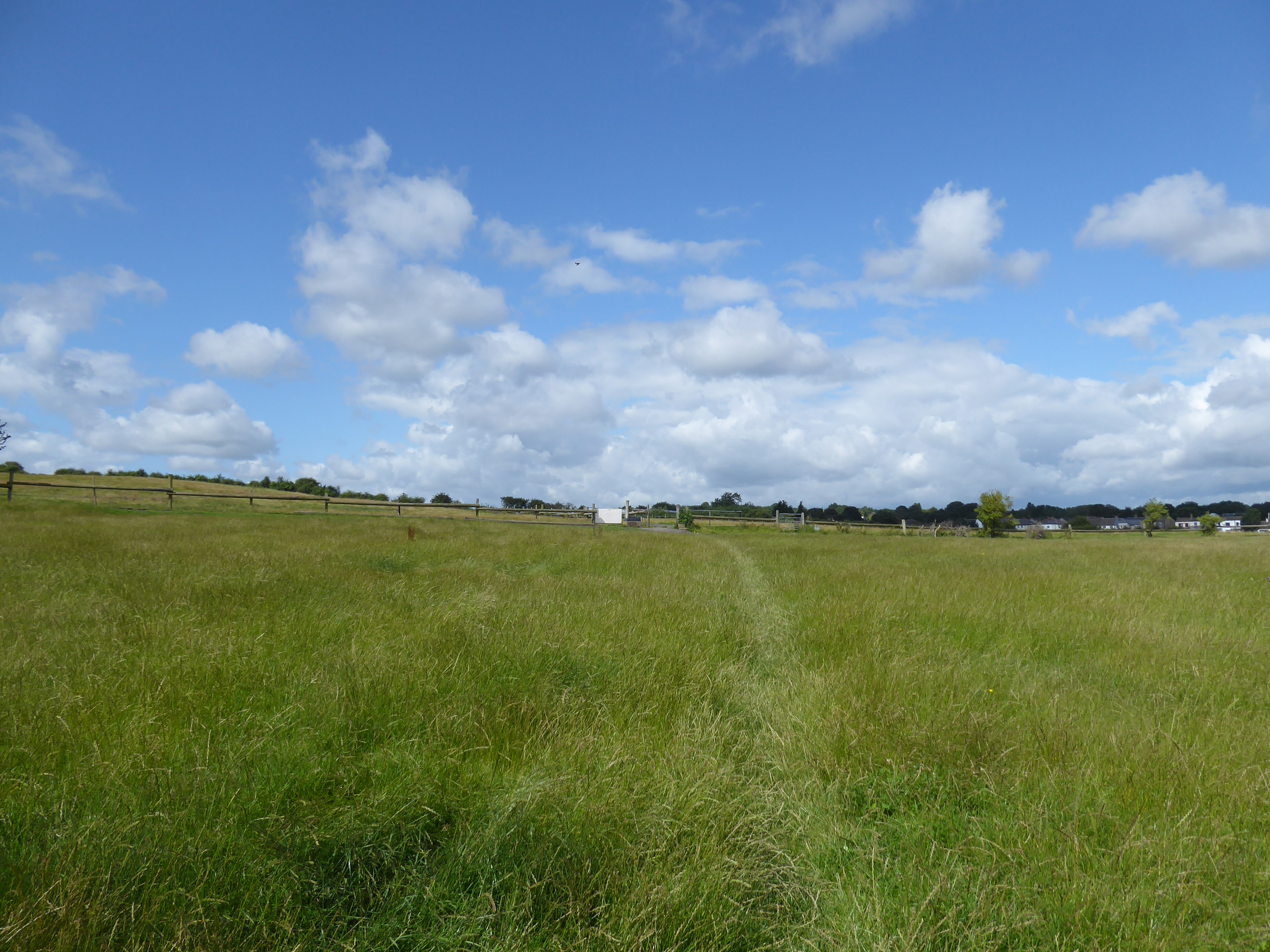
It also offers an alternate path around to Geldard Road, as beyond the A62 Gildersome awaits and we need to find novel route around that too, which starts by heading north on College Road, and then shifting east as Parkway leads us into the council estate that surrounds it, shifting us over to Finkle Lane and the older faces of the village which continue as we land onto Street Lane where we could ponder the possibility of tracking the Leeds Country Way to our destination as pass the end of Woodhead Lane, an idea discounted as we head on past the Friends Meeting house, and the shopping parade to the turn onto Church Street to pass St Peter's and track on almost as far as the New Inn and the Baptist chapel. A ginnel slips us away, behind the back gardens and across Greenfield Avenue as our eastward tack leads us into the fields, and actually onto the LCW path again as we field walk into the countryside, following the fall off Andrew Hill down to the crossing of Andrew Beck and the switch off the route, which confounded me in 2012, to head on through the fields, uphill in the direction of Dirghlington, among rough greenery, mining remnants and an equestrian enclosure before we discover the hard track that leads up to Old Lane, where we pass the Smithy cottage and descend to the Lumb Bottom Terrace. Turn up the steps through the Lumb Hall Close to come out onto the A58 Whitehall Road, which needs to be crossed so that we might make footfall up the Back Lane to Lumb Hall itself, its 17th century self annoyingly getting hidden away before we meet the footpath that passes across Manor Golf course, a route previously seen on a track to Apperley Bridge, but not seen from home previously, traced as it leads down, away from the risks posed by golfers, to the passage over Ringshaw Beck below the trees of Doles Wood before we rise again, and really set the feel for the day, landing in Bradford district on the rise up along the field boundaries toward Tong village on the hillcrest.
 |
| Parkway, Gildersome. |
 |
| The New Inn, Church Street, Gildersome. |
 |
| Andrew Hill and the LCW route. |
 |
| Field walking towrds Drighlington. |
 |
| Lumb Bottom terrace. |
 |
| Manor Golf Course. |
 |
| The field walk to Tong. |
Benches by the Village hall afford an elevenses spot for us before we pass through this village that always seems to feature on a local passage to the northwest taking us past the Greyhound inn, the cricket club and the pinfold before we pass onto Keeper Lane as it passes over the hilltop to east of the grounds of Tong Hall, with its herd of alpacas, before descending down into the spread of Daffels Wood, finding the declining path to be rather more challenging than is was in 2016, but ensuring this time to make proper note of the remains of the embankment of the colliery tramway that passed over the bridleway, ahead of the crossing over the multiple streams the form Pudsey Beck at the Fulneck Valley floor. Back in Leeds borough, it's a pleasing greenspace to experience still, despite the bizarre idea of putting the Bradford Western relief road into it in the future which we'll pass out of on the steep climb up to Bankhouse Bottom and its rural terrace, the first actually testing one of the day, where we turn on the gentler climb up to the Bankhouse inn, where many morning walkers are already watering, where Bankhouse Lane is met, to take us among the high fields that the suburban growth of Pudsey still haven't claimed, where the fine view back toward Tong Hall is preferred before we drop down back into the urban landscape. It's surprising to find that there a few novel route across Pudsey to be found, so it's all a bit familiar to track north along Greenside again, among this stoney little township, and finding reason to detour with Station Street over to the Royal Hotel and the enduring void where Greenside tunnel endures, partially obscured by an infilling attempt but apparently preserved for future posterity, before we head on again, past the Kings Arms to meet Chapeltown and the Commercial inn, at the west end of the High Street, to finally find a new pavement after we' set off up Uppermoor, turning onto Tofts Lane as it leads us past Pudsey's cricket ground, before we move into the landscape of low-rise flats that have filled the grounds of the Victorian Meadowhurst House.
 |
| Tong Village Hall. |
 |
| Colliery Tramway remnants on Keeper Lane. |
 |
| Bankhouse Bottom. |
 |
| Cresting Bankhouse lane into Pudsey. |
 |
| Greenside Tunnel, Pudsey. |
 |
| Tofts Lane for route variation. |
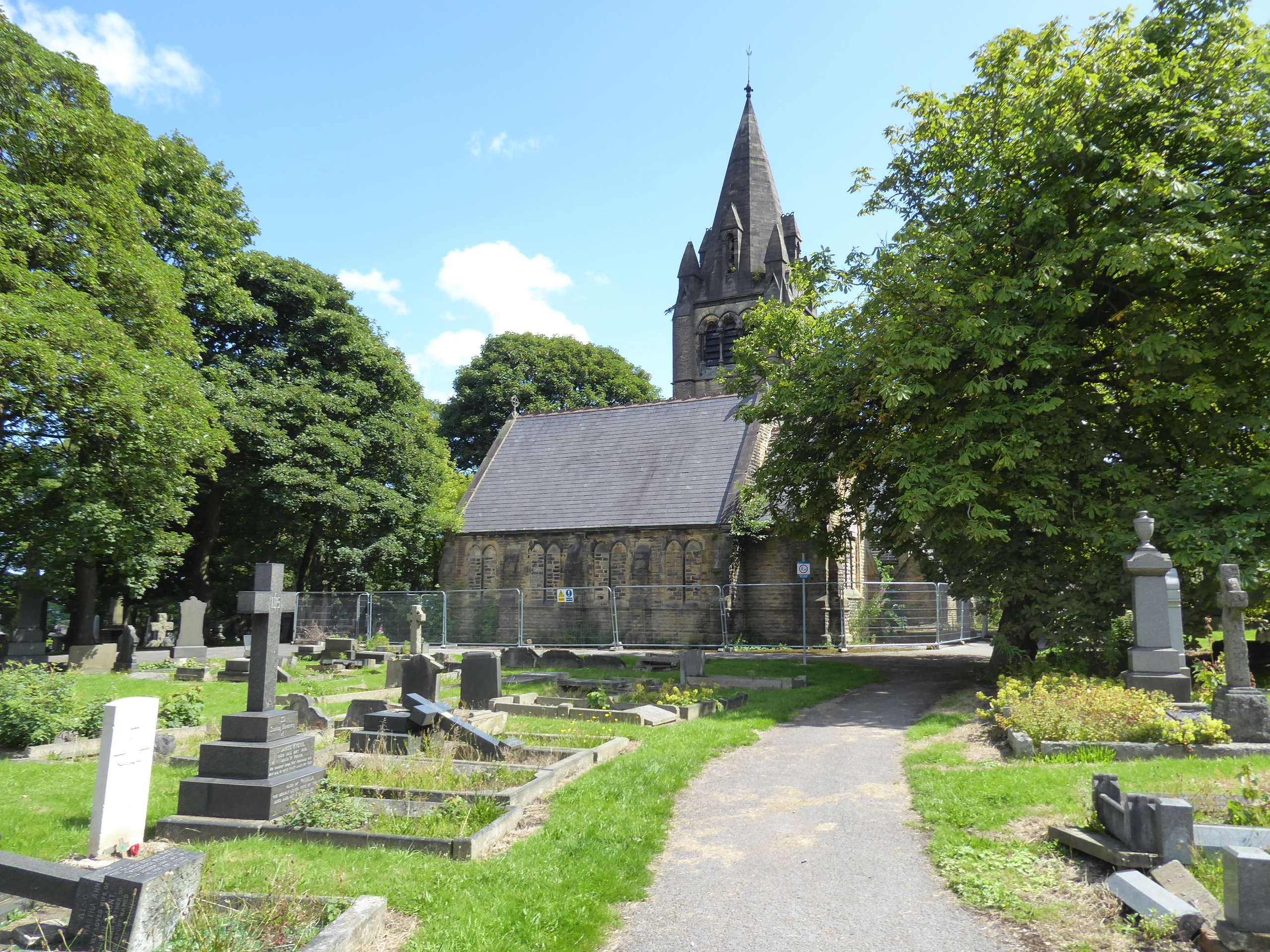
Through the trees beyond, we meet Pudsey Cemetery, which we'll pass through to keep the route fresh, moving over to the mortuary chapel complex with its prominent local spire, which is about as derelict as these things can get, with the passage below it towering archway still passable before we descend the main boulevard to Cemetery Road, which is crossed after the Aire Valley view to come gets its first reveal. and then it's down among the terrace ends and council houses along Lodge Road and Westvale Drive ahead of our passage under the A647 Stanningley Bypass via the footway to Primrose Hill primary school, and thence it's on down the mosaic decorated path below the roadside that leads to the Owlcotes shopping centre. This surely isn't intended as a traversable path, but that's how I'll use it as it takes around past M&S, B&M and AS&DA as we are lead to the other access route up from New Pudsey station, where we'll turn under the railway, with the path that leads shoppers through an industrial estate enclosure and over Bagley Beck, down from Bradford Road, which in turn crossed as we meet Old Road, the southern end previously unseen as we trot into Farsley. meeting a lot of terraces and their ends that seem to have all been constructed off of different blueprints on the 19th century, ahead of the decent starting to kick in, past the library, the constitutional club and our lunch break spot, in the yard of St John's church. The declining Town Street seems awash with bars and boutiques, like the hipsters who did over Chapel Allerton have done their handiwork here too, giving it all a bit of a revivified feel as we come down to Sunny Bank Mill complex, and the tangle of previous route by The Green at the War Memorial corner, beyond which all suggestions of new route finding are abandoned as we rise with Calverley Lane, up the recreation ground and the suburban edge, beyond which the wooded fall of the Aire Valley towards Rodley, Horsforth and Bramley is revealed again, before the A6120 Leeds outer ring road is crossed, ahead of the Palmer Plants & Landscape garden centre complex, and the continuing rise of the A6156 above the river valley.
 |
| Pudsey Cemetery Mortuary Chapel. |
 |
| Lodge Road Pudsey. |
 |
| The Mosaic Wall, by Stanningley Bypass. |
 |
| The Owlcotes Shopping Centre. |
 |
| Passing under the Leeds & Bradford Line. |
 |
| Old Road, Farsley. |
 |
| Sunny Bank Mills, Farsley. |
 |
| Airedale views from Calverley Lane. |
Views are absorbed and speeding traffic is avoided before the fields are quit and the lane leads into Calverley again, arriving by the Calverley Arms and taking us on alongside the A657 and the Brookleigh House boundary wall simultaneously, though we don't stay on Town Gate as the alternative variation, Capel and Rushton Streets lead us up through the stoney suburbia and up to Victoria and Chapel Streets, where the Parkside school. and the Calverley Victoria park can be passed, with cricket field's boundary being traversed while their club's game is in full swing as we head back around to the War Memorial and the A657 Carr Road to vary up all the possible route across the village that we could make. Our final descent to the Aire comes past the New Inn at the suburban edge as the bridleway down into West Wood is joined, leading under the Clara Drive bridge and into the roughly hewn rocks of Calverley Cutting, and down the steep incline that doesn't seem to have ever had an industrial purpose, to provide some majestic Summer woodland on the way down to our re-association with the LCW path, ahead of passage over the Leeds & Liverpool canal and our arrival in the urban corner of Apperley Bridge, and Bradford district once again, where attention wanders to the state of the river Aire, even before we've gotten to the A658 Harrogate Road. It's apparent that flood defence work is ongoing out here, building up the wall on the southern bank, around the new and old bridges, with the latter by the George & Dragon inn getting some extensive protective work done to it, probably putting it beyond traffic use, and inaccessible today as we roam around, past the cycle shop and hand car wash, and on to find some high retaining walls have been built to contain a new flood containment plain that has been formally established on the playing fields below the Stansfield Arms, beside the rising main road.
 |
| The Calverley Arms. |
 |
| Calverley Victoria Park. |
 |
| Clara Drive Bridge, Calverley Cutting. |
 |
| The Incline, West Wood. |
 |
| Flood Wall under construction, Apperley Bridge. |
 |
| Flood prevention measures around the old Apperley Bridge. |
 |
| Flood Wall containing the field below the Stansfield Arms. |
It's a short trot uphill and along the approach road to get to Apperley Bridge station, where the way beyond into Esholt waterworks feels like it ought to be publicly accessible, and the trip to Airedale can resolve at 2.25pm, with trains available in both direction despite it being a train strike day (a ride from Leeds turns out to be an entirely different matter, and after a Spring of Shuffling the Tiers. today's jaunt really does a number on rearranging some distant locations, as despite only moving one destination to my local tier, getting the Harrogate to Apperley Bridge walk into the second tier sets waves go much further afield. It doesn't just move the two location along that track into the second tier, namely Pool in Wharfedale and Weeton closer to home, but it also draws the two trails that we blazed to the north from their into the third tier, and by extension works a chunk of the fourth tier, notionally far from home to being not quite so remote, placing both Darley and Brimham Rocks, on either side of Nidderdale one step closer to Morley, illustrating how we are still travelling considerable distances without ever getting too far from the localities of West Yorkshire. ~~~ While we're in the vicinity, it's also worth noting the other flood prevention, or management works that have been going on downstream towards Leeds, first observed when I travelled up to Skipton the other weekend but properly regarded, where a dam and hydro seem to being constructed above Horsforth and Rodley, in order to allow the river to overspill in a managed space, and the long-fallow plating fields at Kirkstall seem to be getting a similar treatment, finally being abandoned to officially become wetlands and managed pools, contained behind supposed secure flood walls at the side of the railway line, which I'm sure will be tested in due course.
 |
| Flood management measures under construction downstream from Apperley Bridge. |
 |
| Same Site, Different Angle, from a Moving Train. |
5,000 Miles Cumulative Total: 6093 miles
2023 Total: 170.8 miles
Up Country Total: 5,601.2 miles
Solo Total: 5750.4 miles
5,000 in my 40s Total: 4693.4 miles
Destinations Moved from Tier 2 to Tier 1: Apperley Bridge
Destinations Moved from Tier 3 to Tier 2: Pool in Wharfedale, Weeton
Destinations Moved from Tier 4 to Tier 3: Darley
Trails moved from Tier 3 to Tier 2: 1
Trails moved from Tier 4 to Tier 3: 2
Next Up: Seizing the Day, whenever it makes itself available.


No comments:
Post a Comment