11.4 miles, via Valley Mills, White Rose, Beeston Park Side, South Beeston, Beeston,
Elland Road, Lowfields, Wortley Rec, New Wortley, HMP Leeds, Botany Bay, Burley,
Burley Park (station), Headingley (station), Queenswood, Morris Wood, Spen Lane,
West Park, Ireland Wood, Clayton Wood, Cookridge Hospital, and Tinshill.
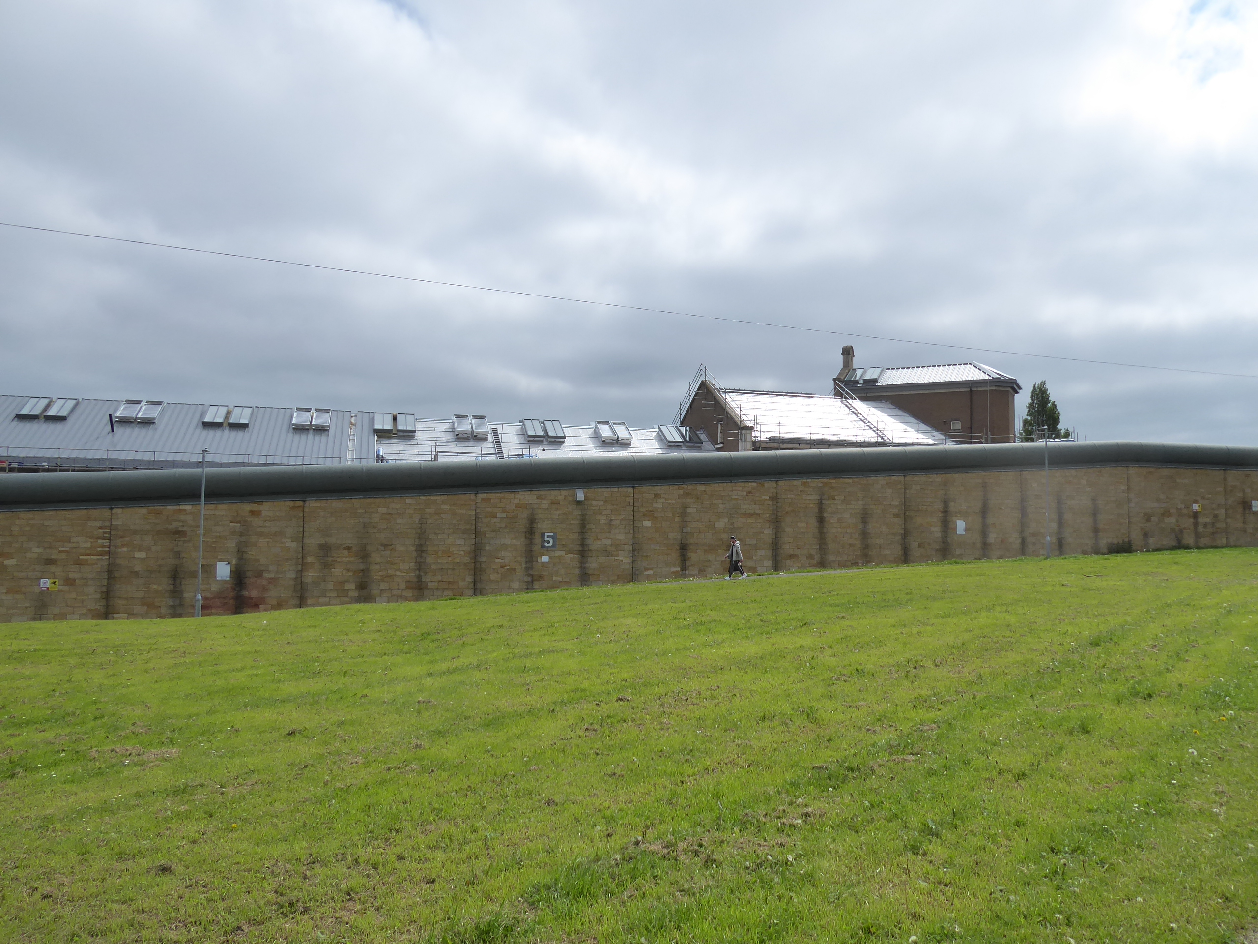
It's not really related to what we're doing today, as we already lack trains going through Morley due to another engineering possession and there's another train strike happening this weekend too, but on 11th May it was announced that Trans Pennine Express were not getting their franchise renewed, which is a rare bit of good news for us travellers to hear after many months (and years?) of their failure to maintain services and self induced industrial strife, which means we might have a competent operator taking on the North Country's premier express services once the mainline upgrade is finally completed in the 2036-41 window. Anyway, the good start to May continues as we rise to another Saturday trail, hopeful that the early gloom will shift before too long as we target a new trail from home to my local Old Country and beyond, starting out from Morley station at 10.15 am and heading down the Valley Road path with only the most cursory of glances being given to the deliveries of aggregate as I'm actually growing bored of spotting local freight trains now, heading on down by the Gasworks and Valley Mills site to strike for the fields beyond, rising over the false ridge and equestrian fields that have Cotton Mill beck concealed beneath it, and down again on the Millshaw Beck side. Land by the gas plant and exposed stream ahead of the staff car park at the south end of the White Rose centre, where we pass across the access road, and the A6110 Ring Road carefully, to progress up the side of Dewbury Road as to comes down the hill, rising up towards the railway bridge and the path to Stank Hall farm, passing up by the side of the former GNR Hunslet Goods line and soon enough find ourselves in the exact same part of Beeston Park Side that we visited last weekend, by old St David's and coming up to the Tommy Wass corner, where we'll swap sides to progress north rather than east (or in reality, South).
 |
| I actually tire of the site of freight train at Morley. |
 |
| Over the false ridge above Cotton Mill Beck. |
 |
| Meeting Dewsbury Road, tangling with the Ring Road. |
 |
| The former St David's church, Beeston Park Side. |
The turn onto Old Lane lands us among a lot of foot traffic as despite the early hour we find ourselves among the crowds heading to Elland Road stadium for a lunchtime kick-off, and so as we progress our way trough the rathe ad hoc suburbia on Beeston Hill, we try to not cut too incongruous figure among all the tribally worn colours as we rock on past the Asda store and St Anthony's RC church to cross Town Street by St Mary's and thence down Wesley Street by the chapel to find myself fully among the Leeds United faithful, again trying to not look like a weirdo while wielding my camera as we descend with the throng. It's actually remarkable that being in the vicinity of Elland Road on a match day is something that I've avoided thus far and I'll happily ghost my way through the crowds as they gather, passing below the Jack Charlton Stand and the Centenary Pavilion to go completely against the tide of people as we go below the M621 via the footway to the Lowfields Road industrial estate that has ceased to be a backwater lane and become a hive of activity to satisfy all the dietary and adornment needs of the sports enthusiasts, who'll continue to arrive as we rise up, all full of the thoughts and permutations of what might need to happen for LUFC to dig themselves out of the hole they're in. Beyond the A62 Geldard Road, I can be the lone walker against the tide on the footpath that leads under the London mainline and over the lost Wortley & Holbeck line, rising up to the A58 Whitehall road to follow the footbridge over the old rail yards by the L&NWR metals and on to the playing fields of Wortley Dragons ARLFC, south of Wortley Rec, where our route finding needs to direct us to the northeast corner, following the path past the skatepark and park lodge house, with only the company of exerciser and mums with buggies as we wend our way down to Oldfield Road to pass under two sides of the Wortley railway triangle.
 |
| Old Lane and St Anthony's RC church, Beeston. |
 |
| Wesley Street and the Elland Road-bound Throng. |
 |
| Elland Road on Matchday. |
 |
| Lowfield Road, and the sports traffic. |
 |
| The Trans Pennine Line and old rail yards. |
 |
| Wortley Rec. |
Pass below the Wortley Park tower blocks as we short cut across to Tong Road, to find the path of Green Lane as it passes through a corner of new Wortley that wouldn't be ventured through under other circumstances, passing Holy Family RC church and Castleton Primary school before presenting a slightly elevated view across the low rise rooftops towards the city ahead of the sweep around Hall Lane that leads us behind HMP Leeds (or Armley Gaol), which doesn't present is best crenelated face on this side, and above Wortley cemetery, beyond which we cut across the lawn to Stott Street, where get buzzed by an urban Red Kite, for our troubles. Entering the landscape of redbrick low rises, the sunshine finally makes its breakthrough, lighting up the estates on Abbott Road and Ley Lane before we find the stepped path that leads us down to the A647 Armley Road, which is crossed as we head off this hill nab and down the newly resurfaced Pickering Street to meet Carlton Works and the disused Armley Canal Road station at 'Botany Bay', next to the Aire Valley railway line, and the Leeds & Liverpool Canal, where Viaduct Road tangles us with the last route paced out this way as we pass below Kirkstall Viaduct and over the river Aire, taking pause to note the extensive flood prevention works ongoing below the bridges. A different path needs to be blazed going north from here then, the other side of the bath store (which my brain still thinks is Harley Davidson Dealership, across Kirkstall Road and up Willow Road, past the Alexandra Park apartments on the site of the old Liberal club and up Cardigan Road from its bottom end the first time, where there are more flats among the terraces than there used to be though the woodyard endures and St Margaret's church has new life as Left Bank Leeds, and all the stores along the terraced ends seem to being doing business, on the fringe of Student Land, as we come up to the Cardigan Road Co-op, where I shopped many a time, back in the day.
 |
| Green Lane, New Wortley. |
 |
| HMP Leeds, or Armley Gaol. |
 |
| The stepped path down to Armley Road. |
 |
| Flood Prevention works ongoing, on the River Aire. |
 |
| Cardigan Road, with terraces and apartments. |
 |
| Cardigan Road Co-op. |
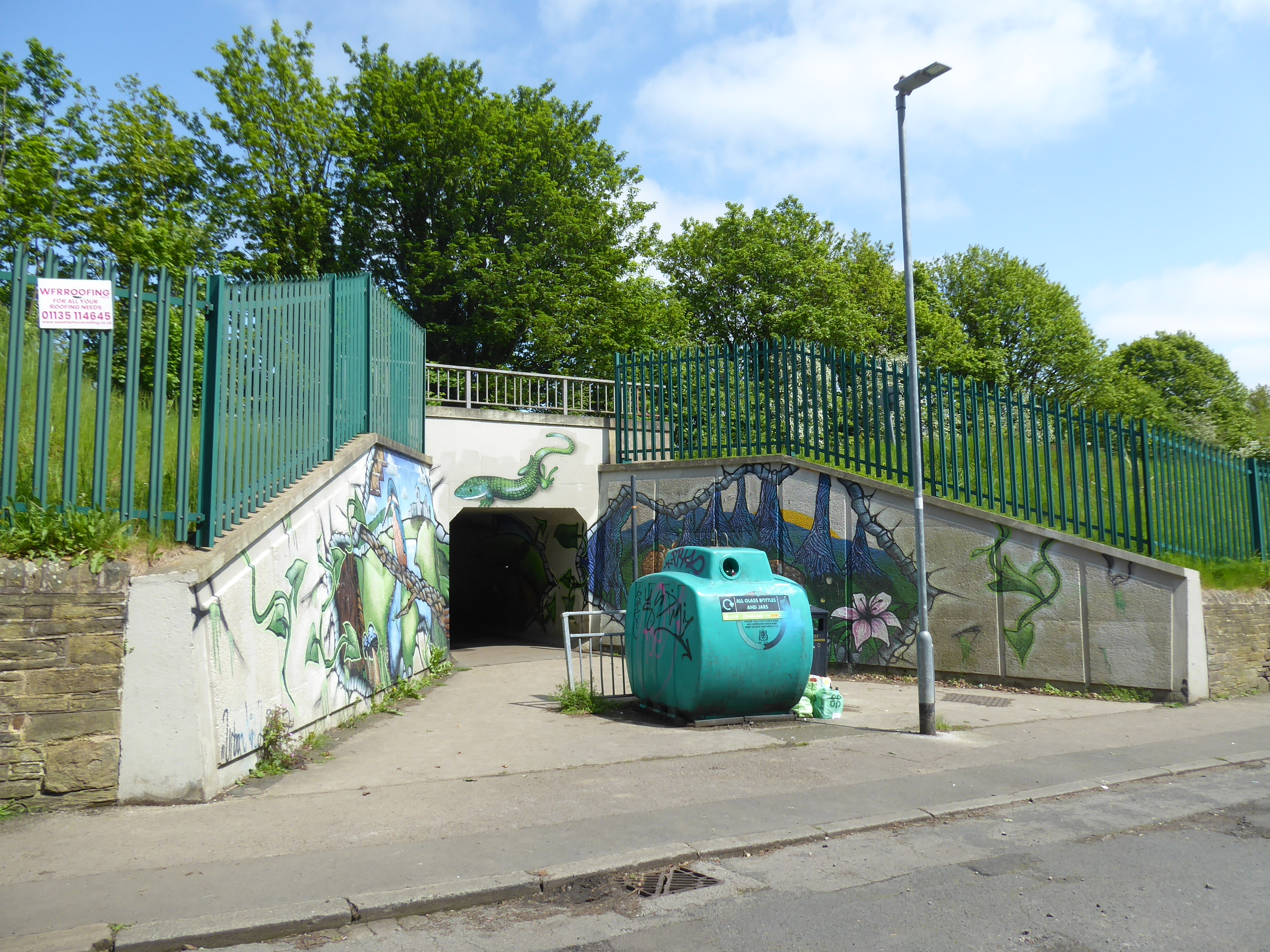
Burley Park station lies just beyond, at the end of Cardigan lane, and we'll break here for lunch on its benches, tagging it to my local tier even if there aren't any trains to catch, before we go off in search of more stations, up Chapel Lane and behind Our Lady of Lourdes RC church, and up Newport Road and View between terraces and semis that I know I've never ventured among despite a decade of local residence, leading us up to St Michael's Lane by Headingley Stadium once again, where it's a whole lot quieter than Elland Road, and our route takes us over the railway bridge in the opposite direction from last time, and on among the suburbia up St Anne's Drive. Emerging onto St Anne's Lane and then Kirkstall Lane, we're put in very close to Headingley station, only a short way east along the B6157, which we will approach to demonstrate that it is only 20 minutes distant on foot from its neighbour down the line, while actually being less convenient for its namesake venues, and we'll pass under the line here to pick up the other end of the path we drew this way last month, where we'll blaze around the Queenswood Social Club's playing fields, where a 20-a-side game seems to be going on, admire the painted foot tunnel behind St Stephen's church and this time find the path behind the Woodbridges and the allotments. This leads us into Morris Wood for some shade, bluebells and wild garlic aroma on a descending dirt track to a bridge over the railway, which leads into Kepstorn Close beyond, where we emerge among the council flat blocks and thence onto Spen Lane, where our forward route becomes a lot clearer, taking us under the towering vintage railway bridge that might be one of my favourites, and on up the steep lane that's one of the hidden red routes into northwest Leeds, where the Hark to Rover inn no longer resides and the rising tree-lined boulevard between the semis and Norman Towers provides quite a challenge in this Spring Heat, for which I am naturally over-dressed.
 |
| Newport Road is old country local but previously unseen. |
 |
| St Anne's Drive. |
 |
| Headingley Station house. |
 |
| The decorated foot tunnel, behind St Stephen Kirkstall. |
 |
| Morris Wood. |
 |
| Spen Lane Railway Bridge. |
Levelling off, we find ourselves in the extensive and varied borough of West Park that seems to encompass council estates and suburbia around if beyond its playing fields, past the Butcher Hill Co-op and it parade, and growing smarter as we press north, taking us past the URC and out towards the A6120 West Park Ring Road, which is crossed after the terraced ranks of semis on the hillsides in the top left corner of the city, with Spen Lane getting steeper once more as we press on, rising to their local Co-op store which has actually motorized drones outside for delivering shopping among these elevated suburban streets, parked all around the Iveson Drive corner. We'll split eastwards here, rising among the whitewashed council house and low rise blocks of Ireland Wood, passing above Clayton Wood and finding that the Woodside Vale housing development advertised on the Silk Mill Way corner is actually the suburban reclamation of the disused quarry site therein, while a little further along and up Oak Park Lane, we can find the former Cookridge Convalescent (and Oncology) Hospital, gradually being developed around but with three major late Victorian buildings still remaining as School, Care Home and Apartments, with the latter looking a whole lot like Cragside to my eyes, which shouldn't be a surprise as they share an architect in Norman Shaw. Despite having done work with NYCRIS here two decades(!) back, it oddly doesn't seem familiar, and its views over the Aire Valley are hard to process to as we seek our way out, back to the main road and east into the estate streets of Tinshill, also ranked up the hillside, with a route needing to be sought that doesn't involve going uphill unnecessarily, and that means cutting along Silk Mill Bank and then down Woodnook Drive by the Tinshill & Cookridge Social club and onto Haigh Wood Road, almost adjacent to the railway once more.
 |
| Spen Lane and West Park Playing Fields. |
 |
| Spen Lane and the rise of northwest Leeds. |
 |
| Iveson Drive and whitewashed Ireland Wood. |
 |
| Clayton Wood Quarry becoming Woodside Vale. |
 |
| Cookridge Hospital (former) |
 |
| Silk Mill Drive, Tinshill. |
 |
| Haigh Wood Road and the rise to the finish line |
That provides the direct line to our finishing point at Horsforth station, our third and final on for the trip, where we wrap at 2.35pm, where we'll finish feeding and watering at the end of the year's longest walked day so far, without a quick route home due to a total absence of trains, and a triumphant beverage in the Fox & Hounds might appeal if it wasn't for having to wait for the #6 bus to ride its circuitous route back to Leeds, which even then doesn't provide the troubles as its waiting for the #51 back to Morley is the absurd delay on my 2+ hour ride back home, earning First Bus more of my ire for their garbage timetabling, and a fine illustration of why I've never bothered walking the city by bus along the way.
 |
Q: How can you tell if someone is a local or not in Horsforth and its environs?
A: Only visitors pay attention to the aeroplanes landing at Leeds - Bradford airport. |
 |
...and if you prefer your birds less big and less metal,
why not enjoy some urban Red Kite action? |
5,000 Miles Cumulative Total: 5988.2 miles
2023 Total: 66 miles
Up Country Total: 5,507.5 miles
Solo Total: 5645.6 miles
5,000 in my 40s Total: 4578 miles
Destinations Moved into Tier 1: Burley Park, Headingley, and Horsforth
Trails moved from Tier 3 to Tier 2: 3
Next Up: Spring Jollies on the North Yorkshire Coast, with a Rail Trail in my Sights.


No comments:
Post a Comment