8.8 miles, via Kirkstall, Kirkstall Abbey, Kirkstall Forge, Hawksworth Wood,
Horsforth New Road Side, Low Fold, Park Mill, Low Green Rawdon, Nether Yeadon,
Henshaw, New Scarborough, Nunroyd park, Guiseley, White Cross, and High Royds.
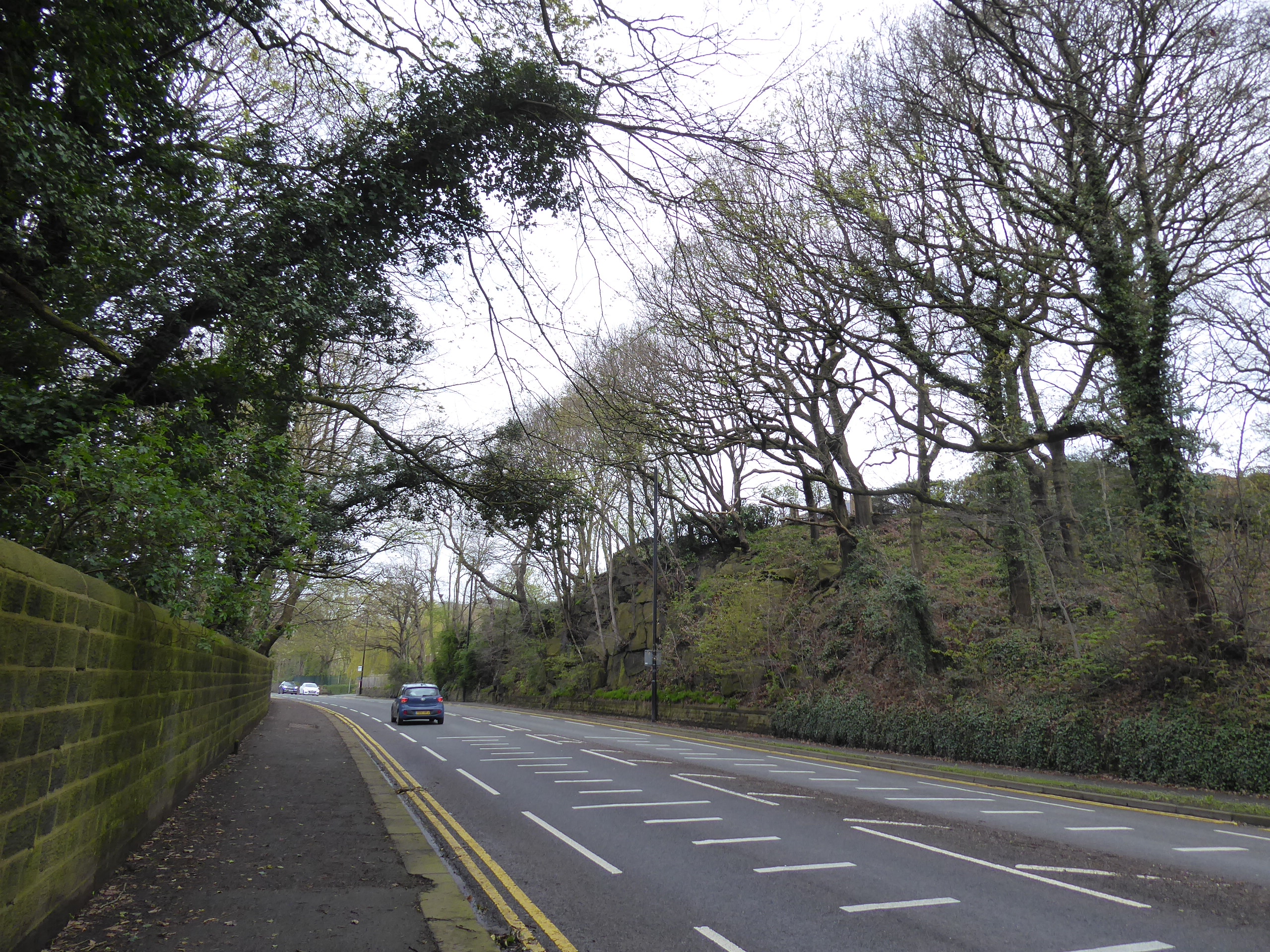
Having had three rest days over the Easter weekend, and only worked four days of the following week, we feel good enough to go again as the next weekend rolls around, giving us a seemingly rare occasion for a bit of Saturday walking, not that we seem to have schemed out 2023 yet, aside from having an idea of targeting a number of railway station that haven't been used as destinations over the last 11 years, and maybe threading all my trails for the season into a single continuous line that reaches all over Leeds district, an idea that's as fanciful as it is ridiculous, one that would be sure to tie me in mental knots. Regardless, we ride out to Headingley on this gloomy morning, alighting at 10.05am and feeling none of the warmth in the air that we might be anticipating this year as we target a long stretch of road that we haven't approached in full along the days of our walking trails, to be found down the drop of Kirkstall Lane and beyond the Morris Lane crossing, where new development emerge on our left on the way down to Kirkstall Lights, where we take a right turn by the leisure centre to immediately join our trajectory for the day, north-westerly on the A65 where Abbey Road has had it Beatles connection noted as it leads us on between the Abbey Mills and West End Inn, and below the drop of the terrace ends. Just around the corner lies Kirkstall Abbey, the most enduring historical pile in the city which we haven't seen from the main road side on the course of my travels on foot, so a different aspect is presented as we go by its north face, passing the crowds that have already gathered in it parkland and progressing on pat the Abbey House museum and the fields of Burley RUFC on the way on past the Vesper Gate inn and on along the roadside to the Kirkstall Forge milestone marker and the observation that hardly any further development has occurred on the forge site itself since we first passed this way in 2017, judging by what we can see over the high perimeter wall that we pass around.
 |
| Developments afoot on the Kirkstall Lane Corner. |
 |
| Abbey Road Kirkstall acknowledges its influences. |
 |
| Kirkstall Abbey from the road-side. |
 |
| Kirkstall Forge, where nothing is developing. |
There's not a whole lot of greenery coming on yet as we pass below the urban forestry of Hawksworth Wood, looking bare as it looms over the hillside and around Cow Beck, which is passed over as we make the transition into Horsforth, finding another ne stretch of the A65 to pace as we rise up through the rock cutting that starts our push above and away from the River Aire, taking us above the fall of Newlay and presenting us as across the valley from Bramley and Rodley as we rise on into the distinctly stoney parts of the shopping parades and terraces of Horsforth New Road side, with the A65 just keeping on going uphill. Past the Fleece inn and New Fold farm, we get suggestions of the cloud breaking, which seems rather appropriate as we arrive at the edge of the de facto city, passing over the A6120 Ring Road as it rises up from the river crossing, noting the horse sculpture on the roundabout and resuming the adventuring along the A65 as we get clear views over the fields to the south to put us in context across from Rodley and Calverley across the valley, with the suburban edge petering out on the north side as we are drawn on, into the woods around Rawdon crematorium and out to the passage over the path of the Leeds Country Way as it progresses southwest to northeast. A bus shelter offers as a space for a watering break as the sunshine makes a breakthrough completely changing the feel of the day before we follow Leeds Road onwards and pass below the suburban edge of Rawdon and around the Airedale International Air Conditioning plant, with our view expanding upstream as sightlines emerge to Idle Hill and Ovenden Moor, and beyond which gives me amazement that new scope on the landscape can still be gained in West Yorkshire, before we get the surprising reveal to the southeast of direct sight of Morley, its towers and spires prominent on the Aire-Calder watershed.
 |
| The Rock Cutting, New Road Side. |
 |
| Horsforth New Road Side. |
 |
| Aire Valley view from the Horsforth Fringe. |
 |
| The Woodland space between Horsforth and Rawdon. |
 |
| Suburban Rawdon, above Park Mill. |
 |
| Bramley Park mast, and distant Morley. |
It would be very easy to get caught up in these views, as we press on above the Low Green farmstead and hamlet, as well as the historic Rawdon Hall among the fields above the valley, but we have an urban landscape to return to as we pass the Conservative Club (advertising a show by a 'Good Female Vocalist') and the Rawdon Golf, Lawn Tennis & Padel club (which is definitely a sport I've never heard of), ahead of the War memorial garden and the shopping parade ahead of the old Harrogate Road crossing and Micklefield park, where the road starts to descend after so long going uphill as it passes the stone terrace ends and gives us sight towards Otley Chevin. We come down to Nether Yeadon by the traffic island on the A658, where the Benton Park Methodist church, Sainsburys Local and JCT600 cluster opposite the one tower block in the area, down the hill from Yeadon itself, with the stone house and suburbia landscape resuming as New Road carries on, taking us through Henshaw and past the Woolpack inn, the local RAFA and the low-rise estate on the edge of Guiseley, before we come upon the old MR Yeadon branch, which we've passed below on our travels but now needs to be observed from above, lying ahead of the RC church at New Scarborough and the passage of Dibb Lane. We cross maybe our fifth traversal point on this otherwise unseen stretch of the A65, before we pass around the southern perimeter of Nunroyd park, with its tree-lined green spaces and playing fields, and come down upon the Westside retail park on the Nunroyd Mills site, which despite being somewhat larger is easily mistaken for the more modestly scaled Guiseley retail park, to be found further along the Leeds Road, beyond the mural on the gable end of the Yorkshire Rose inn, celebrating the relative achievements of Revie, Wilkinson and Bielsa with LUFC, and across the railway line that burrows below the tangle of lanes at the south end of south end of Guiseley's main street
 |
| Low Green farmstead and hamlet. |
 |
| The Leeds Road - Harrogate Road crossing, Rawdon. |
 |
| Benton Park chapel, Nether Yeadon. |
 |
| The Woolpack inn, Henshaw. |
 |
| Nunroyd Park. |
 |
| The Yorkshire Rose and Leeds United's three First Division winners. |
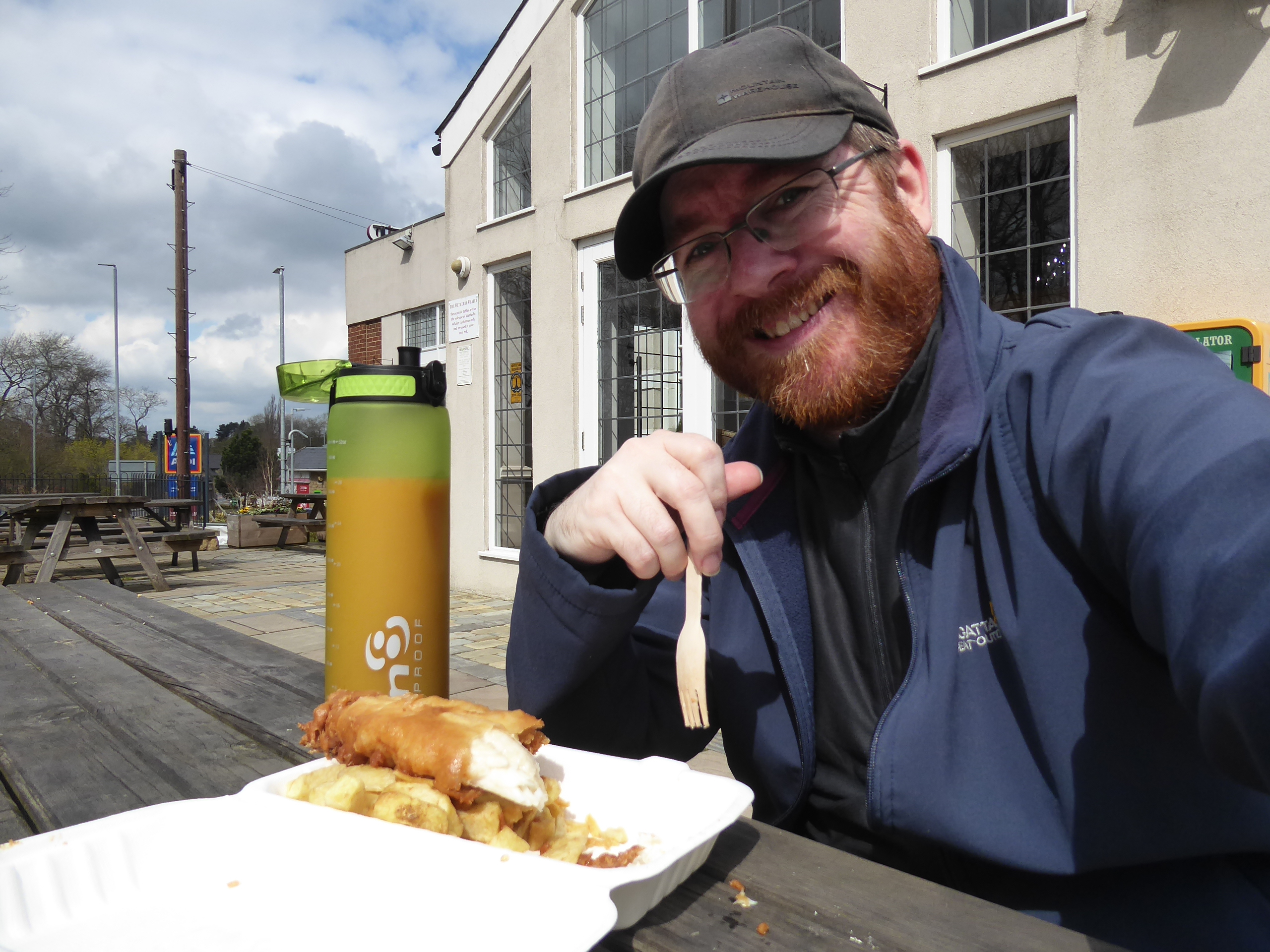
Our sunny day looks to be breaking apart as we progress on, across from the bars and takeaways on the run opposite the Morrisons store, still finding a new stretch of the A65 beyond the Station inn, where long terraced faces conceal the railway station, and the gloom that announced the day resumes as we come past Nethermoor Park, and the homes of Guiseley AFC and Cricket Club, following the Otley Road as it wends it way past the rural looking Birks terrace and the Nuffield Health centre in the old Tram depot, ahead of the White Cross in and junction where our target for the day can be found, the Wetherby Whaler, where a celebratory portion of F'n'C awaits. Admittedly, it's a bit early for me marking my 6,000 career miles, but getting any amount of miles down has felt like an achievement this year, and all that fat will keep me charged for the final push, as the sunshine unsuccessfully fights to gloom as we process on, along the A65 as it passes by St Mary's RC primary school and the wholly redeveloped High Royds hospital, in the cleft that lies between Otley Chevin, close to the east and Rombalds moor, further to the west, and the remains of the private railway that once served the County Lunatic Asylum have to be noted before we depart our companion of the last 3+ hours to head for the finish line. Arriving in Menston, and Bradford district for that matter, we turn onto Bingley Road to make for the path across the middle of Menston Park, with sightlines giving us a sense of a Wharfedale horizon before we reach the end of the Main Street, which progress along for one block before we turn down the suburban fall of Cleasby Road, clearly directing us down to the valley that we haven't done any pacing in since 2018, before we meet the railway station beyond it road, finally making Menston a destination on my travels almost 11 years after first using it a jump-off point, all done at 1.50pm and feeling like that's honestly as far and as fast as I could have managed for the day today.
 |
| Guiseley Main Street, Otley Road. |
 |
| The White Cross Tram Depot. |
 |
Any Activity in 2023 feels like an Achievement worth celebrating,
at the White Cross Wetherby Whaler. |
 |
| The High Royds Hospital railway bridge remnant, Otley Road. |
 |
| Menston Park. |
 |
| Cleasby Road, Menston, descending into Wharfedale. |
5,000 Miles Cumulative Total: 5967.8 miles
2023 Total: 45.6 miles
Up Country Total: 5,487.1 miles
Solo Total: 5625.2 miles
5,000 in my 40s Total: 4557.6 miles
Next Up: The Path from Menston Leads Us Where, Then? Or Not...


No comments:
Post a Comment