12.3 miles, from Morley Hole, via New Brighton, Dartmouth Park, Howley Park, Howley Hall,
Lamplands, Upper Batley, Brown Hill, Birstall, Field Head, Moorside, Adwalton, Gildersome,
Hart Hill, St Bernard's mill, Rooms, Daffil Woods, Churwell (Lane Side), Daisy Hill,
Chapel Hill and Banks Hill.
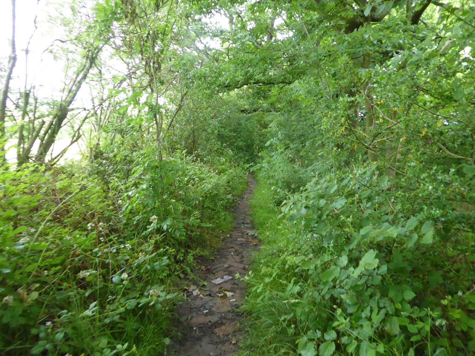
In our final episode of 'June doesn't know what the hell it's doing' we get it dropping three midweek days of unbroken sunshine and high temperatures which are concluded by one of the most epic cloudbursts that I have ever experienced (and I should know because I was right out in it when it happened), and as the weekend lands it decides that it's going to shift our climate back into that of early Spring rather than Summer, presenting weather of teeming rain than might inspire me to stay at home in normal circumstances, but as we know, we are in a world that's far from normal, and I need my routine of stretching to keep my head in good order. So to Morley Hole we head, waterproofs donned against the persistent drizzle, for a 9.10am start, aiming to get this tour done at the hurry-up to stay ahead of the threat of storms in the afternoon, starting out up the causey into New Brighton, because original routes are proving hard to come by now, risking early injury on the slippery setts before we head south via the way to Corporation Street, which we cross and find a couple of un-walked roads through the estate beyond, Highcliffe Road and Gerard Avenue, which pass St Francis' RC school along the way to Scatcherd Lane. Steps are retraced again past the cricket and rugby clubs and on into the upscale Victorian suburbia that surrounds Dartmouth Park, before we actually do locate the route along New Park Street, which leads us among its terraces towards Fountain Street before not actually joining it, instead slipping down the back lane of Oak Road, which gives access to a whole block of suburbia that would otherwise go unnoticed as it leads us to a ginnel behind the old chapels on the corner of Bruntcliffe Road, on which we land by the Halfway House inn at the top of Scotchman Lane. Over the A650 and again onto familiar pavements, down among the suburban ribbon out of town and over the M62 before we split onto the route of last year's Long Walk, angling down the farm track and across the fields on the site of the original Howley Park quarries, getting none of the views down to Batley and across Kirklees that we enjoyed in 2019 as we pass above Morley tunnel and between its vents, meeting a crowd of grazing horses and foals at the bottom corner of the field where we join the path that skirts the perimeter of Howley Hall golf course, where the well-grown vegetation shows up a greater risk of giving you a soaking than the rainfall does.
 |
| Finding a new route in Morley, via Highclife Road. |
 |
| Oak Road is another hidden back street. |
 |
| Rain haze block the view over Batley to Kirklees. |
A new route awaits across the Golf Course, the right of way angling us away from the fairways on a rough track to meet the access drive, which we negotiate carefully among more traffic than you might expect in the conditions, and finding that the local golfers are much friendlier than expected as I slip across the car park between the clubhouse in the new Howley Hall and the stable blocks to the west, happy that the ongoing path is easily identifiable as it carries us on, not getting in the way of anyone's game as it we are directed into the rough growth of trees at the southern perimeter of the course, where we spill onto the more popular path that leads up to the old Howley Hall remnant. We won't linger up here on the brow this time, or linger with the downstream view that is largely greyed out, as a steep path down leads us into the rough growth below, angling ourselves among the mud and damp foliage for the pylon that sits at the head of the path down to Howley Park farm, which we approach down another slick track before getting a hard surface to pace on its access track as it leads us down to meet the Kirklees Way path, slipping northbound as our route starts to kink around, following Howley Beck upstream with dirt track of Howley Mill Lane. Switchback again at the Lower Mill site, and pass through this residential enclave in search of the path that will lead us up to the ancient footbridge over the railway, easily located despite its path having little obvious purpose these days, a fine place to train-spot in more clement conditions, and only one passing train is snared before we carry on, through the long grass that saturates the trews, as we pass alongside the long walls of Sunny Bank house, to pass over the old GNR line up to Adwalton junction, and on with the lane into the outer suburban enclave of Batley known as Lamplands. Take some turns around the bungalows to find York Road and the way onto the B6123 by Blenheim House at the top of Batley Field Hill, and we'll not descend here, instead passing north and west with Heaton Road to meet Timothy Lane as it reaches into Upper Batley, which still has a distinctive feel with its large out-of-townhouses and high walls, and as we pass north with Low Lane and on to Upper Batley Lane, it's notable that suburbia really hasn't bloomed up here among the mini-estates and farmsteads, even though every road facing field has grown a house on it, as its aged and rural flavour still endures.
 |
| The new Howley Hall is the golf course clubhouse. |
 |
| Howley Park farm. |
 |
| The Howley Lower Mill footbridge. |
 |
| Upper Batley brings the Stately residences. |
The proper hill rise then comes on, as the rain eases back, at last, ascending us out of greater Batley and onto the ridge between the valleys of Howley beck and Smithies beck, with fields opening up over the top to reveal another panoramic view that your brain needs to assemble anew, while showing up new vistas in quite the most unexpected of places, and thence it's on to the next town over, soon landing in the suburban spread of greater Birstall, among the semis and stone terraces of Brown Hill as the lane reveals perspectives that are completely new despite their proximity to home, incidentally revealing a benefit of wandering from home along pavements that cross-country routes have failed to access. We descend to drop out onto the A643, on the lower reach of its traverse down from Copley Hill, and we'll follow Leeds Road as it meets the A62 where we'll cross the very end of Gelderd Road beofre we rise into the heart of Birstall proper via Nelson Street, where the market place area looks to be as busy as it ever is, passing the statue of Joseph Priestly and the pleasing frontage of the Co-op store as we seek not to linger among the shoppers, splitting away as we meet Middlegate, to rise out of the valley head we've been in, so close to the bulk of 2020's planned walking field, and yet still so far away. We elevate, among council flat blocks to come upon the estate edge from whence one of our walks to Halifax brought us, passing the White Bear inn and elevating ourselves further up the course of the B6125 as Field Head Lane rises on through Birstall's suburbia, to meet another railway relic that only the keen eyed would notice, namely the Fieldhead bridge over the deep cutting of the Leeds New Lines, of which the long western parapet endures, with the structure at least partially extant below, despite the infilling post-closure, which has been built over to the east and is marked for development to the west, so that stretch towards Oakwell Park probably needs an explore before its lost forever. Birstall's urban fringe extends beyond as we rise on, realising that we are heading up to the Aire-Calder ridge only as we hit the top of the town, where the Field Head terraces stand, claiming the birthplace of Joseph Priestley along with the Essential Group's HQ, ahead of the passage over the M62 which is shared with the Kirklees Way path, and the view back over the district shows a lot of ominous cloud coming on from the southwest as we reach the lane head where we meet the crossing over the A650 bypass road, right at the point where Adwalton junction on the GNR lines once divided to the east, and a pair of railway vintage cottages still stand.
 |
| Surprise views from Upper Batley Lane |
 |
| The stoney charm of Brown Hill. |
 |
| Birstall Market Place. |
 |
| The Fieldhead viaduct remnant, Field Head Road. |
 |
| The Field Head terrace and Joseph Priestley's Birthplace. |
Arrive at Adwalton's southern suburban edge, and Leeds district once, more as the rain comes back on, somewhat harder than before and thus snaring a bench outside The Railway inn for elevenses seems unwise, and we'll have to shelter under nearby trees instead before we press on along the edge of Moorside, opposite the enduring rough fields where the English Civil War Battle of Adwalton Moor was fought in 1643, claiming an identity separate from its neighbours on the Old OS map and presenting a good sort of aspect to the north and west as the cloud cover breaks up for a while, illuminating the distant face of Drighlington as we progress on to meet Wakefield Road in what was, and is, Adwalton proper. Rise past the medical centre and the amateur rugby club to return back inside our originally established local walking bubbles as we pass the wonky-walled cottage and slip off the main road by Riyana Stores onto the field track in the direction of Gildersome, a path the feels like its had a makeover since I last passed over it in 2013, dropping us down the north side of the ridge and offering some elevated views towards Pudsey and Tinshill to the north, across west Leeds and to the Aire-Wharfe gap beyond, before we drop down to the bottom by the still enduring tips of the long vanished Waterloose coal pit. Elevate with the uphill section of path that is vaguer than the western half, rising among more rough plots that have doubled as BMX tracks to get confused by paths that have arrived in the landscape since my map was printed, picking out the correct route as we are directed up towards the end of Woodhead Lane, and looking back it's pretty remarkable just how well the clear track that we've descended hides in this landscape, and that suburban growth hasn't made its way into this broad bowl of fields, for which we should be grateful. Our arrival in Gildersome has us touching the Leeds Country Way route again, progressing our way to Street lane beyond the grounds access to Birchfield primary School, and coming out down from the shopping parade opposite the Quakers' meeting rooms, and thence it's down past Gildersome Primary School and the Conservative club to the corner of Town Street, and despite my many trips across the village over the years, this middle portion of the main road seems to have resisted non-bussed visits until now, where a number of pleasing frontages present themselves to the roadside along to the Mill Lane corner.
 |
| Adwalton Moorside. |
 |
| Pacing the track toward Gildersome. |
 |
| Tracing the view back to Adwalton. |
 |
| Street Lane, Gildersome. |
We could strike for home from here, but there's another hard to trace path to fit into the schedule, taking us away from the 'South-West' direction that we've claimed, to be sought once we've made footfalls through the suburban development of the village that I've surely noted as some of the most utterly haphazard in the county, a track to be found beyond the factory and chapel on Town End, hidden away behind the old Sunday School building of the Zion Chapel, the ancient Harthill Lane, which rises as a concealed footpath to near the hill top behind which the village spreads to the west, just below the 171m trig pillar that is guarded by local horses. As the path opens out, we get a grand old view open out to the north, across the fields of Farnley Wood to Upper Moorside and New Farnley, while further east we get the best and most expansive view over the city of Leeds to have been uncovered so far, with the tall buildings of the city centre illuminated by a break in the clouds, which we have to capture before the next rainstorm sweeps over, causing me to retreat under the cover of the trees that surround this ancient lane as it slips down hill, betraying its vintage by the depth of the groove that it runs in, shedding altitude with more purpose than your normal farm track, whilst almost keeping us dry. It's lack of apparent direction is something of a mystery as it settles into its foliage clad lower stretches, as it even has a cobble of herring-boned bricks for a stretch or two, among fields that still have a distinctly medieval shape and feel, which leads us down to the large meadow by the side of the A62, where the path route abruptly ends, it's way forward vanished with the loss of old boundaries, though the perimeter of the field offers the easiest way out to Gelderd Road, grazing the edge of Farnley Wood beck before rising past where a terrace once stood by the side of St Bernard Mill. The AMW Skips plant retains a portion of the old mill buildings, which do have a statue of a dog atop them, and our route takes us along the side of A62 for a stretch, past the pair of derelict that we noted a few weekends back and on to the Workshop Cafe at Poplar House before landing by the Cottinglet Springs caravan parks and just up from the Jewish cemeteries where we make our turn for home, aiming ourselves into the rural district of Rooms, passing under the railway bridge of the Leeds New Lines and rising with the lane in the direction of home.
 |
| The old Sunday School at the head of Harthill Lane, Gildersome. |
 |
| The surprise view to Leeds from Hart Hill. |
 |
| The herring-boned lower stretch of Harthill Lane. |
 |
| St Bernard Mill (remnant), now AMW Skips. |
 |
| The old railway bridge at Rooms, again. |
There won't be a great many original footfalls to be made from here, as we settle back inside our local walking bubble, retracing steps from our first excursion up to the panorama over the city and then down to the passage under the M621, as the post rain heat and sunshine makes it feel foolish to still have the waterproofs on as we come around through the Churwell nature reserve and into the Urban Woodlands, where folk have dashed out to enjoy this spell of warmth and our track leads us through Daffil Woods and out to the lane of Westwoodside, where a left turn gives us our last fresh path of the day, leading us up past Churwell Primary school and through the suburbia to the A643. Cross the top of the ascending Elland Road and head staraight into the fields that still surround the access track out to Broad Oaks farm, where the nearby edge of the Harwill block of Churwell gives a feeling of the suburban face that is sure to claim these fields within a decade, and it's longer trek over this high bluff than feels appropriate on this last leg of the day, with Morley's horizon of towers, spires and chimney's teasing its apparent proximity as we head back into the routes of our Social distancing circuits from the earlier half of the Spring. Start to feel the heat and duration of the day as we come down the field path that leads us up Daisy Hill, which we watched blossom and bloom some weeks back, to now find that it's awash with waist high nettles and bracken at present as we come on up to the equestrian fields, the mill site and the reach of Suburbia that stretches beyond, all too familiar through this year's exploits, drawing us on into the terraced landscape along New Bank Street, coming up to the crest of Chapel Hill and the crossing to the old Bank Street just as the weather takes a damp turn again. We shan't escape one last soaking on the last leg as we come up past the Bank Court flats and the back of the Cheapside parade, as the heavens open as we drop down and ascend with the road and its retaining walls through the landscape of Banks Hill that suggest little by way of coherent urban planning over the years as we are led out onto Victoria Road, and down to Morley Hole to seal another day, feeling like it's been a long day for distance, which it has been, relatively, but as we wrap at 1.40pm, we can note it has also been an unusually quick one, which might go some way to explaining why I'm feeling so tired once we've broken off to head home.
 |
| Daffil Wood, Churwell. |
 |
| The Broad Oaks farm track. |
 |
| Daisy Hill. |
 |
| Bank Street and Victoria Court (formerly mills). |
5,000 Miles Cumulative Total: 4462.5 miles
2020 Total: 196 miles
Up Country Total: 3999.5 miles
Solo Total: 4143.2 miles
5,000 in my 40s Total: 3056.3 miles
Next Up: One Last Local Circuit, for now, with another 4,000 milestone due.
~~~
Pandemic Thoughts: Week 16
Another post-lockdown week concludes and again I don't have much to report personally, not least because I've spent my entire working sequence doing a cover for at Seacroft MRL, which means I've no insight at all to share with regards what's going on in the city as the shops continue to open up, and my travelling involves different train services from and to Morley in the mornings and evenings, earlier and then later than usual, with no obvious crowding on either that would suggest many additional people are travelling into the city with the regular key workers, and it's remarkable just how few people seem to be riding the rails to or from Cross Gates either, meaning that even a two-car 195 doesn't sit at anywhere near 25% capacity. Still, the extra two mile of walking gotten in along the way is welcome, especially as we land some very warm days to enjoy whist out of the city centre (which is why I'll set up shop in the office with a window while I'm working off-site, to enjoy some natural light and a breeze after so long working in various basements), and being in another part of Leeds still means there's the odd opportunity to see some of the exotic train services that run to the east, like the hybrid Azuma that runs the early morning service out to Aberdeen, or the TPE 68s thundering their way between York and Manchester on empty stock movements. Otherwise, there's only minor frustrations to report, like making connections in the one-way system at Leeds station and finding that the trip from platform 11 to platform 13 is and ungodly long way when you time window is limited, and also taking the trip out to Morley Morrisons for the Sunday morning NHS hour and finding that nearly everyone there is too old to be a hospital work and nary a one of the other shoppers is wearing a mask (They do know that hospitals give a risk of infection that's 20 times higher than the average, right?) as the situation in the world just has us waiting on what happens next, just like every week. This time around we do have a clear(er) impression of what's going to come in the future, though, as plans are laid out for the revival of the hospitality industry on 4th July, and it's not an announcement that has me filled with confidence as the pub and restaurant sectors seem to have gotten their way in getting the 2m social distancing spacing reduced, having complained for weeks that most premises wouldn't be able to viably operate with it in place, conveniently ignoring the fact that it's in place for public health reasons in a global pandemic situation.
Indeed, the restrictions seem to be being lifted with indecent haste across all parts of the tourism sector too, as hotels are due to reopened, holiday lets can be booked and even foreign travel is to be opened up, which seems awfully suggestive of the fact that the industry has been lobbying for an early restart so that they might be able to maximise their business through the Summer, having been so badly squeezed in the Spring, and again it just looks like the profit motive is being placed ahead of any public health concerns, just like the how HM Government insists that schools will be reopened in September despite the concerns of the teaching unions, with whom a collision seems inevitable at present. Only a couple of weeks back, I was thinking that the support bubble concept might be in place to last the Summer, gradually rolled out to allow wider social interaction, and now, before the end of June, that seems like an outdated concept, and those in power seem desperate to relax the rules as swiftly as possible, as if they didn't know the adage 'Act in haste, Repent at leisure', and that they had themselves said that lockdown restrictions would be lifted incrementally and gradually, and barely enough time has passed to see if the events of the last two weeks are having adverse effect on the situation. Just this week, we've seen how easy it is for planning to go off the rails, as several schools in Leicester have already been closed again due to new COVID infections being found in their constituency, lending to the speculation that the city might be placed back in lockdown, just when Mum was hoping to travel away or have people come to visit from afar, and the mini-heatwave has had various seaside resorts swamped with day-trippers out to enjoy the weather without any obvious concern for the risk of spreading infection after so many weeks of trying to keep it under control with so much enforced isolation. Sure, all future events are supposedly to be dictated by maintaining of social distancing rules, with the expectation that the populace will act to take care, but that just feels like a huge gamble to me, as too many people will feel the need for release after lockdown, or feel like the whole risk situation was over-stated due to the supposedly moderate(!) death toll of 43,000, and we all know how trusting the wisdom of the crowd is never a sensible manoeuvre, and if things do go wrong do you think that the decision makers will be the ones accepting the blame for acting in haste, or do you think the people might have it sent in their direction? As ever is the case with 2020, all we can do is wait and see...


No comments:
Post a Comment