The 2018 season finale weekend is here, and my Eighth year of walking is going to have a concluding trip, one that I was pretty sure wouldn't happen when I was looking forward back in the difficult days of September, and after all this exercise, which has taken us past the 500 mile mark by quite a stretch, it makes sense to have a trip to the Chip Shop for my celebratory lunch of F'n'C. This route won't be from my front door as a trip longer than a quarter hour is in order, and I set course for another look at the oddly neglected quarter of West Leeds before I go for my food, but when Northern Trains have been marking their cards badly with weekend strikes that have lasted since August Bank Holiday, I don't need Trans Pennine Express cancelling their stopping services through Morley as that puts me an hour back before I can get to Kirkstall Forge for a start just short of 9.50am, with only a three hour window of decent weather ahead of us. Thus we go from where the 2018 season started, where the developemnts alongside the Aire don't seem to have grown at all since February, as we head south this time, along the hard path into the woods that surely leads on towards Newlay and the site of the WW1-era munitions works that used to sit upstream from the Forge, not that we will see much of what endures there as we'll seek the stepped route up to the side of the Leeds & Liverpool canal, where exercisers and a trio of flying swans are already out and about along the towpath. We'll follow the path west to Newlay Locks, not the shortest route but the only way to go to see the side of Bramley Fall park that hasn't been visited so far, and we cross over the double lock to meet the signage that indicates us into Bramley Fall woods, which immediately form a dense Autumnal canopy above us, and despite the paths being relatively clear and open, route-finding still feels challenging as we rise away from the river and canal among the terracing and quarry remnants. Instinct and elevation eventually brings us out at whereabouts I expected we should, about halfway through the park, above the open stretch that bisects the woods and just below the lodge house, where we depart onto Leeds & Bradford Road, to process east in front of the Bramley Moorside estates, with the Fall Park providing a wooded flank for a stretch until we get to the opening out view down the Aire Valley, with Headingley stadium rising on the horizon, and Kirkstall Abbey hiding among the late season colours of the valleys woods below.
 |
| Airborne Swans over the Leeds & Liverpool Canal. |
 |
| Bramley Fall Woods. |
 |
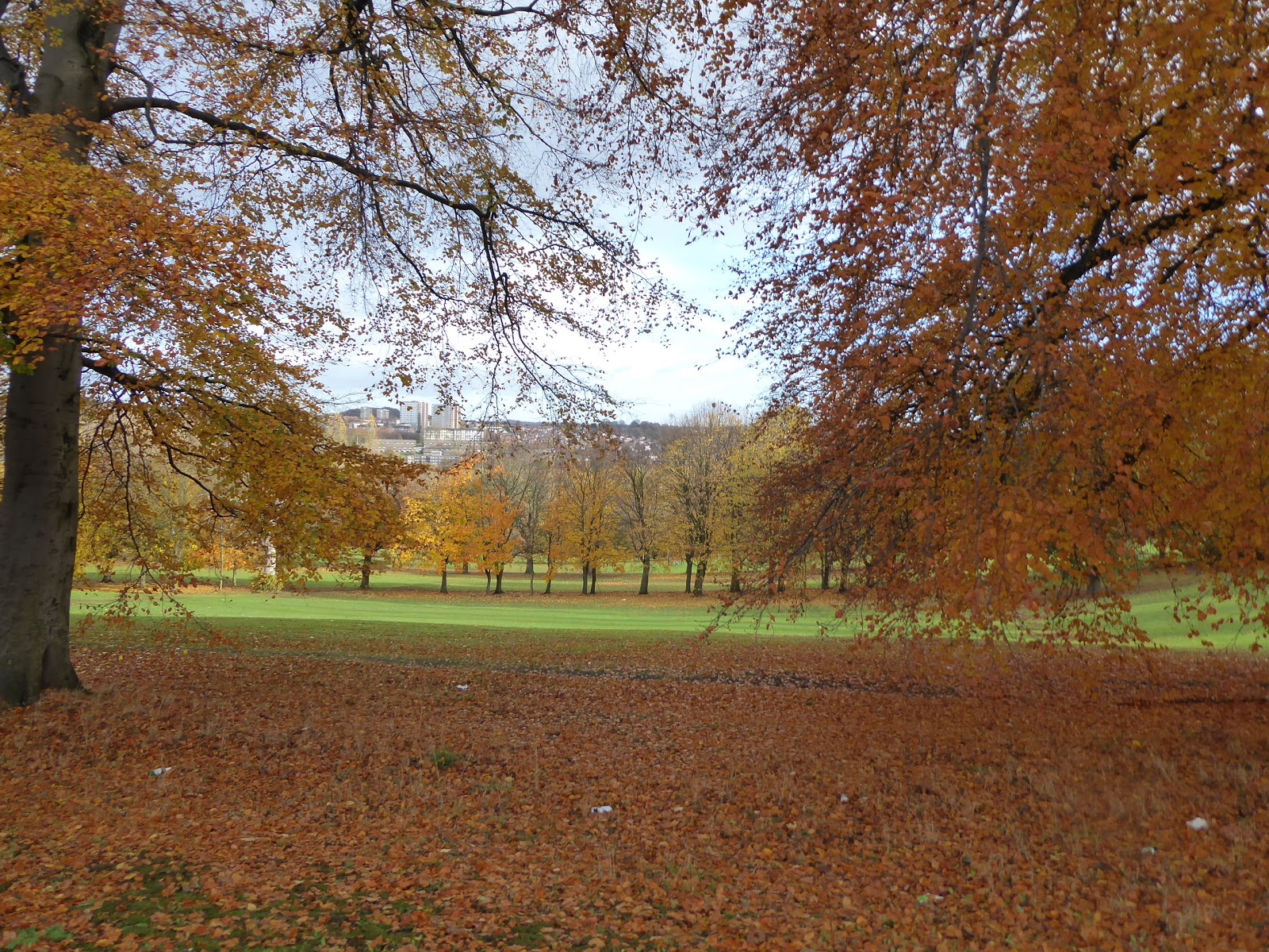
| Bramley Fall Park. |
 |
| The Aire Valley view from Leeds & Bradford Road. |
The route back to Morley can start in earnest as we turn into the Broadlea Estate on the eastern end of Bramley Moorside, rising with Broadlea Grove and missing my turn as I'm momentarily distracted by a pair of trainers slung over a telephone cable, and by iridescent clouds lit by the low sun, and so we have the look of a slightly lost man as we pace on among the council houses on Broadlea Avenue, finding our planned path as we catch sight of the elliptical circus on Broadlea Hill. Pass around this to get back on course along Broadlea Terrace, a long drag that is lit most appealingly, showing up the sheer variety of house styles that have passed through the City Council's planning pattern book though the years, which show the cultural value of visiting the many estates in our towns, which are left behind as we cross Broad Lane and enter a wholly more terraced and old suburban stretch of eastern Bramley, along Kirkstall Avenue and Victoria Park Avenue, to meet our previously burned path across West Leeds at the bottom of Raynville Road. Cross over at the Church at Amen Corner, and Armley Ridge Road leads our path uphill, passing the edges of more estate varieties as we ascend directly into the low sun, and only gain a pleasanter view as we hit the outer edge of Gott's Park, offering more grassy vistas and the colours of turning leaves as we rise sharply, wondering if the suburban semis facing the park along here are so appealing in icy weather. Roll past the old terrace and lodge houses at the entrance road to Armley House, orginally Benjamin Gott's house, walking on past the enclosed garden to meet the A647 Stanningley Road, a dual carriageway which we have to cross to make our way on into Upper Armley, continuing on along the Ridge Road between the terraces and semis to the boldly imposing Christ Church, passing the shop fronts that remind you that this area once aspired to be more residentially desirable than it is now. Meet the Christadelphian Hall at the Town Street corner, which we join to make a proper passage through Armley for only the second time, passing Armley Moor, the patch of common land that still endures in the shadow of a trio of residential tower blocks, and then continue along a street that has retained much of its 19th century vintage face between the White Horse and the Royal inns, but then loses it all for the worst sort of 1960s shopping parades down to the corner of Wesley Road by the Branch Library. Away from the local shoppers we head as we pass the Malt Shovel inn and seek out Chapel Lane, one of the many back streets that seem to form this borough, which we are taking because its leading to the parkland behind St Bartholemew's church, the best one in the city, which is best viewed from the east, which really shows its impressive bulk.
 |
| Broadlea Hill circus, Bramley Moorside. |
 |
| 'Amen Corner', Raynville Road - Armley Ridge Road. |
 |
| Gott's Park. |
 |
| Upper Armley, and Christ Church. |
 |
| Town Street Armley (the pretty end). |
 |
| St Bartholemew's, Armley. |
Descend off Armley's hill and meet Strawberry Lane to pass between the Community Centre and St Bart's school, before crossing Tong Road by the old Co-op store and continuing south down Amberley Road to pass through the local industrial park and thence under the railway line to Bradford Interchange, a route which seems to be defined by its imposing bridges, entering this rather indistinct part of Wortley as we are drawn on to meet Oldfield Lane and the local branch of Asda. Rise again with Highfield Lane, the most aspirant of the local terraces, which looks nice in the sunshine and offers fine elevated views back to St Bart's before we crest and meet the corner of Wortley Rec, where the view over to Elland Road stadium is immediately recalled from a previous visit, and our path takes a sharp right to pass behind the Upper & Lower Wortley cemeteries, which have clearly over-spilled from their original plots to claim an equally sized field that looks about half filled with graves from down here. Drop out by the residential care home to meet the close of Lynwood View, where the Victorian Villa of Highfield house sits rather incongruously among the semis, a relic of an age passed which is a bit of a feature of these parts as our way across Dixon Lane and down Walkers Lane leads us to another, Balk House, which looks like it contains multiples of residences nowadays. A footpath leads around it and the Heaton Lodge nursery, and down through the semis of Far Royds, that odd little location around the A58 Whitehall Road, which we meet and cross to pass down among more industrial units and over Wortley Beck as Royds Lane leads us to the A6110 Ring Road, which we also have to cross at the hurry up to meet the way between the Pavilion Business Park and the Leeds branch of Makro. The reason to come this way is to see what has become of the L&NWR Farnley Junction engine shed site since residential redevelopment claimed it, after a half century of lying fallow as a brown field site, and while much of the junction's northern arm has been dug out, with apartments and houses having grown on the new Honeybourne Way, Piebridge Way and Uppingham Gardens within the triangle, the bridge over the south arm is still in situ, having been spruced up when it could easily have been demolished, the RoW crossing it having probably saved it. We'll pass over it to head south down the green path to the A62 Gelderd Road as my plan to go though the foot tunnel is scuppered by the approach being full of heavy plant, and feeling close to home now we choose to start the homeward stretch by pacing the trunk road as far as the Jewish Cemetery and meeting the driveway to Snittles Farm, passing us over the lost New Leeds Line and under the M621, then descending to meet the bottom of the Churwell Estate, where the contemporary developers in the area have at least restored the stretch of path that was missing when we passed this way last year.
 |
| The Bradford Line bridge, Amberley Road. |
 |
| Highfield Lane, Lower Wortley. |
 |
| Highfield House, lost in Wortley's suburbia. |
 |
| Wortley Beck, Far Royds. |
 |
| The enduring bridge, Farnley Junction. |
 |
| Farnley Junction engine shed was here, once. |
 |
| Cross country and under motorway to Cottingley and Churwell. |
Rise with Digpal Lane, among that most Lego-looking stretch of houses to close the loose end on our Leeds Walks at Cottingley station, feeling good that West Leeds isn't feeling quite so off the radar at the end of walking season #7, and the day would probably have wrapped here if it wasn't for the lack of trains, and thus we'll have to walk the last hour up the hill instead, dropping down with the path to cross over Farnley Wood Beck and pace New Village Way to the corner of Old Road, which we ascend passing the enduring Manor House farm house. Rise as far as the Churwell WMC, and split away from the old village to pass into the many back lanes that I never quite acknowledge despite all my trips up the A643 Churwell Hill, taking the old green path that leads to the end of the tearrce on Granny Avenue, and then down a ginnel to find the way onto Churwell park from William Street, which we wander through to find the ongoing route onto Hepworth Avenue, where 1950s semis are the landscape feature. More green paths can be found beyond, and not ones that follow ancient rights of way either, as the developers of the 1980s-90s decided to include green spaces as the upper Churwell - Lower Morley developments were built, creating the Urban Woods, which start with the bulk of Daffil Woods at the lowest end of the site, and then stretch on between houses and Churwell Primary school, with residential lanes intersecting before meeting Japa Woods, secluded behind the site of Lane Side Mills. It's certainly a better way to see suburbia than many that I've seen, and adds to my appreciation of the local geography that I've never previously seen, left behind as we follow Westwood Side out to the A643, where we cross Victoria Road to get the view over to Middleton and distant Leeds, before entering suburban Morley along King George Avenue, which is entirely a landscape of bungalows, all the way to New Bank Street, where we can briefly detour to see Crank Mill, the enduring industrial fixture in town that I've never seen up close. Descend via the path through the close of King George Croft to land by Morley station and then hit the final push westwards, having walked down Station Road, a good few thousand times over the years without having ever added it to may walking resume, heading up past Dartmouth Mill, the Recreation Ground and the flats on the site of Perseverance Mills before joining Albert Road and rolling up to Morley Bottoms, home to the Royal Inn and the best parade façade in town. Join Brunswick Street to pass the former Victoria Mills to roll up at Morley Hole, and most importantly Hillycroft Fisheries, for a 1.10pm finish, in good time for lunch, just as the day turns into the wet glumfest that was projected for it, and that's that for the 2018 walking season, my seventh year all done and dusted, I'll now take my Fish & Chips home for a celebratory lunch, to be followed by a good three months of hibernation, which I honestly think I've earned, thank you very much.
 |
| Descending to Lego Churwell. |
 |
| Granny Avenue terrace, Churwell. |
 |
| Daffil Woods. |
 |
| Japa Woods. |
 |
| Suburbam Morley's Empire of Bungalows. |
 |
| Station Road, Morley, gets officially walked. |
 |
| Hillycroft Fisheries, and the end of Walking Season #7! |
5,000 Miles Cumulative Total: 3650.4
2018 Total: 537.9 miles
Up Country Total: 3257.3 miles
Solo Total: 3364.1 miles
Miles in My 40s: 2244.2 miles
Next Up: What Have We Learned in 2018?


No comments:
Post a Comment