15 miles, via Riddings Hill, Barden (Beck, Scale, Tower & Bridge), How Gill, Skyreholme,
Troller's Gill, Appletreewick Pasture, Grimwith Fell, Grimwith Reservoir, Gate Up,
Hartlington Moor, Hartlington Raikes, and Hartlington.
The last viably warm weekend of the year comes around, and it's not feeling as good as some that we've had in previous seasons, as if Autumn in 2018 feels determined to disappoint us, and we're going again on Sunday as the Saturday weather doesn't look so clever and the appeal of a lie in after an extremely testing week as work is strong, and we can be quietly overjoyed that the road up Wharfedale is open again, which allows us to take the bus ride up to Bolton Abbey without having to take any stressful diversions. The additional bonus is that travelling on the Sunday gives us an extra half hour on the schedule, which is most welcome as a 15 mile tilt over some rough and remote paths in only six hours would certainly be a bit of a test as the cooling days of October start to take their grip, and despite the waning season, the #874 seems to be busier that ever as it's not even standing room only all the way to our start line, somewhat delayed as we disembark at 10.40am, but still with plenty of time available to complete our trip. Our first hour will follow the B6160 as we head north to Barden, setting off behind the Priory Gatehouse that has been gradually redeveloped into Bolton Hall, passing the tope edge of Priory church's grounds before rising with the path above the dramatic loop of the Wharfe and meeting the Cavendish Memorail Fountain, where we split away from the Bolton Abbey estate to continue against the oncoming traffic past the farmstead at the roadside and above the riverside car parking fields. Thankfully the Sunday traffic is light and the sightlines keep progress un-fraught as we elevate further to see the company of hills on the fringes of Hazlewood Moor and Barden Fell rising above the river valley, with North and South Nab, with Carncliff Top beyond, presenting a drama filled view that had been seen many times when riding the bus down Wharfedale, and one that need to be added to my walked experience list. This keeps us company as we progress past Cowpert Gill and Riddings farm, as we skirt Riddings Hill on the green south-eastern edge of Barden Moor, getting a truly fresh perspective on this quarter before the road descends markedly and views diminish as the road grazes the top edge of Strid Wood, where we pass more car parking and tourist facilities to keep the day trippers happy, sneaking a view west to the heart of the moorlands as the depression filled by Barden Beck approaches. The thing to see here is beyond the plantation as the road bottoms out, and that's the Nidd Aqueduct, making another of its appearances above ground, just south of where its castellated companion passes over the Wharfe, making a multi-arched passage over the beck before disappearing underground again on its long journey to Chelker reservoir and on towards Bradford, which I take many pics of, not really satisfied that they're better than the ones I once took from a moving bus.
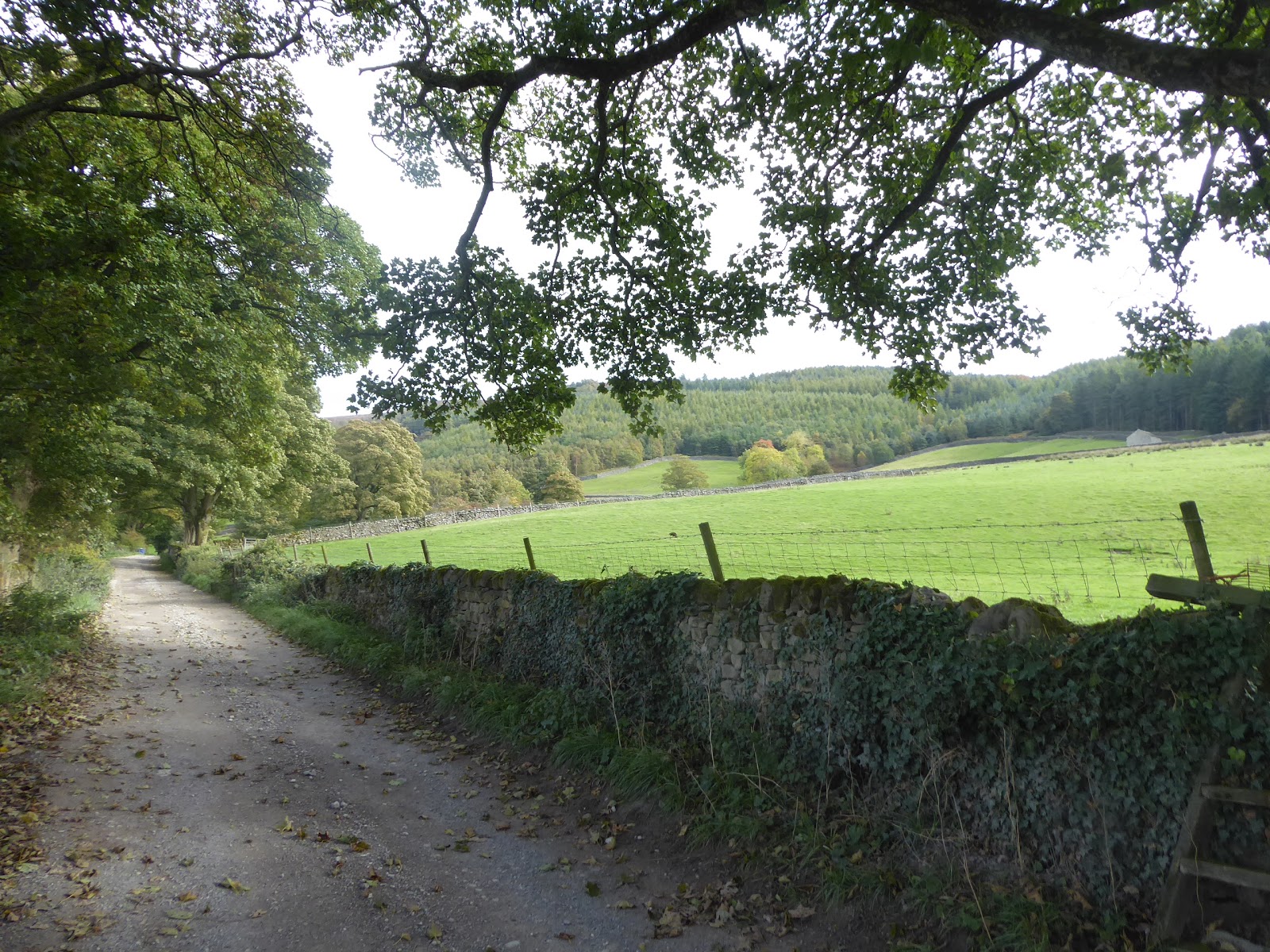
Rising again, towards the farmstead and cottage cluster at Barden Scale, we get fine views of the narrow cleft of Wharfedale beyond Barden Bridge, with Barden Tower located at the centre, creating on of the best roadside views from anywhere in Yorkshire, one which I photographed extensively when attempting to mast the arts of analogue photography back in 2003, and it's view as timeless now as it was then, arriving far too late on my walking itinerary if we're being honest. Pound the road on to meet that Elizabethan hunting lodge up close, happy to have made my arrival within an hour, meaning that my schedule is still sound as we split away from the former school and chapel on the road that would ride us around to Burnsall directly, dropping down the road through the woods instead to make another passage over Barden Bridge to meet The Dales Way route, and the memories of this being an alien landscape in 2013, which we pass along and over as the road rises sharply away from the river and up to Water Gate house, just past the junction of the lane coming up from Storiths. I once road this lane on a trip up to Grassington, the only time the Dalesbus ever took me this way, and it settles in at a steady height passing us below to Lower Fell Plantation that surrounds the western flank of Barden Fell, as we can look out over the river and to the evolving view across the valley with the hamlet of Drebley, central to the aspect on its high bluff above the water's passage, with Barden Moor forming the backdrop, while the cows around Gamsworth farm seem eager that I shouldn't want to make a detour into their fields, thank you very much. Stick to the road as far as Wharfe View house, sure that we must have been following a spring line as we went, taking in our last views towards the Wharfe's westwards shift past Appletreewick with the high hills of the uppermost stretch of the dale visible beyond, before we join the rougher lane that will take us on, under the shade of trees mostly, towards Howgill, where the cleft of the How Beck provides an accessible route up through the plantation onto Barden Fell, and the local farmsteads have all seeming had the holiday home and campsite treatment. To progress over towards Skyreholme our path quality diminishes again, hitting a grassy farm track beyond the farms that will lead us above the passage of Fir Beck beyond Adders wood, and the campsite below Howarths Farm, before we hit a declining field walk across the Craven Fault that takes us out of Gritstone territory and into Limestone country, and try to locate the correct path forwards to the beckside, where the right way to go turns out to not be on the side of the drainage ditch that we were tracing, spotting traces of limekilns down here below the dramatically rising northern profile of Simon's Seat, suddenly elevating itself into this landscape above the Skyreholme valley.
No further doubts about this route once we meet the footbridge over Fir Beck and the tight and twisting footpath that leads us up to Skyreholme hamlet, which still seems to have larger multi-storeyed houses than such a location could have ever surely needed, all seen before on a much drier and less green day than today, showing just how thoroughly a landscape can revive after a relative drought, a route which we retrace to Middle Skyreholme before we split off with the road that leads on towards Parcevall Hall. I'm pretty sure that this house, noted for its gardens and already in a landscape that seems far too wild for a stately home-style property, is actually completely invisible as on a second pass about is perimeters it hides well away from view again, and all we shall see of its grounds at even this close quarter is the boundary of a walled garden and a lot of tall trees beyond Skreholme Beck. We follow the path by the stream, with a course set for Troller's Gill, without real certainty that a path endures when there's no actual right of way to follow, but such concerns are pointless once we meet the broken dam that once flooded the secluded depression among the limestone crags, and a clear route takes us on below the looming edges of Nape Scar and Old Man's Scar to the point where the beck bubbles up out of the ground with the valley beyond completely dry. This take us into Troller's Gill proper, a deep and rough chasm though the limestone hillside, which has a feel of a combination of Malham's dry valley and Gordale Scar on a much smaller scale, not that it lacks drama as the ragged sides rise steeply above the rocky riverbed that is hard enough to traverse when dry, and would be horrifying to encounter in spate, certainly a location with a slightly other-worldly feel, which would be much stronger if it didn't happen to be full of other walkers. It's a good spot to break for lunch as the day brings on gathering gloom and sharpening winds, and I'll find a spot beneath the overhang to break whilst I observe folks set up for climbing and make chit-chat with a passing party of German holidaymakers, and I'd thought I might have this space to myself on a Sunday afternoon in October, but it seems the results of violent post glacial melting and the passing of waters through limestone have an appeal at all times of the year. Then press on though the gill, rising out of the sheer sided passage filled with ankle injury-risking rocks, that turns out to only be a half mile or so long, to follow the dry stream channel north into a much gentler valley to the point where the waters disappear into the sinkholes below, and then tracing the distinctly wet Dry Gill up to the remains of lead mining workings where the path makes a sharp and steep ascent westwards out of the gill, which reveals our proximity to Dry Gill hamlet and Stump Cross caverns along the Grassington - Pateley Bridge road off to the north.
After a warm first couple of hours, the day has now taken a turn for the autumnal as a layer of cloud blocks out the Sun and the wind cuts in from the south west, an ideal time to find yourself on a high patch of moorland grass with half your day's trip still to come, tracking across grassy paths among the lumpiness of the Limestone moors, seeking a way onto the road that you are certain is west of here, with only the receding valley and the looming side of Simon's Seat off to the south giving you any familiar context to the landscape as you go. Find the correct route, as it passes over the much more obvious right of way, taking us away from all the other folk who went up Troller's Gill and on around shake holes and around some distinct patches of marshiness before we emerge from the moorland grasses onto New Road, from where the view north finally becomes familiar as the cragginess above Dry Gill hamlet becomes apparent, and our brief dalliance with the tarmacked surface ends as we meet the green lane that will take us north again. We are finally rising to high moor altitude as we cross the eastern edges of Appletreewick Pasture, with views to Uppermost Wharfedale revealing themselves to the west as we progress, giving sight of Great Whernside across Grassington Moor before Barden Moor returns to the southern horizon along with the lamentedly lost walking lands of Malhamdale, even sensing views to Airedale and Pendle from this lofty eyrie. We land on the B6265 after a half mile or so, just above the long descent down to Dibble's Bridge, and beyond the track continues, rising around the rough and undulating western side of Grimwith Fell, and above the valley of the River Dibb, with the bulk of Grimwith Dam ahead of us, containing Yorkshire Water's largest reservoir behind it, all surrounded by the darkly forbidding south-eastern corner of the Wharfe-Nidd moors that lack paths and don't invite the mind to wander into at this late season stage. The track leads us to the Reservoir houses and the car parks at Grimwith Reservoir, where a facilities break is needed and the toilet block provides a few minutes respite from the wind before we press on to find the track that presses us eastwards to start our circuit around the perimeter path, which is indicated at 4.5 miles, and has good level access for those travelling on wheels, but we'll soon slip off this track as we ought to take a closer look at the Yorkshire Dales Sailing Club. Unlike the Washburn, the facility here is all about the boating, and in as incongruous location as you could find, and watching the antics of boaters, and the folks in motor launches trying to prevent an accident is certainly a diversion as we descend closer to the shore at the south-east corner of the reservoir, with the water level looking markedly low after the dry middle of 2018, meeting the circular path again just shy of the outspill of Shaws Dike.
Here we can find a preserved cruck barn, maintained unlike so many that have passed from use because it is of A-frame construction, meaning its much older than the others and also something of a rarity in the Yorkshire Dales as most were replaced after the 17th century, and now it almost invites a party to visit it on the shore, which is a much wider apron of sand than it would be after wetter years than this one. The track take us on past Grimwith House, the large farmstead of this quarter that has lain abandoned since the original Bradford Corporation reservoir of 1864 was enlarged sevenfold in 1970, though after nearly half a century of baffling disuse it looks like it's finally getting revivified and as a holiday home or outdoors pursuits centre it will certainly have a fine aspect over the reservoir, so long as the weather is coming from the right direction. Press on to the north-eastern corner of the reservoir, over the outspill of Cadger Beck and across the dammed lagoon at the bottom of Grimwith Beck, where the track branches off a couple of times to serve converted barns just beyond the walled perimeter, but the signage indicates that there's absolutely no access to the moorlands beyond from here, so there'll be no trips to the Wig Stones from here, then. There's not much shelter to be had on the north side of the water as we press west, now close to the busy crowds of boaters out on the water, so we'll have to keep the pace on before we find somewhere not cold or breezy to take second lunch, and we'll have the prominent valve tower and full length of the dam to keep us company along the southern side as we run up to the enduring ruins of the lost hamlet of Gate Up, also noting fragments of poetry carved into the dry-stone walls and many raptors flying in the air as we hit the perimeter's half way point. The path quality drops a bit as we start to pass among the dying bracken that runs down to the shore at the north-western corner of the reservoir, and the surroundings get dramatic as we first get a look into the deep and craggy ravine of Blea Gill, and noting the reservoir is so low that the inflowing streams almost merge shy of the water's surface, before passing around to meet the opens and dynamic valley of Gate Up Gill, which could almost invite a wander up it, if it wasn't for the fact that miles of trackless moor lie beyond. Trees cluster at the uppermost corner of the reservoir, providing shelter from the wind as we pass over the outspill of Blea Gill, which also marked as distinctly inaccessible and as the path rises behind trees that shade this corner, we finally find a spot to eat again, contemplating the possibility of crossing these moors that separate my experiences in the upper Wharfe and Nidd, feeling that a traverse further north is possible, though venturing from hereabouts into Hebdenhigh or Appletreewick moors will probably be forever a pipedream.
The track remains coated by foliage on the reservoir side as we strike for the finish line, on a southwards track with plenty of time to spare as we pass the site of the lost Far Rams Close farm, and start the rising ascent away from the perimeter path that means we won't be getting a complete circuit in today, and will have to save the dam path for another day, not that an embankment of that size is going to disappear that quickly as it will linger behind us for quite a while as we press on and away. Barden Moor forms the southern horizon as we press on down Hartlington Moor Lane, which starts to turn into one of those absurdly long miles that just keeps on going, while offering no views into the western stretches of moorland, so attention settles to the main road as it slips down towards Dibble's Bridge to the east, and forwards to the western end of Rombalds Moor as it appears beyond the passage of Wharfedale. Half an hour after lunch and after maybe just one instance of the road being more than arrow-straight and level between stone walls, we finally land back on the B6265, with time aplenty to break for Burnsall, not that the pace is going to drop off as we join Hartlington Raikes road as it starts its meander down the last two miles of the day, first dropping down to meet the cottages and farmstead at Holes Beck house before rising again towards West Gates Lathes. At least I'd mentally prepared myself for this lane to be less than straightforward, having acknowledged the marked lumpiness of the limestone country above Appletreewick and below Hebden on previous visits, and as we crest this lane we can espy the shooting hut high up on Thorpe fell and feel close to the end of the day, and it's all downhill from here as we meet the corners past South View house and Raikes farm, feeling bold enough in our timekeeping to eschew the cross-country field path shortcuts that present themselves. We even get the sun returning as we drop down the steep conclusion of the lane past Worklands Lathe, leaving the high vistas to Simon's Seat and around Wharfedale behind us, and down into the hamlet of Hartlington, which feels no more substantial from this angle, though it's road can now take us on to Burnsall, where even this late in the day, trippers can be found, lost while trying to find the path to Loup Scar. That's not too far past my finish line, which is less than a half mile away, though it does take me a while to get there as I'm going to fart around for a good 10 minutes taking pictures of Burnsall bridge before I roll up to conclude the trip outside the Red Lion at just after 4.45pm, 20 minutes ahead of the #874 bus, and certain that I'd have made it within the 6 hour Saturday window if needed, sitting down to watch the low sun settling above the high edge of Barden Moor and feeling sure that this as late in the year that you should ever contemplate travelling far afield and against the clock.
5,000 Miles Cumulative Total: 3596.9
2018 Total: 484.4 miles
Up Country Total: 3203.8 miles
Solo Total: 3310.6 miles
Miles in My 40s: 2190.7 miles
Next Up: A Rest, and then our Homeward Stretch down Airedale commences!
The last viably warm weekend of the year comes around, and it's not feeling as good as some that we've had in previous seasons, as if Autumn in 2018 feels determined to disappoint us, and we're going again on Sunday as the Saturday weather doesn't look so clever and the appeal of a lie in after an extremely testing week as work is strong, and we can be quietly overjoyed that the road up Wharfedale is open again, which allows us to take the bus ride up to Bolton Abbey without having to take any stressful diversions. The additional bonus is that travelling on the Sunday gives us an extra half hour on the schedule, which is most welcome as a 15 mile tilt over some rough and remote paths in only six hours would certainly be a bit of a test as the cooling days of October start to take their grip, and despite the waning season, the #874 seems to be busier that ever as it's not even standing room only all the way to our start line, somewhat delayed as we disembark at 10.40am, but still with plenty of time available to complete our trip. Our first hour will follow the B6160 as we head north to Barden, setting off behind the Priory Gatehouse that has been gradually redeveloped into Bolton Hall, passing the tope edge of Priory church's grounds before rising with the path above the dramatic loop of the Wharfe and meeting the Cavendish Memorail Fountain, where we split away from the Bolton Abbey estate to continue against the oncoming traffic past the farmstead at the roadside and above the riverside car parking fields. Thankfully the Sunday traffic is light and the sightlines keep progress un-fraught as we elevate further to see the company of hills on the fringes of Hazlewood Moor and Barden Fell rising above the river valley, with North and South Nab, with Carncliff Top beyond, presenting a drama filled view that had been seen many times when riding the bus down Wharfedale, and one that need to be added to my walked experience list. This keeps us company as we progress past Cowpert Gill and Riddings farm, as we skirt Riddings Hill on the green south-eastern edge of Barden Moor, getting a truly fresh perspective on this quarter before the road descends markedly and views diminish as the road grazes the top edge of Strid Wood, where we pass more car parking and tourist facilities to keep the day trippers happy, sneaking a view west to the heart of the moorlands as the depression filled by Barden Beck approaches. The thing to see here is beyond the plantation as the road bottoms out, and that's the Nidd Aqueduct, making another of its appearances above ground, just south of where its castellated companion passes over the Wharfe, making a multi-arched passage over the beck before disappearing underground again on its long journey to Chelker reservoir and on towards Bradford, which I take many pics of, not really satisfied that they're better than the ones I once took from a moving bus.
 |
| Bolton Priory gatehouse, now Bolton Hall. |
 |
| Riddings Farm, and Carncliffe Top. |
 |
| Strid Wood. |
 |
| The Nidd Aqueduct, Barden Beck. |
Rising again, towards the farmstead and cottage cluster at Barden Scale, we get fine views of the narrow cleft of Wharfedale beyond Barden Bridge, with Barden Tower located at the centre, creating on of the best roadside views from anywhere in Yorkshire, one which I photographed extensively when attempting to mast the arts of analogue photography back in 2003, and it's view as timeless now as it was then, arriving far too late on my walking itinerary if we're being honest. Pound the road on to meet that Elizabethan hunting lodge up close, happy to have made my arrival within an hour, meaning that my schedule is still sound as we split away from the former school and chapel on the road that would ride us around to Burnsall directly, dropping down the road through the woods instead to make another passage over Barden Bridge to meet The Dales Way route, and the memories of this being an alien landscape in 2013, which we pass along and over as the road rises sharply away from the river and up to Water Gate house, just past the junction of the lane coming up from Storiths. I once road this lane on a trip up to Grassington, the only time the Dalesbus ever took me this way, and it settles in at a steady height passing us below to Lower Fell Plantation that surrounds the western flank of Barden Fell, as we can look out over the river and to the evolving view across the valley with the hamlet of Drebley, central to the aspect on its high bluff above the water's passage, with Barden Moor forming the backdrop, while the cows around Gamsworth farm seem eager that I shouldn't want to make a detour into their fields, thank you very much. Stick to the road as far as Wharfe View house, sure that we must have been following a spring line as we went, taking in our last views towards the Wharfe's westwards shift past Appletreewick with the high hills of the uppermost stretch of the dale visible beyond, before we join the rougher lane that will take us on, under the shade of trees mostly, towards Howgill, where the cleft of the How Beck provides an accessible route up through the plantation onto Barden Fell, and the local farmsteads have all seeming had the holiday home and campsite treatment. To progress over towards Skyreholme our path quality diminishes again, hitting a grassy farm track beyond the farms that will lead us above the passage of Fir Beck beyond Adders wood, and the campsite below Howarths Farm, before we hit a declining field walk across the Craven Fault that takes us out of Gritstone territory and into Limestone country, and try to locate the correct path forwards to the beckside, where the right way to go turns out to not be on the side of the drainage ditch that we were tracing, spotting traces of limekilns down here below the dramatically rising northern profile of Simon's Seat, suddenly elevating itself into this landscape above the Skyreholme valley.
 |
| Barden Tower, from Barden Scale. |
 |
| Barden Bridge. |
 |
| Wharfedale, above Gamsworth farm & opposite Drebley. |
 |
| Howgill Lane, and How Gill. |
 |
| Field walking into the Syreholme Valley. |
No further doubts about this route once we meet the footbridge over Fir Beck and the tight and twisting footpath that leads us up to Skyreholme hamlet, which still seems to have larger multi-storeyed houses than such a location could have ever surely needed, all seen before on a much drier and less green day than today, showing just how thoroughly a landscape can revive after a relative drought, a route which we retrace to Middle Skyreholme before we split off with the road that leads on towards Parcevall Hall. I'm pretty sure that this house, noted for its gardens and already in a landscape that seems far too wild for a stately home-style property, is actually completely invisible as on a second pass about is perimeters it hides well away from view again, and all we shall see of its grounds at even this close quarter is the boundary of a walled garden and a lot of tall trees beyond Skreholme Beck. We follow the path by the stream, with a course set for Troller's Gill, without real certainty that a path endures when there's no actual right of way to follow, but such concerns are pointless once we meet the broken dam that once flooded the secluded depression among the limestone crags, and a clear route takes us on below the looming edges of Nape Scar and Old Man's Scar to the point where the beck bubbles up out of the ground with the valley beyond completely dry. This take us into Troller's Gill proper, a deep and rough chasm though the limestone hillside, which has a feel of a combination of Malham's dry valley and Gordale Scar on a much smaller scale, not that it lacks drama as the ragged sides rise steeply above the rocky riverbed that is hard enough to traverse when dry, and would be horrifying to encounter in spate, certainly a location with a slightly other-worldly feel, which would be much stronger if it didn't happen to be full of other walkers. It's a good spot to break for lunch as the day brings on gathering gloom and sharpening winds, and I'll find a spot beneath the overhang to break whilst I observe folks set up for climbing and make chit-chat with a passing party of German holidaymakers, and I'd thought I might have this space to myself on a Sunday afternoon in October, but it seems the results of violent post glacial melting and the passing of waters through limestone have an appeal at all times of the year. Then press on though the gill, rising out of the sheer sided passage filled with ankle injury-risking rocks, that turns out to only be a half mile or so long, to follow the dry stream channel north into a much gentler valley to the point where the waters disappear into the sinkholes below, and then tracing the distinctly wet Dry Gill up to the remains of lead mining workings where the path makes a sharp and steep ascent westwards out of the gill, which reveals our proximity to Dry Gill hamlet and Stump Cross caverns along the Grassington - Pateley Bridge road off to the north.
 |
| Fir Beck, and Skyreholme. |
 |
| The Walled Garden, Parcevall Hall. |
 |
| Below Troller's Gill, with Nape & Old Man's Scars. |
 |
| Troller's Gill, looking north, |
 |
| Troller's Gill, looking south. |
 |
| The Dry Gill watersink, above Troller's Gill. |
 |
| Lead mining remnants and breeched dam, Dry Gill. |
After a warm first couple of hours, the day has now taken a turn for the autumnal as a layer of cloud blocks out the Sun and the wind cuts in from the south west, an ideal time to find yourself on a high patch of moorland grass with half your day's trip still to come, tracking across grassy paths among the lumpiness of the Limestone moors, seeking a way onto the road that you are certain is west of here, with only the receding valley and the looming side of Simon's Seat off to the south giving you any familiar context to the landscape as you go. Find the correct route, as it passes over the much more obvious right of way, taking us away from all the other folk who went up Troller's Gill and on around shake holes and around some distinct patches of marshiness before we emerge from the moorland grasses onto New Road, from where the view north finally becomes familiar as the cragginess above Dry Gill hamlet becomes apparent, and our brief dalliance with the tarmacked surface ends as we meet the green lane that will take us north again. We are finally rising to high moor altitude as we cross the eastern edges of Appletreewick Pasture, with views to Uppermost Wharfedale revealing themselves to the west as we progress, giving sight of Great Whernside across Grassington Moor before Barden Moor returns to the southern horizon along with the lamentedly lost walking lands of Malhamdale, even sensing views to Airedale and Pendle from this lofty eyrie. We land on the B6265 after a half mile or so, just above the long descent down to Dibble's Bridge, and beyond the track continues, rising around the rough and undulating western side of Grimwith Fell, and above the valley of the River Dibb, with the bulk of Grimwith Dam ahead of us, containing Yorkshire Water's largest reservoir behind it, all surrounded by the darkly forbidding south-eastern corner of the Wharfe-Nidd moors that lack paths and don't invite the mind to wander into at this late season stage. The track leads us to the Reservoir houses and the car parks at Grimwith Reservoir, where a facilities break is needed and the toilet block provides a few minutes respite from the wind before we press on to find the track that presses us eastwards to start our circuit around the perimeter path, which is indicated at 4.5 miles, and has good level access for those travelling on wheels, but we'll soon slip off this track as we ought to take a closer look at the Yorkshire Dales Sailing Club. Unlike the Washburn, the facility here is all about the boating, and in as incongruous location as you could find, and watching the antics of boaters, and the folks in motor launches trying to prevent an accident is certainly a diversion as we descend closer to the shore at the south-east corner of the reservoir, with the water level looking markedly low after the dry middle of 2018, meeting the circular path again just shy of the outspill of Shaws Dike.
 |
| Finding the path from Troller's Gill to New Road. |
 |
| Simon's Seat from New Road. |
 |
| The green lane to the B6265 over Appletreewick Pasture. |
 |
| Grimwith Dam and Reservoir. |
 |
| The Yorkshire Dales Sailing Club. |
Here we can find a preserved cruck barn, maintained unlike so many that have passed from use because it is of A-frame construction, meaning its much older than the others and also something of a rarity in the Yorkshire Dales as most were replaced after the 17th century, and now it almost invites a party to visit it on the shore, which is a much wider apron of sand than it would be after wetter years than this one. The track take us on past Grimwith House, the large farmstead of this quarter that has lain abandoned since the original Bradford Corporation reservoir of 1864 was enlarged sevenfold in 1970, though after nearly half a century of baffling disuse it looks like it's finally getting revivified and as a holiday home or outdoors pursuits centre it will certainly have a fine aspect over the reservoir, so long as the weather is coming from the right direction. Press on to the north-eastern corner of the reservoir, over the outspill of Cadger Beck and across the dammed lagoon at the bottom of Grimwith Beck, where the track branches off a couple of times to serve converted barns just beyond the walled perimeter, but the signage indicates that there's absolutely no access to the moorlands beyond from here, so there'll be no trips to the Wig Stones from here, then. There's not much shelter to be had on the north side of the water as we press west, now close to the busy crowds of boaters out on the water, so we'll have to keep the pace on before we find somewhere not cold or breezy to take second lunch, and we'll have the prominent valve tower and full length of the dam to keep us company along the southern side as we run up to the enduring ruins of the lost hamlet of Gate Up, also noting fragments of poetry carved into the dry-stone walls and many raptors flying in the air as we hit the perimeter's half way point. The path quality drops a bit as we start to pass among the dying bracken that runs down to the shore at the north-western corner of the reservoir, and the surroundings get dramatic as we first get a look into the deep and craggy ravine of Blea Gill, and noting the reservoir is so low that the inflowing streams almost merge shy of the water's surface, before passing around to meet the opens and dynamic valley of Gate Up Gill, which could almost invite a wander up it, if it wasn't for the fact that miles of trackless moor lie beyond. Trees cluster at the uppermost corner of the reservoir, providing shelter from the wind as we pass over the outspill of Blea Gill, which also marked as distinctly inaccessible and as the path rises behind trees that shade this corner, we finally find a spot to eat again, contemplating the possibility of crossing these moors that separate my experiences in the upper Wharfe and Nidd, feeling that a traverse further north is possible, though venturing from hereabouts into Hebdenhigh or Appletreewick moors will probably be forever a pipedream.
 |
| The Cruck Barn. |
 |
| Grimwith House. |
 |
| Grimwith Dam and Valve Tower. |
 |
| The last remnants of Gate Up hamlet. |
 |
| The north-west corner, looking to Blea Gill. |
 |
| Gate Up Gill. |
The track remains coated by foliage on the reservoir side as we strike for the finish line, on a southwards track with plenty of time to spare as we pass the site of the lost Far Rams Close farm, and start the rising ascent away from the perimeter path that means we won't be getting a complete circuit in today, and will have to save the dam path for another day, not that an embankment of that size is going to disappear that quickly as it will linger behind us for quite a while as we press on and away. Barden Moor forms the southern horizon as we press on down Hartlington Moor Lane, which starts to turn into one of those absurdly long miles that just keeps on going, while offering no views into the western stretches of moorland, so attention settles to the main road as it slips down towards Dibble's Bridge to the east, and forwards to the western end of Rombalds Moor as it appears beyond the passage of Wharfedale. Half an hour after lunch and after maybe just one instance of the road being more than arrow-straight and level between stone walls, we finally land back on the B6265, with time aplenty to break for Burnsall, not that the pace is going to drop off as we join Hartlington Raikes road as it starts its meander down the last two miles of the day, first dropping down to meet the cottages and farmstead at Holes Beck house before rising again towards West Gates Lathes. At least I'd mentally prepared myself for this lane to be less than straightforward, having acknowledged the marked lumpiness of the limestone country above Appletreewick and below Hebden on previous visits, and as we crest this lane we can espy the shooting hut high up on Thorpe fell and feel close to the end of the day, and it's all downhill from here as we meet the corners past South View house and Raikes farm, feeling bold enough in our timekeeping to eschew the cross-country field path shortcuts that present themselves. We even get the sun returning as we drop down the steep conclusion of the lane past Worklands Lathe, leaving the high vistas to Simon's Seat and around Wharfedale behind us, and down into the hamlet of Hartlington, which feels no more substantial from this angle, though it's road can now take us on to Burnsall, where even this late in the day, trippers can be found, lost while trying to find the path to Loup Scar. That's not too far past my finish line, which is less than a half mile away, though it does take me a while to get there as I'm going to fart around for a good 10 minutes taking pictures of Burnsall bridge before I roll up to conclude the trip outside the Red Lion at just after 4.45pm, 20 minutes ahead of the #874 bus, and certain that I'd have made it within the 6 hour Saturday window if needed, sitting down to watch the low sun settling above the high edge of Barden Moor and feeling sure that this as late in the year that you should ever contemplate travelling far afield and against the clock.
 |
| Grimwith Reservoir and Dam from Far Rams Close. |
 |
| Hartlington Moor Lane. |
 |
| Holes Beck House farmstead. |
 |
| Raikes Farm. |
 |
| Hartlington, hamlet? |
 |
| Burnsall Bridge. |
 |
| The settling late Autumn sun, above Barden Moor. |
5,000 Miles Cumulative Total: 3596.9
2018 Total: 484.4 miles
Up Country Total: 3203.8 miles
Solo Total: 3310.6 miles
Miles in My 40s: 2190.7 miles
Next Up: A Rest, and then our Homeward Stretch down Airedale commences!
No comments:
Post a Comment