10.6 miles, via Meanwood, Miles Hill, Potternewton, Harehills, Osmandthorpe,
Halton West, Skelton Moor, Newsam Green, and Leventhorpe.
 |
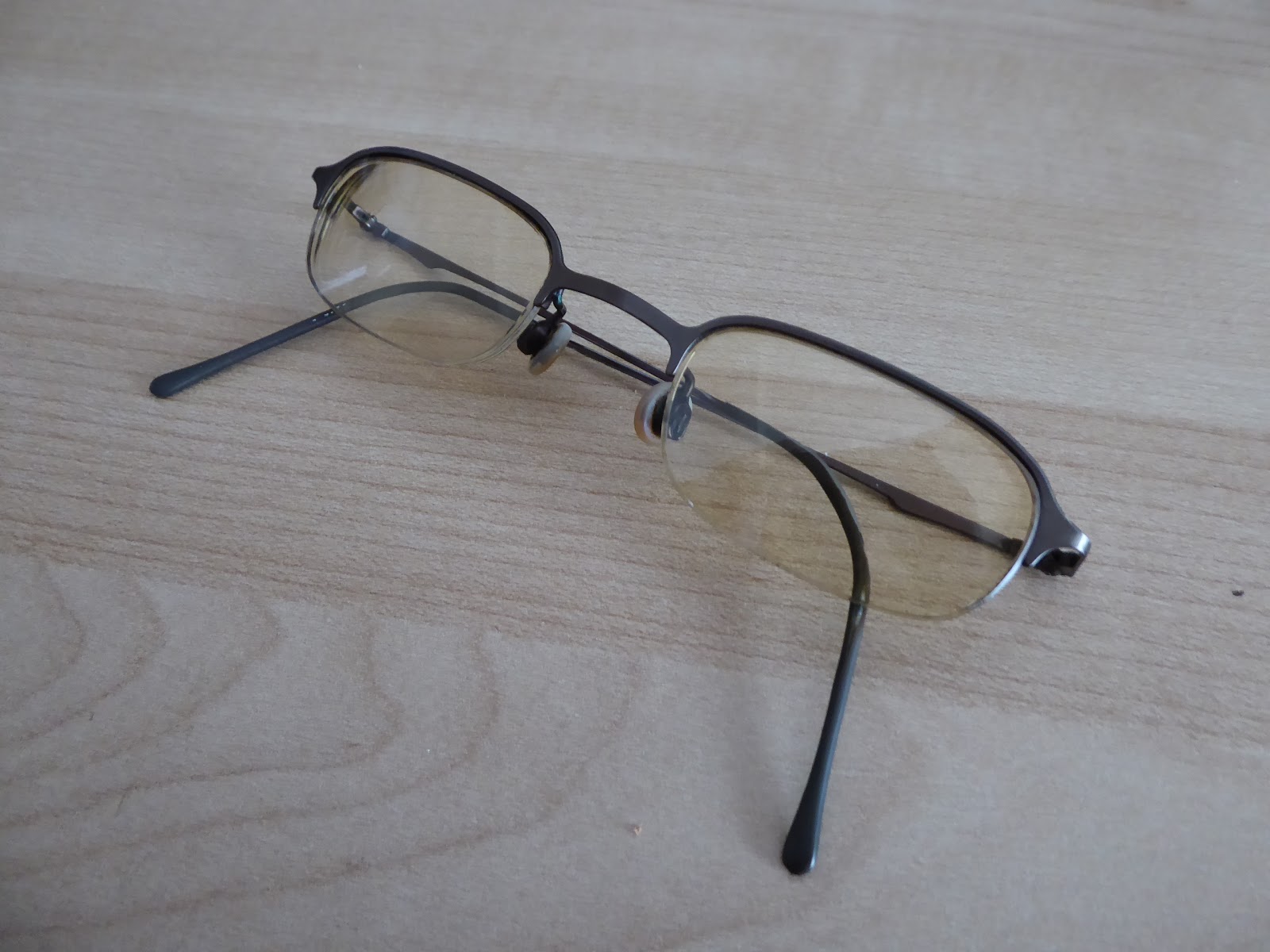
The Specs that saw Everything so far
get retired after 11+ years service.
|
Before we get going again, we have to announce another early season retirement as my other constant companion of the last decade gets replaced, the specs that I got in 2006 finally get an update, and the eyes that have literally seen everything I have over my walking career get renewed, not because my sight is suffering, more that the time has come for something new. So the small and wiry pair that were definitively the best glasses I have ever worn get retired, replaced by the nearest equivalent that I could find in Specsavers as current styles of chunky and plasticy are certainly not my thing, and not costing me a whole lot of coins either, and if the new ones do me right for 11+ years, I'll certainly be a happy camper. And so we move on, due for more Crosstown Traffic in the City of Leeds, as there have been so many trails radiating out from the centre and not enough going from side to side, and so we set out with a two-day circular route in mind, to get in much of North and East Leeds along the way of leg #1, disembarking at Headingly station at 10.40am, starting late and hopeful that the winter sunshine will offset the low temperature and persistent easterly wind, with the day warming through a bit as we go. So eastwards we head, from this charmingly domestic station in the suburbs, past the railway cottages and setting course along Kirkstall Lane for the village centre, among the suburban spread, but noting the large Victorian houses of Oakfield and St Ann's Tower that stand on either side of the railway line and the Queenswood Drive junction before we run into the terraces that student land is still just about clinging onto. The looming mass of Headingley stadium, home of Yorkshire CCC and not enough England Test matches, appears on the horizon, looking much larger now that the Carnegie pavilion rises above the Len Hutton gates, and it's telling that my detachment from cricket is so bad that the last time I came here was in the days when Twenty20 was a fun diversion rather than a scourge on the modern game.
 |
| NER Station cottages, Headingley. |
 |
| The Carnegie pavilion and Len Hutton Gates, Headingley stadium. |
It's always handy to recall that there's more to this district than just being home to the Cricket field, and Rugby stadium for that matter, and the parades along North Lane, in the heart of student land will always have good associations for me from my much younger days, despite the fact that Polar Bear records, the Lounge cinema and Ferret Hall bistro have all gone, but Sakura, Brett's F&C and the Headingley Taps all still endure, the latter in its old pumping station that is still much smaller on the inside than it appears, in a reverse Tardis effect. Meet the crossing of the A660 Otley Road by the Headingley Arndale centre and slip away into the calm and leafy terrain of Wood Lane where the old Victorian villas enjoy their seclusion opposite the University's blocks of Lupton Flats, one of the few residence sites that hasn't been massively redeveloped in the days since I was a student (compared to Boddington and St Mark's, especially). Head down Grove Road as we slip away from Headingley and shift towards Meanwood, passing the Sue Ryder charity's Wheatfields Hospice as we go before we arriving on Grove Lane by St Urban's RC church and push east again by the long stone terrace with a lot of long and leafy gardens before we pass out of student land completely as we pass over Meanwood Beck and get some views to the tree clad side of Woodhouse Cliff as the fields open up to the south. Run on to Meanwood Road, at the bottom of the local valley, and now the other side must be ascended, among the Lego houses on Stainbeck Road as far as the Kingdom Hall before taking a right onto the rising Potternewton Road that moves away from the Beckhill council estate spread to the north and passing up a tree clad bank that never quite offers the view down the valley that might be hoped for, even with the total absence of leaf cover. We leave the temptations of the wooded paths behind as the road virtually hits a line of latitude as it straightens out to run through the Miles Hill council estate, looking very characteristically Leeds-ish in the sunshine as we run out to the passage over the A61 Scott Hall Road, where the towers of the city centre can be glimpsed through the haze, especially across the adjacent playing fields. Local interest is found in a pair of rural looking cottages by the roadside, as well as the prominent gatehouse that once lead to Potternewton House, now lost beneath flats both low and high rise, and our high viewpoint passes as we slip downhill into that space that exists between Chapel Allerton above and Chapeltown below, with old and upscale townhouses on both sides of the road.
 |
| The Lounge Cinema (former), Headingley. |
 |
| Grove Lane, Meanwood. |
 |
| Ascending Potternewton Lane to the Miles Hill estate. |
 |
| Potternewton House, Gatehouse and Flats. |
Finding a community arts space in the old pub and a tutorial college in neighbouring building suggest something of the local dichotomy before we meet the old stone houses that cluster on the edge of Harrogate Road, where interest is directed to the old lodge house on the other side of the junction, and once we've joined Harehills Lane, we can finally see that after far too many years of dereliction, the Mansion Gate development has finally breathed new life into Gledhow Grove, the old Georgian house and former Chapel Allerton hospital. Moving to a south eastern tack, we run behind the current hospital and the Polish church, for some rather leafy going on the lane, with Potternewton Park to the south, and the smarter suburbs of Gledhow rising to the north, again giving us a rather marked cultural divide along the lane, noting that a Gurdwara now dwells in the park's Mansion house, before we slip downhill and into Harehills. Note again that Harehills Avenue is one of the leafiest of this city's lanes, in one of the most improbable location, before rising to meet the A58 Roundhay Road and the busy shopping street serving the local immigrant populations that dwell in this landscape, notable and familiar and all due to the former Fforde Green pub and Clock Buildings sitting at the bottom of Easterly Road. Harehills Lane rises steeply to the south and east, and we join the shady side to pass through this batch of late Victorian and Edwardian terraces that rise on the hillside offering peeked views back towards our start line as we approach the Bilal Asjid mosque and the branch of Morrisons at the top. Descend some along the busy shopping street, as active as any local parade as met on my travels, where I once got stood up on a date with a university friend many years ago (which looks a whole lot friendlier now than it did on that particular night), meeting the Compton centre and my previous passage in this quarter before we rise with the lane again, between terraces on the west side and the later growth by Harehills park on the east. Pass the Asda supermarket, and the Brown Hare pub beyond the Lupton Avenue corner to run on to the edge on the 19th century city as we meet the Shaftesbury corner on the A64 by the former cinema and pub site which shared the name, though my passage over the York Road footbridge is delayed by running into a couple of female Mormon missionaries who seem determined to take an interest in my walking habit, and prove hard to brush off because they are so damned polite in their proselytising.
Enjoy the views from the footbridge, once I get there, towards Halton and Seacroft in the east and to the city in the west, descending to the south side of the A64 to meet the terrace and motor cycle dealership at the top of Osmondthorpe Lane, and we head south here, straight into the winter sun, where all the streets on the eastern side of the road are named Rookwood, and the spread of industry from the city stalled, giving us little of historical note to see, which is a shame as the lost Osmondthorpe Halls would have given the quarter a small amount of interest. We seem to be doing another passage between districts here as we progress down towards the railway, not really getting into the depths of the Osmondthorpe estates and barely scratching the outer edge of East End Park, but at least we meet the Neville Hill railway depot, the main yard for West Yorkshire's passenger trains, where the shed and maintenance works still occupy the NER building of more than a century's vintage. From there we pass under the eastern throat of the railway yard, where there's just enough clearance to get a single decker bus through, and meet the estate enclave that seems rather isolated from the estates of Osmondthorpe and Halton Moor, and appears to be called Halton West according to the signage, parked on that stretch of Halton Moor Road that still endures for full traffic use. The habitable city ends here for today, as we meet the road that was built to access the back of the Thornes Farm industrial estate, accessible to pedestrians and cyclists but forcefully blocked off to other traffic after someone realised they'd accidentally created a rat run through the estate between the A64 and A63. Pass on among the factories, having the roads completely to myself, 28 Days Later style, drawing the conclusion that packaging and distribution seem to the modern world's growth industries, at least until we meet the BCA yard where many, many cars are stored for future sale, and we can roll out onto the cycleway that runs along side the new-ish A63, opened in 2009 as the East Leeds Link Road on the alignment of the infamous road to nowhere Pontefract Lane. It's a fresh route to get traffic off the M1 and A64 approaching the city from the east, and to be fire the commercial growth of this area, extending the industrial districts of Cross Green and Knowsthorpe across the fields of Skelton Moor, which used to be a mess of colliery workings and where a sole farm still endures, in the shadow of the wind turbine that can be seen from nearly
every high vantage point in the city.
 |
| The Rookwoods, Osmondthorpe. |
 |
| The NER vintage Neville Hill railway depot. |
 |
| Packaging and Distribution rules on the Thornes Farm Ind. Est. |
 |
| The A63 Pontefract Lane, and the prominent wind turbine. |
Pass over the canalised Wyke Beck and note that there isn't a great deal to observe in this landscape, even with the new Amazon warehouse arriving by the roadside, as there's little to see in the low fields between the road and the River Aire, where the sewage farms, the former Skelton Grange power station site and the new Temple Moor Park & Ride are the only features in a landscape with no accessible paths for the walker, and instead watch the skies as an iridescent cloud makes a brief appearance. Meet the bottom edge of the Temple Newsam park grounds, the woods to the south of the golf course, and follow the estate perimeter as views back to the city recede and we run in close to Junction 45 of the M1, where all sorts of heavy plant have been gathered for the on-going roadworks, and have made quite a mess of the track by the main roads, and it looks like their muster point might have blocked our path, but thankfully they haven't as the track rises to give us view of the motorway that is about as pretty as the winter sunshine can provide. Find the pathway under the M1, to move to the Pontwerfact Road side of the motorway, following the track south-eastwards with only waste disposal traffic for company as it runs down to Biffa's Skelton Grange waste management site, where the tipping has created huge mounds on the former opencast colliery site, and huge clouds of gulls fill the skies hopeful for an easy feeding. It can keep the mind nicely occupied as we roll on to meet the farms at Newsam Green, clinging on their almost private road, away from the landfill and the scars of coal mining, and as we meet tracks previously seen, interest can be directed to trying to spot Leventhorpe Hall as it hides away behind clumps of trees, as its apparently still in there, having survived the years of mining surrounding its plots, unlike the lost Swillington House a mile or so downstream. Through the carved groove on the lane and on past the lodge house to run out on the correct route this time to pass the vineyard(!) and meet Bullerthorpe Lane, and check on my time keeping to see if we can make the train from Woodlesford, and thus the last stretch, seen on many prior occasions can go down quickly, past the Bridge End House and over the Aire at Swillington Bridge. Then get frustrated by the distance along the A642 Aberford to the Navigation and then some more on the rise up to the railway, before rolling onto Station Lane and arriving at the station just as the 2.40pm edition of the Five Towns Party Express rolls up to the platform, closer than I'd have liked but a 10 mile trek goes down in 4 hours for the first time this season!
 |
| Skelton Moor farm, enduring in a changing landscape. |
 |
| Between Temple Newsam estate, and the M1. |
 |
| Skelton Grange Waste Management Facility, and so many Gulls! |
 |
| Bridge End Farm and Hotel, Aberford Road. |
To Be Continued and Concluded...
5,000 Miles Cumulative Total: 3139 3143 miles
2018 Total: 30.5 miles
Up Country Total:
2863.4 2867.4 miles
Solo Total:
2882.7 2864.2 miles
Miles in My 40s: 1736.8 miles
Next Up: Six Year Walking Anniversary, and I'm not going any place special!


No comments:
Post a Comment