Dudley Hill, East Bowling, Bradford city centre, Manningham, Frizinghall, & Shipley.
No need for an early start when the first longer walk of the year starts from your home town, so rising can start at an unhurried pace and there's no pressure to get the bags gathered quickly, as the start line isn't too far away and an hour of the day hasn't been burned with travelling as we arrive at Morley Town Hall for a 9.40am jump off, to walk cross Bradford again and head south on a path that initially seems counterintuitive. The main issue with walking in Morley is finding a unique path that hasn't been walked before, so it's good to find that there is still at least one major road in the borough that hasn't already been tramped, and that's High Street, initially accessed behind the New Pavilion theatre and rising in a mostly upscale residential fashion to the B6127 island and then on, below the bridge abutment that is the last physical remnant of the GNR's Morley Top station, and onwards through a landscape of enduring industrial mills and terraces on cobbled lanes. It seems to be named High because of elevation, rather than importance, and leads us out to the A650 Wakefield - Bradford turnpike, and our path turns to the northwest at the Stump Cross Inn, the roadside marker itself being long lost, and this is a section of Britannia Road that hasn't had much occasion to be travelled in all my years in Morley, with the Cross Keys, the Mermaid fish restaurant and the Asda superstore having all gone unvisited in the last decade. Pass the Halfway House, and the B6123 before we pace more of the unseen turnpike before passing St Andrew's church and the way out from Dartmouth park and joining the path of Bruntcliffe Road that has been frequently travelled, where many establishments seem to claim a 27 in their names, and the path stays familiar as we hit Bruntcliffe crossroads and press on past the Toby carvery and onto Wakefield Road over the M621. It's the frustration of travelling that the motorway provides such an obstruction and limits my choice of routes, but here we go past the Gildersome Spur industrial estate and onwards to Gildersome Street and the island of Junction 27 again, to finally find a fresh path on the other side of the A62 Gelderd Road as we meet the dual carriageway stub left behind as Bradford Road was cut off and isolated by the construction of the A650 Drighlington bypass.
I'm sure than the changing road names are gonna get confusing as we stick to the same roadside and have the same names coming around again and again, but such is life on the old turnpike, passing the outer edges of Leeds district's brick suburbia, and meeting the local landmark, the tall chimney of the Old Brickworks, nowadays surrounded by a Brewer's Fayre and Premier Inn complex. The B6135 sits upon that point on the Aire - Calder divide that offers a view over the wrinkles of Gildersome and Pudsey towards Leeds on one side, and to the higher hills of Calderdale and Kirklees on the other, quite viewpoint to be found over the fields before we run into Adwalton. It's rather easy to mash this settlement into its neighbour, Drighlington, but every thing to the eastern side of Adwalton moor is distinctive and separate as the residences resume from the New Inn to the local rugby club, and then slip along King Street into the latter village where suburbia and light industry mix at the roadside, along with the pub that's now a pizza restaurant (with a bus in its front yard), along to the pub that's now a Chinese restaurant, and I'll guess the Indian restaurant has always been such, unless anyone knows better. Across the A58 Whitehall Road, a more suburban face comes on along Bradford Road, the brick semis and stone terraces still having a Leeds-ish face, and the caprices of the late winter weather are shown as the sunshine breaks into our rather glum day, providing warm and illumination as we pass the edge of the Manor Golf Course and get sunlit views towards Tong, and to Rombald's Moor and Otley Chevin in the far distance. Meet Bradford district at Tong Lane End, by The 6 Acres 'Famous Carvery' and the equestrian farm with the horse carousel, and meet the end of the Bypass as we move onto the A650 again at Westgate Hill, an odd collection of old farmsteads and contemporary industrial buildings that surely claims a unique identity only to separate itself from its neighbour Birkenshaw, located to the south in Kirklees. A brief examination of the local terraces around the green and the former pub suggest a change in building styles that suggests a more Bradfordian aspect, and as we merge onto the A651 by the extensive site of Tong High School suggests that we are now on the edge of Bradford, and everything in these parts shares the name of Tong, a very small village, which is now attached to the cemetery and the district, Tong Street, which is also the name of the road, to keep the nomenclature confusing.
Tong Street is an odd sort of district, looking like a regular suburban shopping street on one side, all terraces and takeaways on one side, whilst the other is superstores and major industrial units for companies as disparate as Princes and Hallmark, and you get a proper sense of elevation up here too, as high hills loom off to the southwest, as the last of the day's sunshine passes. Despite this being my first time on foot up here, it's a route travelled often by bus so sights like the Holme Wood pub and the pair of Victorian era schools are readily familiar, and a bit of a keen eye will trail my East Bradford railway walk as we pass over the end of Railway Street, a trail that I will get to as soon as Low Moor station opens, I promise. Pass Knowles Park and the Cawthra buildings to bring us to the beginning and end of our Bradford circular trail at Dudley Hill, just as the heavens open for a late winter shower, one that only lasts as long as it takes to get to the A6177 roundabout, but the views gained of the ornate former cinema we get at the top of the hill are somewhat sodden. A return to cool greyness comes as we hit the downhill angle of Wakefield Road towards Bradford proper, with the road becoming wider and less friendly inside the ring road, which seem s to make little sense, and thus as we go, it's helpful to keep looking away from the dual carriageway to remind yourself that there are urban districts surrounding what feels like a bypass road, East Bowling being a large knot of terraces off to our left, whilst St John's Bowling stands proudly on the roadside opposite. The east side is suggestive of an urban district long lost, with pubs and a former police station still standing among the industrial units, and another lost railway arrives on our day, as the GNR's Bowling branch (the Bradford avoiding line) passes overhead on a double span of plate girders, and the eager eye might even spot the steps that once led to Bowling station. Beyond we meet Bowling Park primary school, seemingly detached from its district, and our second Gurdwara on our travels, occupying the old chapel by the traffic island that sits above the Prospect Lane tunnel, which still carries the L&YR's rails towards Leeds. Continue down as the tangle of Bradford inner ring roads takes over the landscape, still remaining keen-eyed to spot the remnants of the older city hidden away behind the trees, and soon we're on very familiar territory as we head on over Croft Street to Bridge Street and land between Exchange and Interchange for the umpteenth time.
Having found the Bradford city centre is only three hours away from home, it's time to admire the frontages along Bridge Street, the eastern side opposite the Town Hall being one of the best assemblages in the city, and looking back to acknowledge that The Bradford Hotel might be the worst building in the city as it genuinely looks like a cardboard box. There will be no pausing in the City Park as the rain starts to fall again, so paces are made onwards to Tyrell Street, where site up the narrow cobbled lanes of Ivegate and Queensgate give another impression that you wouldn't associate with this city, and there some fine Victorian Romanesque - Gothic to be found on Bank Street, especially in the city branch of NatWest. Ascend through the street market, getting the feeling that the supposedly downhill latter stretch of the day will be anything but, and find the Kirkgate shopping centre along Darley Street is every bit as bad a concrete monstrosity as you'd expect to find in a city blighted by 1960's redevelopment, just as awful as Leicester's Haymarket. A more scenic environment returns, along with some more sunshine, on North Parade, home to a thriving café culture and the Pakistan consulate, and this leads us out of the city centre, over the A6181 and onto Manningham Lane, to find that two of the city's notable cupolas are within spitting distance of each other, and that any venue of sufficient size, can become a banqueting hall in a city that has a sizeable Asian population. The odd mixed bag of Manningham's architecture reveals itself again, as upscale Georgian or Victorian terraces stand off from the main road, where later commercial arrivals seem much less ambitious, and there's views too on the northern high road out of Bradford, across the valley to the path previously walked and also to Valley Parade stadium, already making its fourth major appearance on our trails. Up towards the A6177 ring road and beyond, the proud frontages of the first half of the 19th century return, getting more high Victorian as we press north, and its another aspect of the city revealed, and the city study just gets more intriguing, such a pity that it all looks so glum as more rain falls, and I start to wonder if Bradford looks its best in the summer. Lister Park soon joins the roadside, donated to the city by the noted local industrialist and mill owner Samuel Lister. It would invite a leafy walk and a close look at the Cartwright Hall art gallery if it wasn't for the fact that I chose to pace the main road deliberately, so I stay outside the perimeter and ponder the high walled buidlings to the east, concluding that they must be a prison, before they are actually revealed to be the grounds of Bradford Grammar school, which is hilarious.
Pause for lunch at the top end of the park, by the ridiculously castellated North Gate, and the statue of Titus Salt before we resume the path northwards on Keighley Road through the suburban satellite of Frizinghall, which has some very large old houses on the upper side of the road, and that rarest of things in Bradford on the other, terraces constructed in brick. It gets altogether more Arts & Crafts-y and upscale suburban as we press on, with the terraces stretching downhill to offer views across the valley to Wrose and Idle Hill, bizarrely steep, high and residential on the far side of the valley, and the road seems to be dragging us towards Shipley, and the junction at The Branch would take us down towards it if we chose to do so. We'll stay on the higher Bradford Road though, past Northcliffe park, but still much closer to the town centre that might have been expected as the tower of the parish church reveals itself only a street distant from us, and we can ponder it Shipley has been vested or not, or if it really is more than an extension of Greater Bradford (like Sowerrby Bridge is to Halifax) as the backdrop changes to the elevation of Baildon Moor and up the Aire Valley to the woods of the St Ives Estate. Saltaire soon shows up, its uniquely styled buildings stretched all the way up the valley side to the A650, which is left finally left behind without it showing up a single milepost in the 11+ miles back to Morley, and further sadness can be gained from the fact that the day has settled on glum weather as we enter the village that is a UNESCO World Heritage Site. Others could tell you more about Titus Salt's model village, so I'll just reflect on what a gem it really is, the cottages and houses of Victoria Road above the A657 Saltaire Road being the ornate pick of the bunch, where the management must have lived, but all the terraces below are styled uniquely so the place never gets too bland or excessively repetitive. The yellow sandstone streets demand a better day, and I'm certain my camera will come this way again in the summer, but even now I'll love the civic centre of the Victoria Hall and the old school, and admire the shopping parade before passing over the railway to the familiar sight of Salts Mill, altogether it's a place to make you nostalgic for the times when men could reap the benefits of capitalism and still care about the well being of their employees, like Morley native Titus Salt did. Arriving between trains means there's time for a trip around the Wren-ish United Reformed Church, Grade I listed and the non-conformist heart of the village, before we drop down to the station with two more fresh angles made across Bradford, finally attaching it to the Aire valley, and all done for the day at 2.20pm.
5,000 Miles Cumulative Total: 2625.5 miles
2017 Total: 60.5 miles
Up Country Total: 2398.7 miles
Solo Total: 2370.2 miles
 |
| The New Pavilion Theatre (former), Morley. In desperate need of some love. |
 |
| High Street, Morley. High in elevation, not in importance. |
 |
| The Toby Carvery, Bruntcliffe. Many westward trails from home will come this way. |
 |
| The Bradford Road stub, Gildersome Street. A forgotten dual carriageway is a rarity in this land. |
 |
| The Old Brickworks, Gildersome Street. A prominent landmark on the Aire-Calder ridge. |
 |
| Wakefield Road, Adwalton. The Turnpike changes its name and a village remains distinct. |
 |
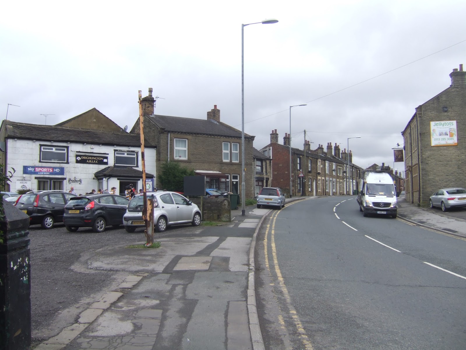
| Bradford Road, Drighlington. Welcome the Sunshine whilst it lasts! |
 |
| Westgate Hill Street, Westgate Hill. Industry and old farmsteads, not in Birkenshaw. |
 |
| Tong, Street, Tong Street. So good they named it twice? |
 |
| The old Picture House, Dudley Hill. For all your discount interior needs! |
 |
| St John's Bowling. I'm sure he is! (A terrible joke, for which I apologise) |
 |
| The GNR Bowling Branch,Wakefield Road. I'm pretty sure the Bradford Avoiding line should still have its uses. |
 |
| Wakefield Road, Bradford. Where the roads replaced so much of the old city. |
 |
| Tyrrel Street and the Natwest Bank, Bradford. So many interesting streets in this city, contrary to expectations. |
 |
| Royal Standard House, Manningham Lane. Banqueting venue conveniently next door. |
 |
| Manningham Lane. The prime location for upscale living in the 19th century. |
 |
| Lister Park, South Entrance. Samuel Lister's name is everywhere in this city. |
 |
| Lister Park, North entrance. A castellated gatehouse? and Why Not? |
 |
| Frizinghall and the view to Idle Hill. This year's path are certain to take me up there. |
 |
| Bradford Road and St Paul's Shipley. So did we really visit Shipley or not, honestly I'm not sure. |
 |
| Victoria Road, Saltaire. A model village of international renown and importance. |
 |
| Victoria Hall, Saltaire. So much to see here, requiring a sunnier day for photography. |
Next Up: Cross-town traffic in West Leeds and Bradford, as if that's a surprise...
No comments:
Post a Comment