Thorpe Arch, Boston Spa & Newton Kyme.
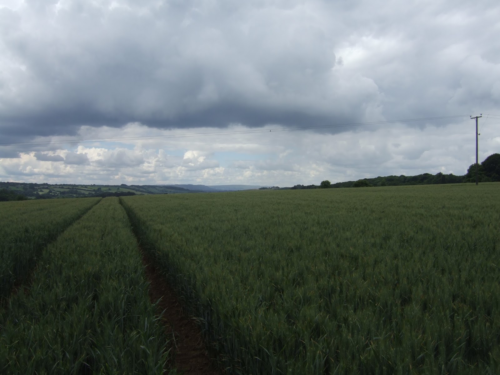
I could not say I was a happy camper with the rising of this new day, far too much ugliness arriving in this land to have me feeling especially positive, but despite that the walking must continue as it's good for my mental health and it would be folly to waste the first weekend of Summer because I'm feeling miserable, so get out of the house whilst the sun shines, early as can be managed because you know this is going to be a long day. So off the #36 bus in Harewood after 9.20am, far too early to be dropping in on my local friends for a pre-walk brew, and the early portion of the day can be burned retracing steps down the hillside from last weekend, and Fitts Lane offers inviting views to the east as passage is made once again on the Ebor Way, the least loved of all the northern long distance paths. Clear illustration of its lack of popularity is gained once the riverside path is met, with the track to Harewood bridge being tidily trimmed and the path east, along the boundaries of the low fields known as The Fitts, being overgrown with spring vegetation and long grass, so the early going isn't particularly easy. Press on among the riverside plants though, the way just clear enough to not get sketchy, and only drifting a bit too close to the high bank of the Wharfe on a couple of occasions, and it all feels pleasingly remote as it describes a long curve eastwards, with the Harewood bank slowly receding and the hamlet of Netherby on the north bank offering not much sight of habitation, the most obvious signs of life being on the slopes of the Stockton Hill Climb off to the south. I'm nearly an hour into the day when I get sent word from my Harewood friends, mildly astonished at my capacity for an early start, and I'll promise to one day manage a proper drop in, despite passing through the village three times this year, and not having dropped in in 4 years. Carthick Wood provides some tree cover and pushes the path ridiculously close to the high bank too, showing clear signs of crumblage in the wake of the Festive Season floods, and despite its presence on the map, I find it hard to believe that there is a bridleway crossing a viable ford somewhere down there.
Drift behind the trees on the eastward push, moving away from the river for a while before meeting the bank again just as it starts to look dramatic and interesting for the first time downstream since Bolton Abbey, so this must be the cue for the path to abandon the riverside and head uphill on the other Fitts Lane, on an enclosed path heavy with vegetation and boggy because of a rising spring. Only when you meet a section that is completely impassable and make a track into the neighbouring field do you realise that the right of way has actually been moved out into the open, but as we aren't too far from the A659 it doesn't matter too much now. The last trip along the pathless section of the Otley & Tadcaster road wasn't much fun, and neither is this one, going against the traffic with only the driveway to the garden centre providing any shelter, so happy times return when Holme Lane drops us back down off the ridge and towards the river again, giving some good views and meeting a passage through some lovely woodlands before crossing to the north bank over Woodhall Bridge, unaffected by flooding and twice as long as the Wharfe is wide. Passing over the low fields, the flood residue can be found as the path starts to rise, with torn up fences and dead grass deposited at the high water mark, showing that the Wharfe can be a beast when it wants to, and that's last sight of it we'll be having for a while following the path uphill to a new perspective on the terrain, but offering no real sight of the Wood Hall hotel. We do meet the walled garden, complete with roaming pigs, and sheep herding can be watched during elevenses before heading into the would-be hamlet of Woodhall, the path directed away from the few houses and the ridiculously modest Carmelite Monastery, but arriving close behind the sizeable hotel and spa complex, where they most definitely do not want you walking up their driveway.
So a mile plus of detour is required, up into Lime Kiln Wood and up to about 50m elevation from the river, to Sicklinghall House Farm, and then down a track that seems to insubstantial to be a bridleway, back into the woods and then out to its perimeter to return across the fields to the gateway of the hotel on Trip Lane. An altogether pointless detour, but at least good for one last view to Harewood bank, Rawden Hill, Caley Park, The Chevin and Rombald's Moor and the Middle Wharfedale panorama, as Trip Lane starts the long decent towards Linton, and the terrain of Lowest Wharfedale is unlikely to offer much drama at all. I've already regarded Linton as the most expensive place in West Yorkshire, where houses look ancient but are actually dateable to the 1920s, and pedestrians are not welcome (or are at least meant to be confused by the roadside paths), but at present it's all a rather plush cul-de-sac, cut off from Collingham since Linton Bridge was put out of service by the Boxing Day floods, which is all a bit of a footnote to the bridge collapse at Tadcaster. Onwards to Wetherby through, as the Ebor Way takes a track through the grounds of the local golf course, allowing the walker to take in the major landscaped feature, the embankment of the NER Cross Gates - Wetherby line, complete with passage beneath the cattle creeps, and once away from the fairways, it's clear going on to Wetherby's riverside park at King George's Field. Over the footbridge to the Ings playing fields, following the curve of the Wharfe below the pleasing waterfront developments that look like former oasthouse but are really nothing of the sort. Pause for lunch, just as the best of the sunny day looks to have passed, and then it's onwards, along the driveway to the leisure centre and up to another Wharfe crossing at Wetherby Bridge, but make no moves into the town, instead hitting Bridgefoot, above the town's park and car park to take the shortest cut to Walton Road, out among an empire of council houses.
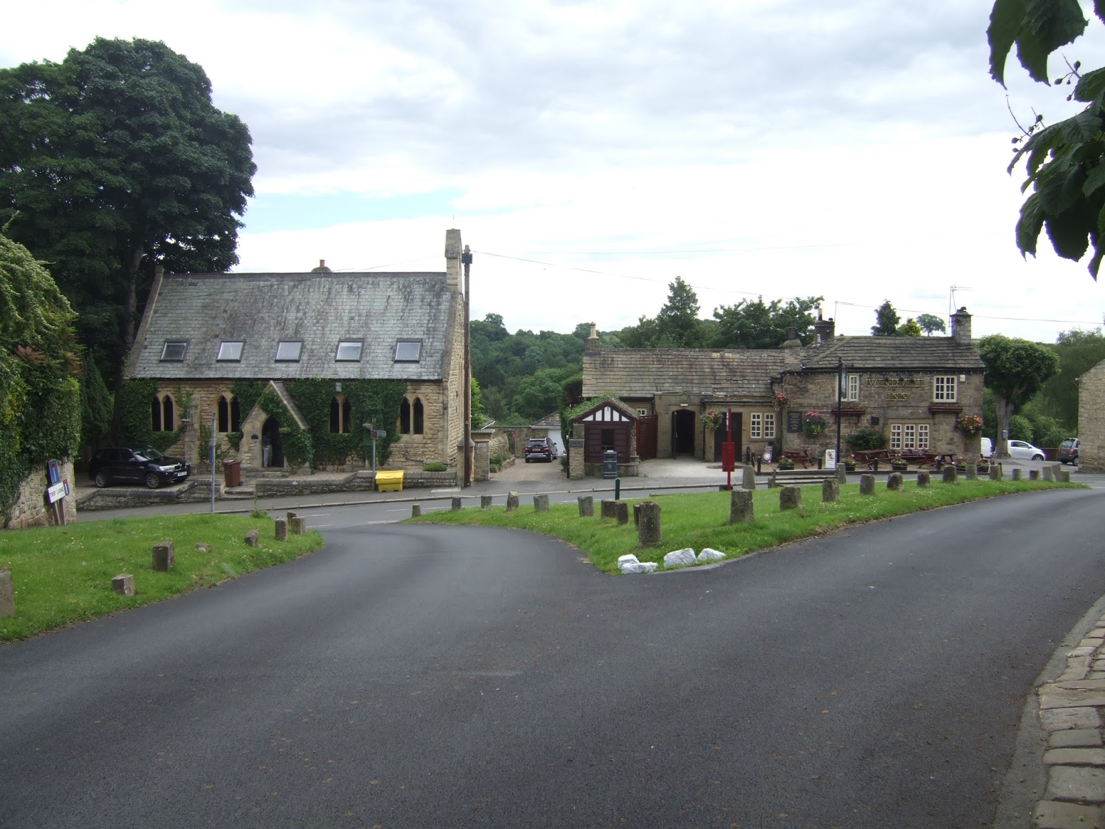
Pass over the A162 bypass, and the A1(M), where to new road construction has left a very odd hairpin to get to the ongoing Heuthwaite Lane, a very pleasant green track with high hedges, sending us east to a field boundary walk that arrives high above the river, which can easily be heard beyond the trees but not seen. Pass through Flint Mill Grange, and the green track continue, location being gained by spotting the Walton Lane crossing houses, before arriving by some serious fencing that seems to be designed to keep you out of the grounds of Thorpearch Park, which I didn't have down as one of the notable estates of the county. Pass onto Wood Lane, and an occasional peer over the high wall gives little indication of anything interesting in the parklands, but Thorpe Arch village is another matter entirely, a charming estate village built in the local yellow sandstone, and looking possibly even more desirable than its neighbour across the river, soon met as the lane dives down through the rocky escarpment and it's over the Wharfe for the last time as Boston Spa is met once again. No opportunity for another look at the town, but it's nice to pause by the riverside and see the Wharfe looking a lot calmer than it did when I was last here, and the sunshine returns, to warm the day again as the waterfront path takes us onwards as the riverbank rises high again, and sights of the old spa can be found, emerging from the shade of the trees, like the original saline bath houses, and the Wharfedale Hall hotel. Soon out into the countryside and the sunshine again, along a rural section popular with anglers and only with the distant sight of Wharfedale Viaduct to give you some feeling of your whereabouts, but before we can get there, the river takes a sharp turn and the path rises to a high narrow strip on the edge of a former industrial site that is getting the Redrow housing treatment, and even this high up from the river there are signs of previous watery inundations.
Pass under the former NER Church Fenton - Harrogate line, and see that summer isn't a good time to get a good photographic angle on this stone and steel beast, so push on along the riverbank as overgrowth seems to have taken over once again, pushing inland on the farm track adjacent to the old Roman Road, as I'm sure it provides easier going. Meet Rudgate proper half way up to the A659, behaving like a farm track on this stretch, and not feeling like a route between Calcaria and Isurium Brigantum, but it does allow a brief detour for more railway relics on this river walk, like the infilled bridge at the throat of Newton Kyme station, and the bridge over Watson's Lane. Head on to Newton Kyme of Croft Lane, finally arriving after having teased from some distance away, noting the old Tythe barn at one end of the village, and the main street offering three houses which could be mistaken for Newton Kyme Hall, itself a boldly fronted edifice facing the parklands and the church of St Andrew, looking very nice under the last sunshine of the day. Clouds and summer rain come on as the path passes among sheep on the way back to the riverbank, snaking its way towards Tadcaster and teasing views of the viaduct from some distance away, whilst I spot the riverside locations seen on my last visit this way. Both breweries and bridge appear closer than they are, and the summer rain soon turns to a proper downpour as the infamous railway to nowhere is passed under and the riverside embankment leads past St Mary's church and on to Tadcaster bridge, where preliminary rebuilding work still proceeds, and with all this rain, Tadcaster feels even more like a ghost town. At least I've sussed that the bus shelter on High Street by the John Smith's brewery is the place to end the day, giving me some cover after my finish after 4.30pm, keeping me just dry and warm enough before the #843 can take us away.
5,000 Miles Cumulative Total: 2303.8 miles
2016 Total: 289.4 miles
Up Country Total: 2107.1 miles
Solo Total: 2072.9 miles
 |
| Fitts Lane, near Harewood, second visit in a week! |
 |
| The Wharfe from the Fitts, the latter stretch of Middle Wharfedale. |
 |
| The Wharfe near Carthick Ford. Showing more signs of flood damage than of any passage to the north |
 |
| The Wharfe's landscape starts to get interesting, so that must be the cue to leave! |
 |
| Woodhall Bridge, newly reopened in 2016, but undamaged during 2015's crazy inundation, remarkably! |
 |
| Woodhall Hotel and Spa, walkers are not really welcome here, or among the houses or the monastery, for that matter. |
 |
| Towards Trip Lane we get our least view of Middle Wharfedale, the going is going to be much flatter from here on in. |
 |
| Linton, West Yorkshire's largest and most expensive cul-de-sac? |
 |
| Wetherby Golf course, putting the railway embankment to good use as a landscape feature. Watch out for the airborne balls! |
 |
| Wetherby Weir, looking calmer than it did in April 2015. |
 |
| Heuthwaite Lane, for some green going away from the river. |
 |
| Thorpe Arch, prettiest village in the county? |
 |
| The Saline Baths, Boston Spa, a relic of a bygone age of Victorian middle class holidaying, used as housing these days. |
 |
| Back on the Wharfe bank, where the Wharfe Viaduct hides behind a lot of foliage, I should know summer isn't the best time for some types of photography. |
 |
| Rudgate, a Roman Relic found in this landscape, but the internet will provide you more information about the brewery than the road! |
 |
| Watson's Lane bridge, on the Church Fenton - Harrogate line, because a river walk demands railway relics! |
 |
| Newton Kyme Hall and St Andrew's church, a prime location basking in the last sunshine of the day. |
 |
| On the winding Wharfe on the path to Tadcaster, between Summer rain and an unseasonal downpour! |
 |
| Tadcaster Viaduct, now seen form both banks, it surely deserves a trip across on a later visit? |
 |
| St Mary's Tadcaster, proudly Perpendicular, and looking bold even with all the rain. |
Next Up: To the mouth of the Wharfe, and beyond!
No comments:
Post a Comment