18.5 miles, via Haslingden Grane, Pickup Bank, Hoddlesden, Darwen, Sunnyhurst Wood, Roddlesworth Reservoirs, Withnell, Brinscall, Wheelton & Whittle-Le-Woods.
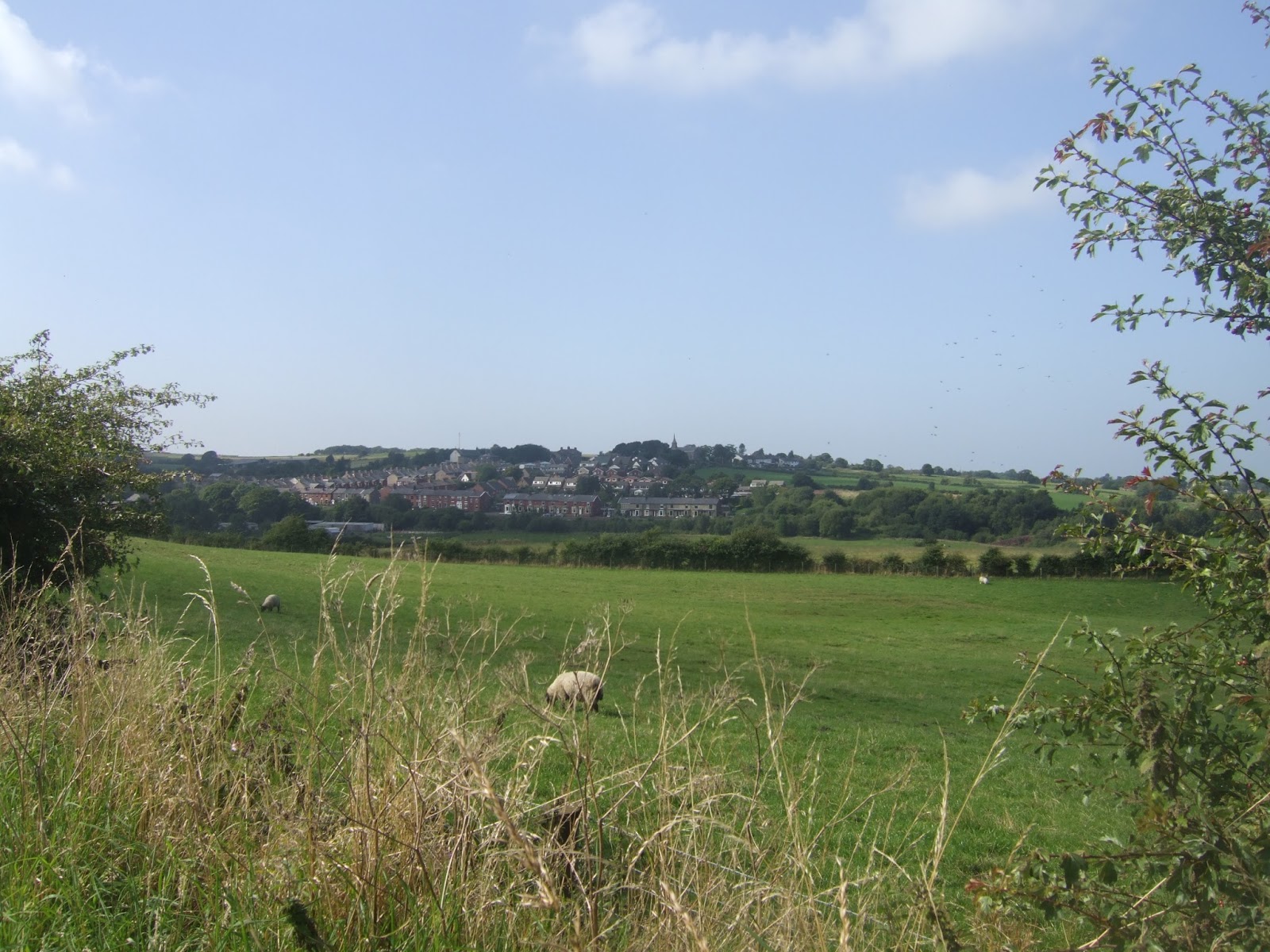
First rest day of my jollies features catching the Tour of Britain cycle race, and the Roman remains in Ribchester, as well as me feeling deeply tired after Sunday's excursion, but I'm going to have myself prepped for a big day as the plan for Tuesday is one of those routes in which I might well have over-reached myself, such is my desire to cross Lancashire in only three days of walking. Inspire my parents to get me out early and down the A680 for a start at the main crossroads in Haslingden at 9.20am, departing down Warner Street and Grane Road, immediately noticing that we are going downhill, a good start when you know there's a lot of uphill to come, passing below the A56 and the former L&Y line that ran up the valley between Ramsbottom and Accrington. Grane Road continues, rising into the Valley of Haslingden Grane, past cemetery and the Holden Arms, where I break off from the road to meet the path over the dam of Holden Wood Reservoir, following the path up towards Tenements farm and then rising over the rough grass to the elevated path which will lead us up the valleys side. A decent surface and clear waymarking of the Rossendale Way means easy going as we rise above Ogden Reservoir, with the steep slopes up to Musbury Heights off to our south, and sight of the windfarm on Oswaldtwistle Moor to the north, continuing above Calf Hey Reservoir which seems to be a popular spot for joggers and dog walkers. Slip into the woods and traverse a couple of stream crossing before getting a confusing moment as we start to rise up the valley head as the path has been moved from its location on my map. The clear route is the correct one though, leading through stickiness at a clough crossing and around some romantically ruined farmsteads before a grassy rise takes us up to Edgerton Moss and the remnants of quarrying, where I manage to completely lose the correct path.
So pass the day's 350m summit and follow a fence and wall westwards for as far as they go before cross-countrying through the long grass and over the damp and uneven surface to arrive on Broadhead Road, running along the edge of Pickup Bank, in more or less the correct place, where an expansive view into the valley of the River Darwen is gained, and hello to the mostly familiar country of the West Pennine Moors. Descend to the lane to Height End farm, and pick out an underused path down the field boundaries to Moss Brook, rising through rough grass to Lark Hill farm, and finally get back onto a decent hard surface on Long Hey Road, and the rise into Hoddlesden, where it's already lunchtime, and my realisation of this being a super-long day finally comes home to me as I take a break in the memorial garden. Straightforward going beyond though, Hoddlesden Road leading up to the Roman Road (to Ribchester!) and then down via Marsh House Lane, towards Darwen, through the outer suburbs with the bulk of Darwen Moor forming a long backdrop, with Jubilee Tower at its apex, a location I ought to be visiting, but that's far too much ascent for this long day. Meet Sudell Road and pass among the terraces, over the railway and by the Darwen Aldridge Academy, a school that seem far too large for this town, and down into the pedestrianised town centre, where café culture seems to be in business these days, and I don't have much time to absorb my surroundings but do spot the very large Italianate chimney and the church with a tower like a toast rack. Across the A666, a familiar road, and the ongoing route is puzzlingly hidden behind leisure and health centres, and among terraces before Tockholes Road becomes distinctive and rises up to the plusher part of town, offering views over Blackburn and being so expensive that footways are not required on these residential street.
Arrive at Sunnyhurst and find my ongoing route blocked as United Utilities are busy with engineering works on the reservoirs above the town, and a diversion send us into Sunnybank woods, where the paths are good but no indication is given of which one to take to get to Earnsdale Reservoir, first choice of the high path proves wrong so a descent to the bottom of the clough and up the other side proves to be the right way to go. Having avoided the mass of Darwen Moor, it's still a 250m rise to pass on the way over to Tockholes Road, another one actually near Tockholes, and take a path down to Higher Whitbank Cottage and across the fields, for the last pathless walk of the day, and down into the Woods around the Roddlesworth Reservoirs. Drop down the steep path to the edge of the dam of the Upper Reservoir, and then pass below it, rising through the woods and take a watering break when the next field clearly has fresh silage being deposited upon it, before moving on to Roddlesworth Road and the side of the A675 Bolton Road, another familiar road, and it seems like a poor show to have passed so close to My Sister's place and not gone to say Hello. A rough track gives us a shortcut over to Twist Moor Lane, between field and two wood yards, and then clear views open out to Withnell, the Abbey Village Mills and to the hills of Witton Park, some distance off to the north, and its towards the former of these we head, descending Norcross Brow to not actually enter the village, instead swinging left to Railway Road. I don't take the hint contained in the name, and focus interest in the dry goit channel that linked the Roddlesworth and Rivington reservoir complexes, and its not until I swing into Brinscall that I take note of Railway Park, which links the villages via the former L&Y Blackburn - Chorley line, and would have been a walking target if I hadn't been using my ancient E287 as my map.
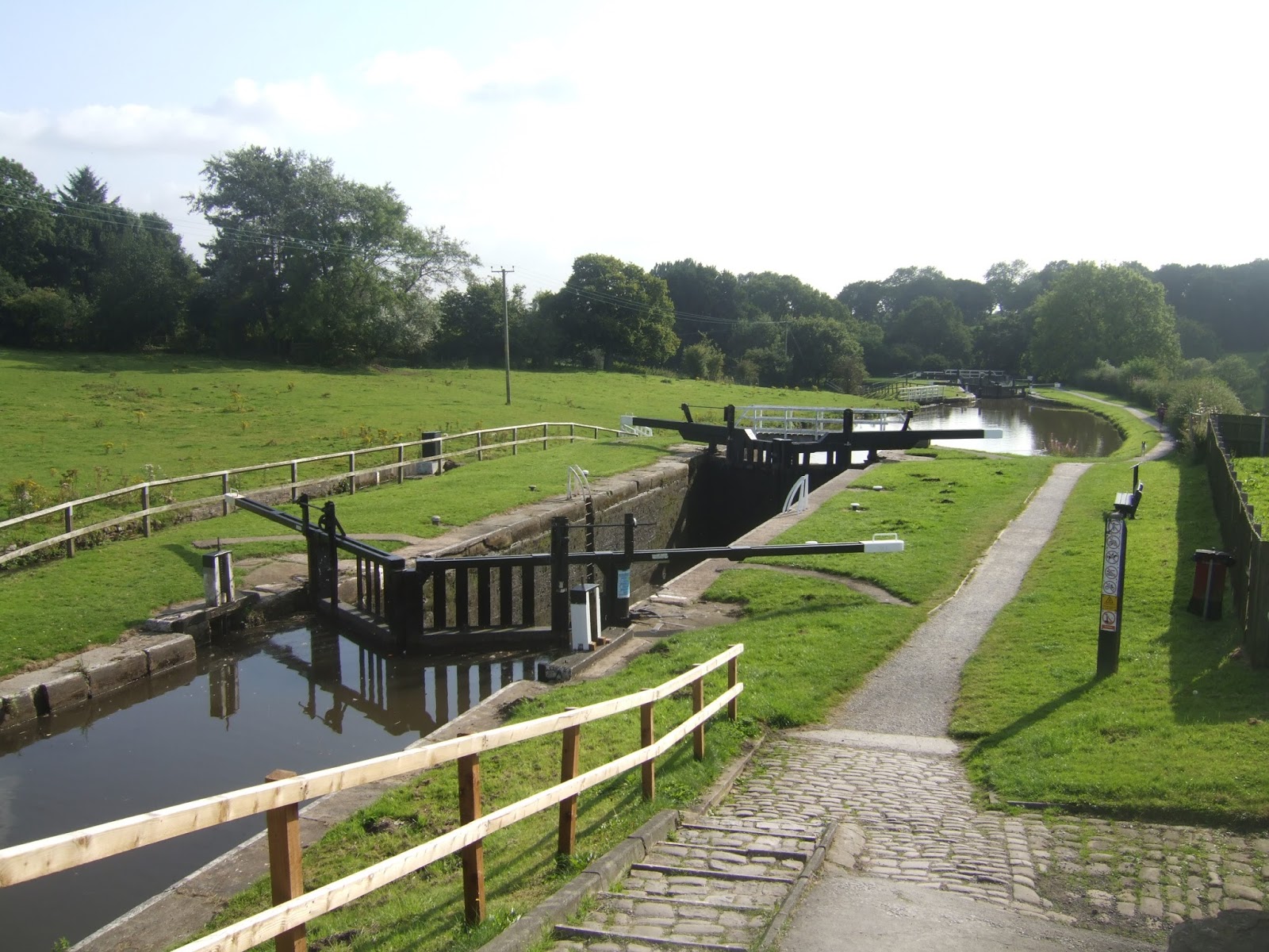
A phone call from My Parents has me providing a progress report and the realisation that three folds of E285 still means two more hours of walking, so the rise on the roadside through Brinscall has me putting on the jets to aim for a 5pm finish, noting the excellent moorland backdrop and the pub called The Cricketers, and excellent on to find for a winning move in Pub Legs Cricket (ask My Dad!). Harbour Lane and Briers Brow both lack footways on the way towards Wheelton, and extra car has to be taken among those doing the afternoon school run, and the surprising amount of heavy traffic on these descending country lanes. Pass over the A674, and into Wheelton, which is small and stone built, but still has enough space for a village clock, and Town lane leads out past St Chad's RC church, where a view to Rivington Pike and Healey Nab has us still close enough to the West Pennine Fringe, before running down to Johnson's Hillock, where the red phone box has become the local book exchange. Cross the Leeds & Liverpool Canal, an old friend in this remote quarter, and we can count ourselves out of the high lands now, the lane leading past the stub of the southern half of the Lancaster Canal, and under the M61 down to the old village centre of Whittle-Le-Woods, which has been absorbed by suburban expansion these days. A step or two up School Brow leads to the side of the A6, the other Old Road to The North, and beyond the parish church, steps are taken down Factory Lane to follow the National Route 55 cycle path through Cuerden Valley Park, a pleasing and shady track along the valley of the River Lostock, a path I deliberately included as I plotted to end in Leyland, rather than making familiar steps into Chorley, and it doesn't disappoint. The B6256 leads through much 80s suburbia in Clayton-Le-Woods, before turning up the A49 for a stretch and walking along the very posh Moss Lane, severed in the middle by the M6 and passed under via a subway to make the final footfalls into Leyland, past the church of St Ambrose and finding My Parents in the station carpark. All done at 5.05pm, and with only one more day to the Irish Sea, and despite there being many more miles to go the coming route will be much more forgiving, I don't think I'll be plotting any more 18+ miles through that sort of terrain any time soon.
5,000 Miles Cumulative Total: 1909.9 miles
2015 Cumulative Total: 507.7 miles
Up Country Total: 1750.2 miles
Solo Total: 1697.9 miles
 |
| Descending from Haslingden in the direction of the Grane |
 |
| Holden Wood Reservoir. |
 |
| Ogden Reservoir. |
 |
| Calf Hey Reservoir. |
 |
| Ruins at the top of Haslingden Grane. |
 |
| Edgworth Moor - Pickup Bank, the correct path is not here! |
 |
| Descent from Height End and hello to the West Pennine Moors. |
 |
| Hoddlesden Memorial Garden |
 |
| Decending Marsh House Lane, Darwen Tower as sentinel. |
 |
| Darwen (pronounced more Darren than Darwin). |
 |
| Sunnybank, at the top of Tockhole Road (one of them). |
 |
| Sunnybank Woods, an unexpected diversion. |
 |
| Earnsdale Reservoir & Darwen Jubilee Tower. |
 |
| Roddlesworth Upper Reservoir. |
 |
| Withnell, almost visited today! |
 |
| Brinscall, loitering on the West Pennine Fringe. |
 |
| Wheelton Clock Tower. |
 |
| The Leeds & Liverpool canal at Johnson's Hillock. |
 |
| St John the Evangelist and the A6, Whittle-Le-Woods. |
 |
| Cuerden Valley Park, worth the detour! |
 |
| Under the M6 and into Leyland. |
Next Up: One Day to the Irish Sea, and many miles and not a lot of contours, at long last!


No comments:
Post a Comment