Only my fourth night away of my jollies, and already I'm on the last leg of my Trail to the Coast, which seemed like a serious undertaking when conceived during the winter, but now the sea lies only a few miles away across the flatlands of Holderness (or maybe not, that district might be to the south of my trail for today). A 9.35am start is due at Beverley station, but before the trail turns east, a large section of this town centre ought to be examined, taking my path down Trinity Lane, past the Masonic lodge, and to the bottom of Eastgate for a walk around the Minster Yard, taking a look at the outsize parish church which shows the town's medieval significance, before making my way up Highgate, and past the Wednesday Market Place, still setting out its stalls as we pass. Up the main drag of Butcher Row and Toll Gavel, showing the Georgian face of Beverley's second prosperous phase, passing the Saturday Market Place, and on to the other pair of Medieval relics, St Mary's church, which would be a proud parish church in any other town, and the 15th century brick Toll Bar, still with a main road running through its narrow entrance. Historical touring done, it's time to make for Norwood road, finally setting course for the coast and closing my loop around the town, crossing my previous path and following the passage of the A1035 over the railway and among the outer suburbs to cross the relief road and make my way along the shared use track alongside Beverley Meadows, which still functions as the town's common land. Break off the main road at Hull Bridge, taking the old road alignment to the original site of the crossing of the River Hull, replaced in 1976 after two centuries of use, and we turn to the bankside by the Crown & Anchor, rising onto the flood embankment and passing away for the noise of the roads to enjoy a leisurely, and long, walk at the riverside with fields for company and the town slowly receding from view.
Detour around the High Eske
nature reserve, staying on the embankment to allow
the bird watchers their peace on the other side of the flooded clay
pit, returning to the Hull bank before taking a right turn as we meet
the Leven canal. As we are still below the navigable limit on the
Hull, a dozen miles inland, a canal to serve the distant town of Leven
must have seemed like a safe proposition when it was cut in 1805, in the wake of the draining of the fields of Holderness, but
since its decline and closure in 1935, it now forms a pair of
isolated straight pounds with its flood lock
infilled and the Far Fox aqueduct over the Holderness Drain removed.
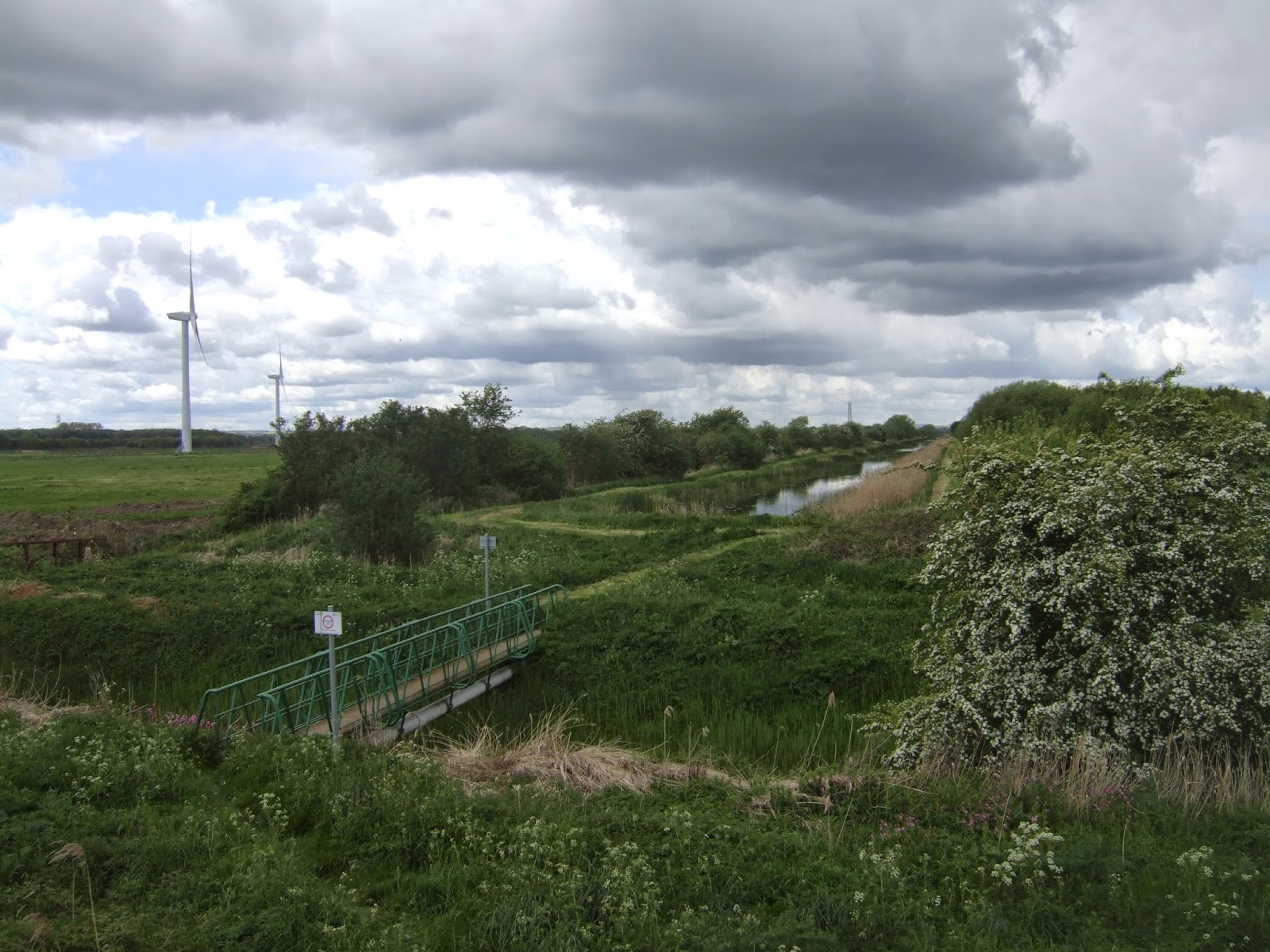
Paths aren't a problem though, despite some uneven going, recent
mowing and clearance of overgrown vegetation gives a clear run for
more than 3 miles between the Leven wind farm and the many agricultural fields
to the caravan park at Sandholme Bridge, but the Leven Wharf site has
now been landscaped into someone's garden and the terminus of the
waterway is not seen before we emerge on South Street. It's a short walk
south to start the field walking, cracking on along the bridleway to
the Catchwater Drain, and then on to a very easy crossing of the A165
before shadowing the edge of the Yarrows sand pit and passing the edge
of Willow Croft farm on the way to Riston Road. The path of choice
leads me on around the perimeter of Manor farm, which means a lot of
duelling with thistles and rapeseed on my way to meet the lane by St
Michael's Church, Catwick, a neat construction in rubble. Late lunch
is taken, and my finish time revised when I see I still have three
map folds to go, passing through the village by the B1244 before
striking the fields once again, through wheat and bare earth (good
for picking out local stone) up to Catwick Heads lane, and then
through rapeseed and grass to meet the churchyard of St Lawrence,
Sigglesthorne, where the church is an ancient mess of stone and
brick.
Pass along Church Lane
and am surprised by the number of 1970s bungalows in the village,
hitting Wassand Balk lane, and make note that there is a lot on
undulating going on in this flat land, as we approach the sea we seem
to be going uphill. Move onto the byway at the perimeter of Wassand
Park, before crossing the unenclosed pasture on the edge of the
B1244, where the Hornsea & Seaton Roads have to be followed as
there isn't a better option for passage on the north side of Hornsea
Mere, but a footway thankfully keeps us away from the charging
traffic and many school buses. The Mere may be the largest freshwater
lake in the whole of Yorkshire, but it's one that hides pretty
thoroughly behind a bank of trees for much of its considerable
length, lacking even permissive paths on this side, probably so as
not to disturb the numerous wetland habitats. Hornsea' s suburban edge arrives almost
suddenly, and arriving on the main streets, Market Place and Newbegin, you are not
greeted by what looks like a seaside town at all, the Medieval
church of St Nicholas and numerous Georgian buildings suggest
that the idea of being a resort came along much later in its history.
Site of the sea only comes along when the edge of the Memorial garden
on New Road is passed, and the seafront terraces and sad looking arcades finally
make their appearance, as I roll onto the promenade to note how
pleasant and peaceful it all feels with the sun shining and the lack
of crowds due to it still being out of season. I hadn't actually
figured a finish line before we arrived at the North Sea coast, so
poses are struck by both the Hornsea Beacon and the terminus of the
Trans-Pennine Trail, before crossing the beach to briefly paddle and
illustrate that there are no more miles to go in this direction, all
done at 3.55pm, and due a celebratory ice cream at the Old Pavilion
with My Parents before heading back to Woodmansey with my first
major walking scheme of the year done and dusted.
5,000 Miles Cumulative Total: 1674.6 miles
2015 Cumulative Total: 272.4 miles
Up Country Total: 1548.2 miles
Solo Total: 1435.6 miles
 |
Beverley Minster. The
most renowned feature of the town and appearing
to be all of a
single period, but its construction actually dates from 1230 to 1490,
it
still looks like a version of York Minister in (relative) miniature.
|
 |
St Mary's, Beverley. A
proud and singular church, dating from the late
13th
century onwards, it would be well regarded in any other settlement,
but here manages to play second fiddle to the Minster.
|
 |
Norwood road. Setting
course on the A1035 main road feels like a bit of a cheat,
but
the obvious routes are sometimes the only ones available, and here closes
my
tour of Beverley, all the remaining paths lead to the coast from here.
|
 |
Hull Bridge. The
original 18th century bridge has gone, worn out beyond
repair
by the time of its replacement in 1976, not an inspiring
structure, but rivers seem
to be a rare breed in these parts, so all
crossings must be worthy of note.
|
 |
The River Hull. Yes, it
is a river, and not just a city, and as the major water
course between
the Wolds and the Holderness coast, it needs to feature as we go,
this is the
view back to Beverley as the Minster looms over the flat lands.
|
 |
High Eske Nature
Reserve. A flooded clay pit that now lives on as one of the many
avian life preserves
in the county, Seriously, if twitching is your
thing, the East Riding might be the place for you!
|
 |
Leven Canal Flood Lock.
Not one of the predictable locations for a canal, but barges could
service the town of Leven some 3+ miles from the Hull for import and
export for 130 years.
|
 |
Far Fox Aqueduct site,
Leven Canal. Obviously a straight pound is easy to maintain, but an
aqueduct becomes an unnecessary encumbrance when disused, and thus it
passes into history.
|
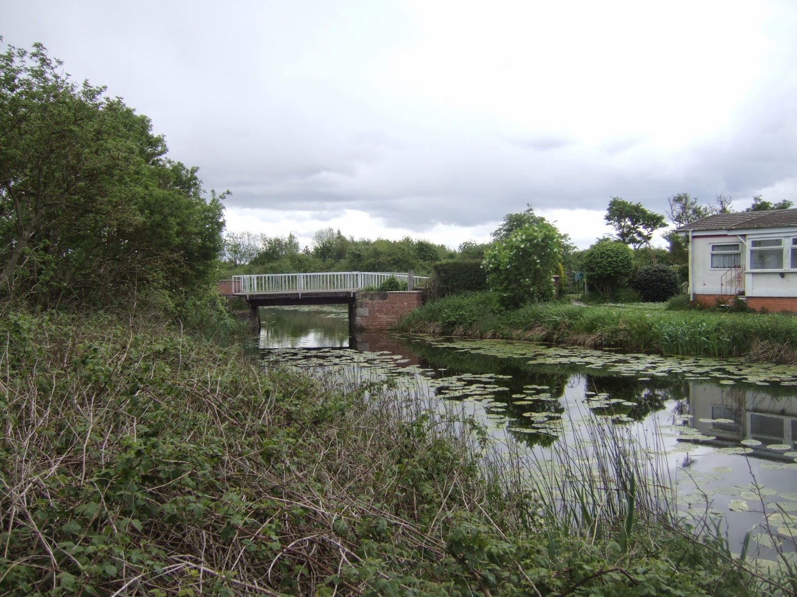 |
Sandholme Bridge, Leven
Canal. A canal-side caravan park now maintains the
only remaining
structure of note on the canal, the other bridges carry a minor farm
track
and a selection of dubiously arranged planks which barely
resembles a bridge at all.
|
 |
Catchwater Drain
Bridge. An actually old bridge, so naturally it passes over a drain
rather than a canal.
The ancient drains of Holderness and the Vale of York
are fascinating in how they divide up the landscape,
steep sided and
deep, making the East Riding one of the most fertile parts of the country..
|
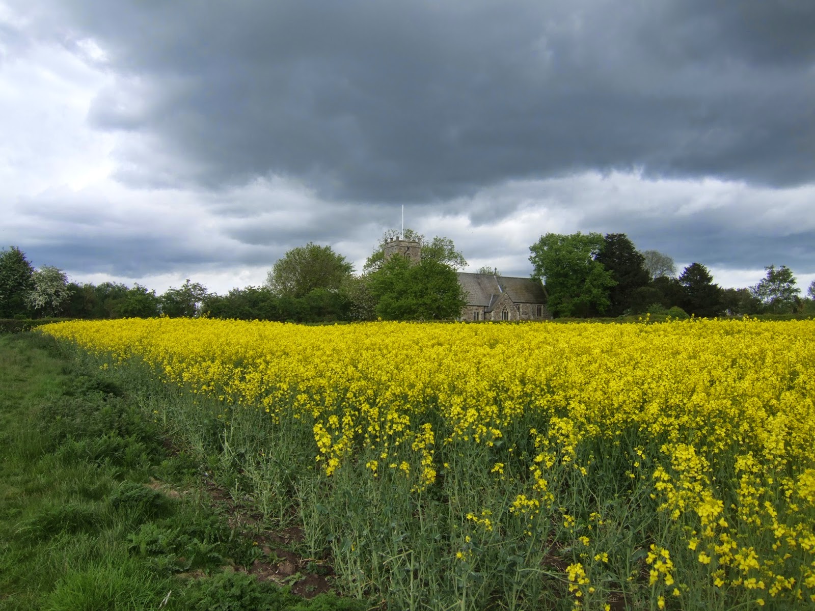 |
St Michael's church,
Catwick. A welcome sight after fighting my way through so much
rapeseed, the kind
of village church that would charm anyone,
especially as it appears to be built entirely in cobblestones.
|
 |
St Lawrence's church,
Sigglesthorne. A mix of stone, cobble and brick of a variety
of
periods from Medieval times to the 19th century, the charming church
award may
have been claimed from Catwick only one village further on the trail.
|
 |
Wassand Park Pasture.
You don't need to be at moorland altitude to find rough grass, still showing
up ridges and furrows beneath the turf, this has been a sheep field
for many centuries.
|
 |
Hornsea Mere. An
impressively large freshwater lake, of which there used to many
in Holderness
before shifting coastlines erased many of them, the lack of footpaths
to access it is deeply frustrating, but once again it's birdwatcher's
paradise.
|
 |
St Nicholas' church,
Hornsea. You'd short-change this town by thinking it a down at heel
seaside resort town, it shows up a far richer history than that, and
the parish church is the first thing
you'd use as counter. (Sorry
about all the churches, but the ERoY has so many good ones!)
|
 |
Hornsea Beacon and
Promenade. The end of the 82 mile trail to the coast, and the recently
Blue Flag-awarded
beach will be our last port of call on this trail, no more miles to
go, unless
a trip to the offshore wind farm or a damp jaunt to Scandinavia
happens to be your thing.
|
Next Up: A Bonus Riverside walk, to Jamaica!
No comments:
Post a Comment