Sunday, 16 June 2019

Barnsley to Holmfirth 15/06/19

17.2 miles, via Shaw Lands, Dodworth, Silkstone Common, Berry Moor, Four Lane End, 
 Oxspring, Spring Vale, Penistone (Bridge End), Scout Dike, Ingbirchworth, High Flatts, 
  Birds Edge, Lane Head, Snowgate Head, New Mill, Lydgate and Town End. 

As we progress into the 2019 High Season, the long days ought to invite the possibilities of starting early, but the appeal of getting on the trail before 9am is diminished by the fact of it refusing to get particularly warm even as we alight on the last weekend of Spring, and even then getting out early is going to be a non-starter when the body isn't willing to get going a work o'clock on a Saturday morning, having not had any rest time over the preceding six days. Factor in the discovery that I'm being reassigned at very short notice at work, and have thus just completed my last shift at Leeds General Infirmary after 20+ years on that site, it's hardly a surprise that my brain is all sorts of haywire as the weekend lands, and all my walking gear has to be gathered at the hurry up to get me out to Barnsley with another South to West Yorkshire stretch in mind, disembarking the train at 9.10am, as the morning's sunshine start fades to be replaced by a light covering of cloud that will persist for the whole day. Third visit of the year, and I'm already starting to get a feel for Barnsley town centre, though its main drag of shops is yet to be seen as we depart the Interchange onto Eldon Street which takes us past the Parkway cinema and the Civic theatre before we take a turn up through the Victorian Arcade, which does its best to culturally elevate its rather humble residents and tenants, as we rise to meet Market Hill and the way past the Town Hall once again as we land on Shambles Street. We shadow the back of the main shopping parade along here, as well as passing below the buildings seen on our previous passage through the town, getting a fresh angle on the Sixth Form college, the Borough Council offices and the Lamproom Theatre in its former chapel before we drop down past the Premier Inn to meet the Townend Roundabout, which offers vistas over southern Barnsley to stimulate interest for a future walking season before we eventually pick out the route that will take us westwards. Dodworth Road, the A628, will take us on into another district of proud townhouses that have probably seen better days, stretched out beyond the soon to be former Marlborough inn, looking like it might have once been on of the town's most desirable residential streets, with only the accumulated centuries of soot staining making it look like the coal town of history, though a peer down a couple of side streets gives some indication of the much more modest terraces that grew with the collieries in the area back in the 19th century.

Wednesday, 12 June 2019

Shepley to Darton 09/06/19

14.9 miles, via Shepley Marsh, Lane Head, Piper Junction, Dearne Low Moor, 
 Whitley Common, Whitley Height, High Bank, Thurlstone, Penistone (Bridge End), 
  Hoylandswaine, Cawthorne, and Kexborough. 

Walking plans for Saturday are junked when the rain comes on hard, continuing June's pattern of frustratingly inconsistent weather and temperatures that are unbecoming for this point in the season, and thus we shift our trip to Sunday, a much clearer looking day, with a more modest mileage scheduled after last weekend's distance, only picking my route minutes before leaving home after trusting my ability to get a 15 mile trip down in a fixed 5 hour 45 minute window. The transport issues are what make Sunday tripping so frustrating, and the 40 minute layover at Huddersfield while awaiting the Penistone Line train is no exception, even when it does allow an extensive trainspot, but despite having only one job to perform, Northern Fail can't get it done, and we don't get underway until 15 minutes after the scheduled departure time as they can't shunt their unit into place among all the TPEs. Thus we arrive at Shepley, right at the western edge of this year's walking field, at 9.40am with my error margin for the day lost already, and thus we set off knowing that no display of urgency will be necessary at all as we strike off southbound on the rising Station Road, which illustrates well how the village gradually grew down the hillside to meet the railway, rising through a century's worth of suburbia to meet the Kirklees Way route by the Old Hall of 1608 (and the replacement New Hall is notable by its absence). Past the Jos Lane corner, we are rapidly off to establish another new southern boundary to my field of walking experience, which has been done so often this season that it's barely worth mentioning, and then it's downhill to meet the village Co-op and the Black Bull inn at the corner of Marsh Lane, and then it's onward uphill again, past the former Sunday School and the church of St Paul and carrying on among the formerly rural cottages and farmsteads that sat at the old top end of the village. Pass the Farmers Boy inn, another one for the fantasy career as a publican and carry on through the ribbon of suburban houses that has grown to meet the formerly separate enclave of Shepley Marsh, arriving in the fields above the village with the looming mass of Nabscliffe rising above, and we'll be heading over that, after a fashion, splitting off onto the rising Row Gate by Marsh Cottage and following a small pony being taken out for their first road walk, and getting some grand views that match some of those from the nearby vantage point from last week, but this time we have sunshine aplenty as we look over the valley of Shepley Dike and beyond, while rising to meet the A635 Holmfirth Road.

Sunday, 2 June 2019

Barnsley to Huddersfield 01/06/19

18.4 miles, via Old Town, Gawber, Redbrook, Barugh Green, Cawthorne, Daking Brook, 
 Nether End, Dunkirk Crossroads, Denby Dale, Upper Cumberworth, Lane Head, Shepley,
  Shelley, Kirkburton, Highburton, Fenay Bridge, Almondbury, Moldgreen, and Aspley.

Having made four trip to Barnsley over the years, by four rather tangled and straggly routes from the north, it's time to definitively add South Yorkshire's closest major town to my field of walking experience by blazing a trail from it through the heart of Kirklees District to that borough's administrative centre, a long trek that will probably be the longest of the season, and one that has felt like it might just be that bit too far as Huddersfield doesn't sit all that proximately in the mind. It's a good one for that start of the High Season though, as we start our burst of trails in the hinterlands of hills and valleys around the Dearne, the Don and their various branches, and despite the distance on the slate we don't get an early start, not landing at Barnsley until 9.10am as despite the lengthening days of June being afoot, this one looks like it'll have little by way of sunshine in it. So we set out by passing through the Barnsley Interchange bus station, which sits on the site of the former Barnsley Court House station, where services on the Midland Railway's metals used to stop before they were combined into the enduring L&YR/MS&LR Low Town station in 1960, and as we cross Eldon Street we pass the court house itself, now a branch of Wetherspoons, before we ascend Regent Street, where the Town Hall stands at it head, dramatically. Pass around this impressively huge pile in Portland Stone, leaving the town's early morning shoppers behind, as we move onto Westgate, which passes into the town's legal and administrative district as it passes the Police station, the law courts and the district council offices, before we make the dynamic turn onto Sackville Street by the Lamproom Theatre and the Premier Inn to enter the Old Town. Barnsley is so mentally synonymous with the coal industry that it's hard to conceive of it having a part that looks like an upscale district for the Victorian Mercantile classes, but endures here as we pass among smart stone terraces and the odd urban villa before we pass over the railway line to Penistone and beyond, to meet more bold terraces in stone and brick on the rising Gawber Road beyond. It's definitely going to be a day of up and down on this trail, as we land on the high crest on this corner of town, moving among much more recent estate buildings as we pass Barnsley Hospital, aka the District General, which is not a building to inspire love, but one that sits large and distinct on its hillside on the site of the former Union workhouse, a very 1960's edifice facing the most 1950s of council estates, where the sole hint of rural vintage is the Gawber Road WMC in the former Halfway House Inn.

Tuesday, 28 May 2019

Denby Dale to Batley 27/05/19

13 miles, via Lower Cumberworth, Skelmanthorpe, Emley, Flockton Green, Overton, 
 Middlestown, Thornhill, Thornhill Lees, Savile Town, Dewsbury, and Batley Carr.

After what felt like my longest break away from home in a while, which was my first proper holiday in two years, we return to the more mundane matters of walking locally again, returning to the previously unseen byways that still litter Kirklees District, and after all that nice weather that sat comfortably over the days in Derbyshire, it all looks rather mediocre as we return to West Yorkshire and tune up for our Bank Holiday Monday stroll. We ought to not be surprised by this turn of events by now, by travelling through the early morning rain as it falls on Dewsbury and Huddersfield hardly gets me feeling inspired as I seek an early jump off so that there night be r'n'r time available at the other end of the day before we get back to work after so many days away from it, and thus we land at Denby Dale station at 8.35am, with most of the borough still asleep and with us setting a course northwards after so many trips going south. We'll not really see anything of the village as it clusters in the upper Dearne Valley, instead taking the exit that leads us past the old goods shed and the yard of a builders merchant to find the walkable path that leads though the linked closes of Bromley Bank and Bluehills Lane, which I can only hope were developed on a brown-field site as this is the sort of suburban-living-in-the-countryside that I find so repellent, which is only used as a path route today as it lets us join Cumberworth Road about halfway up from the valley. Land on this lane as the glum start to the day passes, with a stiff breeze from the northwest sending the weather on over the Dearne Valley and its high southern side as we go north, with sunshine coming on as we rapidly wander into Lower Cumberworth, a much more rural sort of village, where the Kirklees Way brought us on an east-west path in 2014, and thus we've briefly adds another few square miles to the experience field as we pass the Forester's Arms and hit the descending Shelley Woodhouse Lane, which soon has us out among the more scattered houses again. Here we pick our path, joining Ponker Lane, with its awesome name and convenient footway to lead us up the rising lane over Ponker Hill toward Ponker farm, cresting by the covered reservoir and giving us that view to the Emley Moor masts that might be their best angle before the lane starts to descend in Skelmanthorpe, where most of the suburban houses at the town's edge seem to boldly protest the future development of any more suburban houses on the greenbelt land at the top end of Cumberworth Road.

Saturday, 25 May 2019

The Long Walk to Leicester #5 - Rowsley to Belper 23/05/19

17.3 miles, via Northwood, Churchtown, Darley Bridge, Oker, Matlock, High Tor, 
 Matlock Bath, Cromford, the Cromford Canal, High Peak Junction, Robin Hood, 
  Whatstandwell, Ambergate, and Scotches (plus the Derwent Valley Heritage Trail Leg #3).

Long Distance Trek
means Selfies!
#5 at Rowsley
Take two days out from the trail to allow the legs a rest and to blog to my hearts content in the down time, and also to do holiday stuff, because I'm on holiday, which has Tuesday spent riding the train at Peak Rail, because it's not a trip away without visiting a preserved line (which would make Dad happy, for sure) and then Wednesday is spent getting in the industrial heritage in at Cromford Mills, where the concept of factory manufacture took off in the late 18th century. With holiday whims satisfied, we can thus get back in the walking saddle on Thursday, knowing that another 17+ mile day lies ahead, with weather that promises a lot of sunshine and heat, in complete contrast to the already distant feeling trip over the Dark Peak only five days back, taking off in the Parental Taxi with a bag full of food and liquids that I know I'm going to need for a jump off at the Grouse & Claret in Rowsley at 9.05am. We're right by the side of the A6, which as we know is one of Leicester's main roads and could rightly be followed for the remainder of my Long Walk, but we know there wouldn't be as much fun in that, and the Derwent Valley Heritage Way will offer a much more peaceful take as it ventures down Old Station Close, to the sight of the second and longest enduring of Rowsley's stations, lost under industrial units since its 1968 closure, and we could walk the cycle path on the railway formation south from here, but the way wants us to venture into the beech woodlands by the side of the river, and so that's the way we head. A nice and shaded start to the day, feeling that it's much longer walk down to the newer Peak Rail station than it felt when we drove down there, and only slight landscape hints are felt during our passage, and oddly, we miss seeing the confluence of the River Wye as it flows in from the west, and it's odd that such a major branch of the Derwent could arrive invisibly, especially as I knew that I was looking for it.

Wednesday, 22 May 2019

The Long Walk to Leicester #4 - Bamford to Rowsley 20/05/19

14.4 miles, via Shatton bridge, Goose Nest wood, Leadmill bridge, Coppice wood,
 Grindleford bridge, Horse Hay coppice, Froggatt wood, Frogatt, Calver, Bubnell, Baslow,
  Chatsworth Park, and Calton Lees (plus the Derwent Valley Heritage Trail Leg #2).

Long Distance Trek means Selfies!
#4 at Bamford
Sunday makes for a nicely chilled out day away as we spend it settling into our rather curious cottage in Winster, one which has two double bedrooms, a dining room that seats six, but a living room with only space for two armchairs, so it'll be fine for Mum and myself to fill for the week, and the village itself has a tonne of charm, with many stone cottages crammed together on its hillside, largely borne of the lead mining industry and sat around the National Trust's very first property, the 15th century Market Hall. Thus relaxed, we are ready to go again on Monday as the weather showed a marked spike in improvement, tootling our way back up to the Hope and Derwent Valleys to resume the trail, not getting out quite as early as I'd would have liked, due to Mum accidentally breaking our cottage's shower, and me managing somehow to successfully fix it, landing us at Bamford station for a 9.30am start, hopeful that I haven't seen too much of today's passage already on our way back. Anyway, I can guarantee that this will be a much shorter and gentler trip than Saturday's escapade, as we make our way back over retraced steps over Mytham Bridge and past the Hope Valley Garden centre to resume the Derwent Valley Heritage Way, at Shatton bridge, leading into the dead-end village of Shatton and taking us over the lowest crossing of the River Noe, the main watercourse of the Hope Valley itself, which flows to our left as we pass around an equestrian paddock as we make for the Derwent's bank. Where the Noe converges with the Derwent is where the latter becomes considerable, as both drain an extensive area of moorland, and thus we have a large channel to follow as we join the undulating an occasionally high bank of the river, skirting along the edge of the broad pasture below the rises of Offerton Moor to the south, following it around Kentney barn before we get a reveal of the local Dark Peak company behind us, with Lose Hill and Win Hill flanking Crookstone Moor, the eastern edge of the Kinder Scout plateau. Bamford Edge also muscles into the view as we press on, but there's not so much to see going forwards as the bank gets tight and undulating until we get a reveal of the hillsides above Hathersage, a proud Derbyshire village that looks like it will remain completely unseen from this trail, hidden away on the north-eastern bank, with only signage indicating its presence somewhere beyond the coverage of trees and the string of stepping stones.

Sunday, 19 May 2019

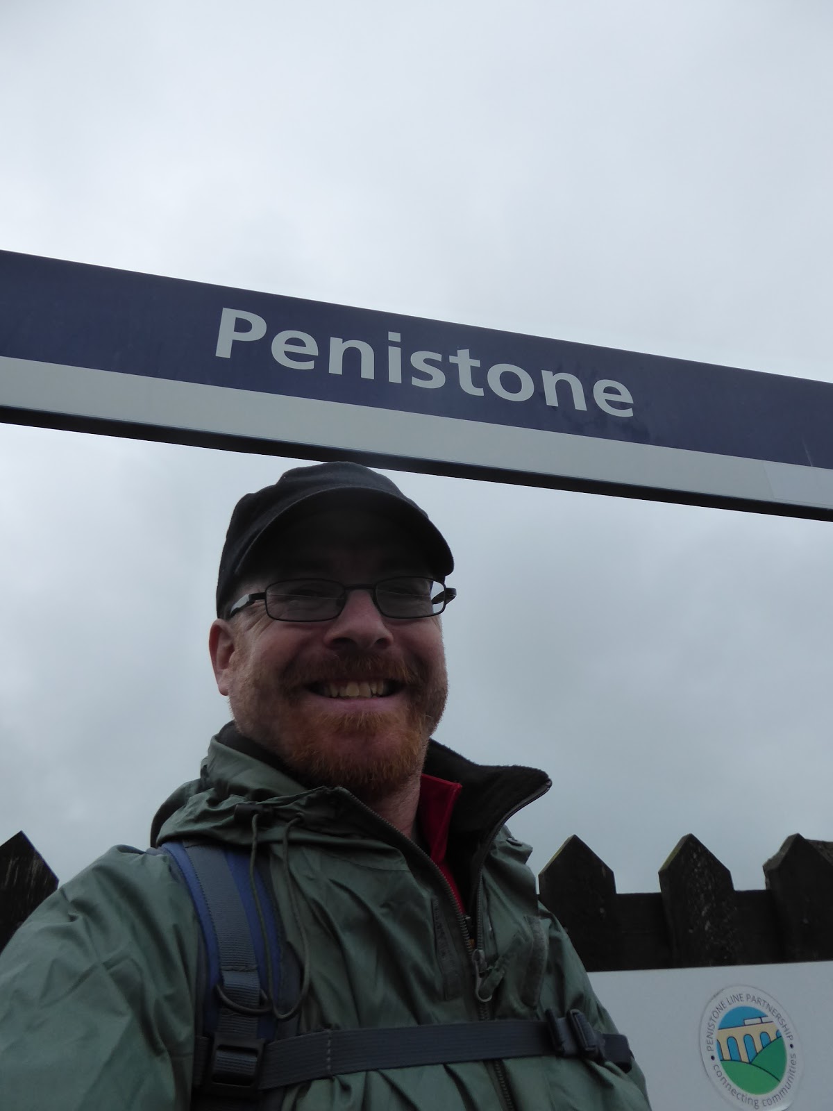
The Long Walk to Leicester #3 - Penistone to Bamford 18/05/19

17.5 miles, via Cubley, Sheephouse Height, Midhopestones, Ewden, Smallfield, 
 Bradfield Dale, Bole Edge Plantation, Strines, Moscar, Ladybower Reservoir, 
  and the Thornhill Trail (plus the Derwent Valley Heritage Trail Leg #1).

Long Distance Trek
means Selfies!
#3 at Penistone.
It's a weird feeling to organise a holiday for the family without having Dad around to enjoy it too, but after his passing getting away for a week was one of the first thoughts for the future that Mum and I shared, and with a legacy having come my way, affording a few weeks away over the coming years shouldn't dent my finances at all, and as Mum has gotten her driving confidence going again, added to getting herself a sat-nav app, her being my taxi for a week of walking across Derbyshire should be as straightforward as is possible. Getting going is the first order of business then, leaving Morley at ouch o'clock in the morning, and leaving Mum as custodian of my flat and the baggage as I make for the trail that will link my local wandering fields to the Midlands, which probably aren't as far away as my brain would think, riding the rails and cursing this month of May that still hasn't brought any consistently decent weather, arriving at Penistone for an 8.45am jump-off, under gloomy skies and clouds that look like they could threaten rain at a moments notice. We thus start our resuming path into the unknown by slipping onto the Trans Pennine Trail path which heads south of the station and reveals the platforms of the former MS&LR Woodhead route, which were coated in trees when we visited in 2014 and haven't seen a regular passenger service since 1970, and we then slip down Eastfield Avenue to make our way through the town, rising among the terraces on Church Street to pass around the other side of the parish church of St John the Baptist. Land on the High Street opposite the pubs and the Co-op, and am struck that folks seem to already be out in force despite the early hour and we press on south as the stone houses slip from townhouse style to a scale more modest, and occasionally rural before the lane takes a dip and slips solidly into suburbia, gaining the name of Mortimer Road as it goes. The rise away from the Don valley resumes as we climb towards the bottom end of town, and there's more to Penistone than you'd expect clearly, meeting the council estate at Cubley, right about where the Barnsley district bus terminates and we start to slip into the countryside, past the Cubley Hall hotel and pub, and into the elevated fields that lie beyond, shrouded in an uninviting grey haze, which sadly gives us little by way of gaining a contextual view into the landscape around-abouts.