12.9 miles, via Levisham Park, Burn Knolls, Birks, Woodkirk. Hey Beck, Gawthorpe,
Ossett Street Side, Ossett, South Ossett, Horbury, Aggingford Hill, Hartley Bank,
New Scarborough, Netherton, Stock's Moor Common, Bretton Common, West Bretton,
and The Weston; plus October's Long Weekend.
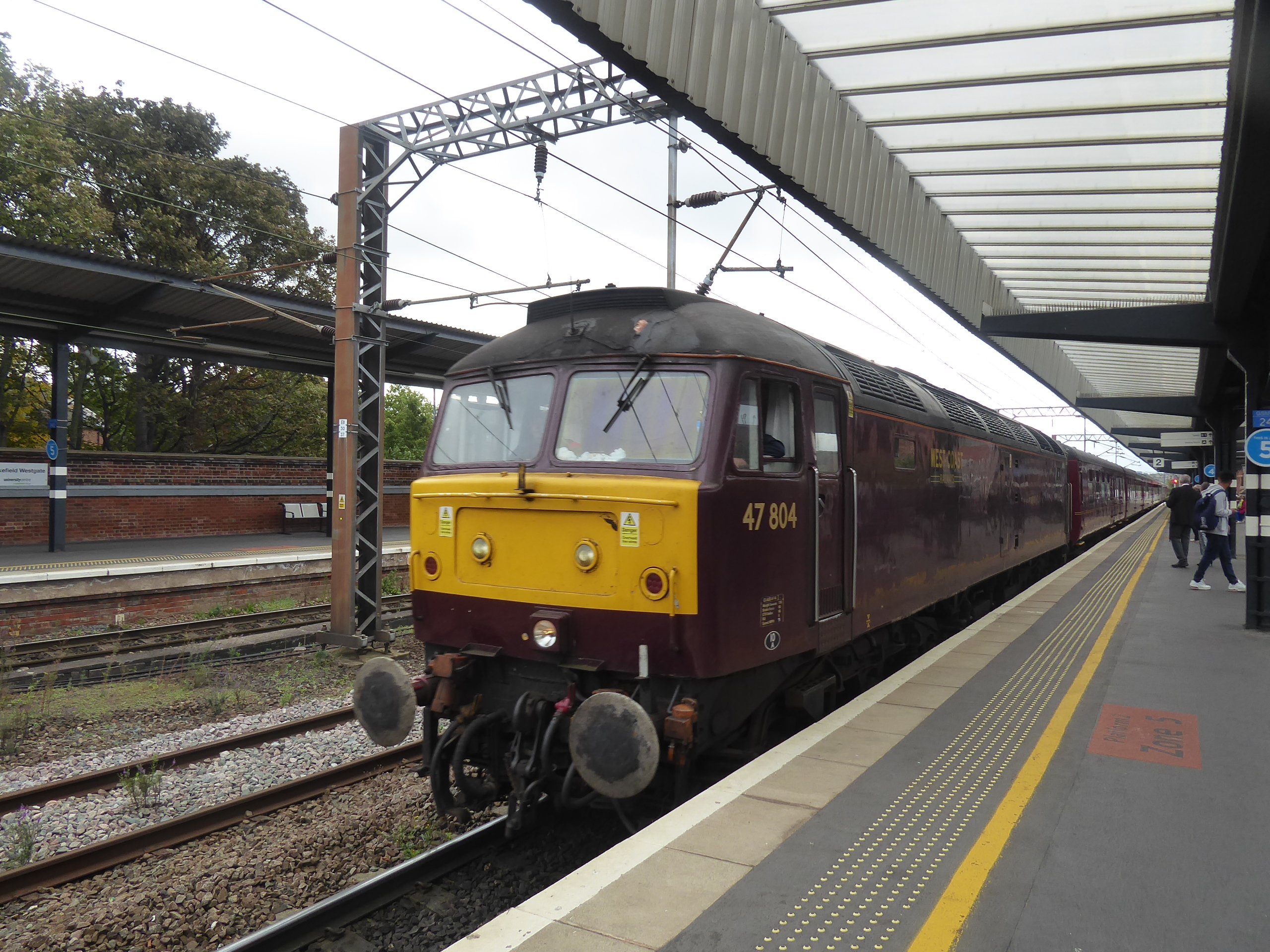
The first weekend of October drops us our next long weekend, thanks to extra days of leave purchased from work, falling neatly between my late Summer and end of season breaks, which had been intended to be a few days to relax and stroll a bit, but turned into a four day spell of activity when I found a steam rail tour for the Thursday, the last of the West Coast Railways season, which travelled up the Settle & Carlisle line and neatly dovetailed with the occasion of my Mum's 81st birthday, which allowed me to fulfil a promise that I made the previous year to take her out for a steam train ride for her 80th, so I've got her company for the period, with us taking each other out to celebrate our birthdays. Riding out from Wakefield Westgate, it's not needing a early start despite the descent of Autumn, though our travel window does tighten somewhat thanks to the service running out of York some 45 minutes late, at 10.25am bringing us our rake of vintage BR Mark 1 coaches and topped 'n' tailed diesels that will take us to Leeds for a reversal and then a merry pound up the Aire Valley to gain our steam traction from Hellifield to take us non-stop over the watershed and up the Long Drag of Northern England's premier scenic line, which we haven't seen in far too long, up the Ribble Valley and among the Three Peaks, to Dentdale, over Ais Gill summit and on down the Eden Valley. Somehow, all the time lost early is regained as we reach Carlisle, at 2.15pm, where we can find that it's been the line-appropriate LMS Jubilee 45627 Sierra Leone hauling us (actually 45699 Galatea in disguise, and oddly wearing the number of 45662 Alberta on its cab sides), and there's locomotive manoeuvres to be watched at both ends of the break, which is otherwise only long enough for a stroll from the Citadel to Tullie House museum and back, where we can have brews and cake, and purchase that Hadrian's Wall Path t-shirt that I've been promising myself since failing to find one in 2014. Departing at 4.30pm, with the daylight still strong and the changeable and rather poor weather not really spoiling the trip we re-ride the path homewards, breaking for water and photographs at Appleby before lamenting the lack of audible chuffing from the locomotive and clickety-clacking of the rails as we ascend to Ais Gill again, gradually losing the landscape in the gloom as we come down the Ribble valley and finally finding ourselves in darkness as engines are swapped again at Hellifield, a long break that coincides usefully with teatime, before we run back to homewards in a surprisingly familiar 1980s train fashion, with the jaunt concluding at 9.15pm, a round trip of nearly 11 hours that we both enjoyed immensely, thankfully.
 |
| 47804 at Wakefield Westgate |
 |
| 45627 at Carlisle Citadel |
 |
| Carlisle Citadel itself. |
 |
| Tullie House Museum. |
 |
| 45627 on Manoeuvres. |
 |
| 45627 ready to depart. |
 |
| Watering and a Photo-Op at Appleby. |
 |
| 37676 at Wakefield Westgate. |
~~~
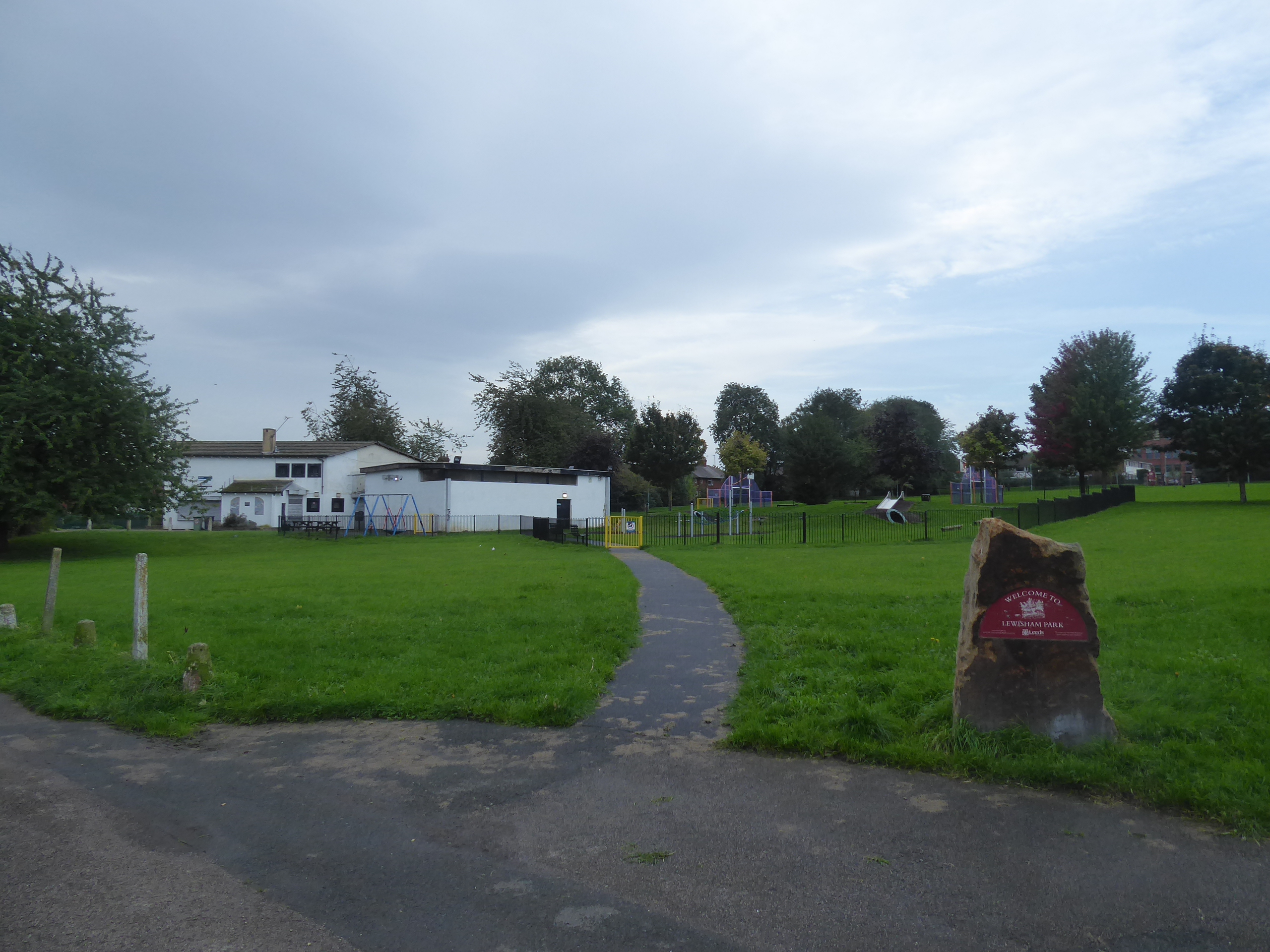
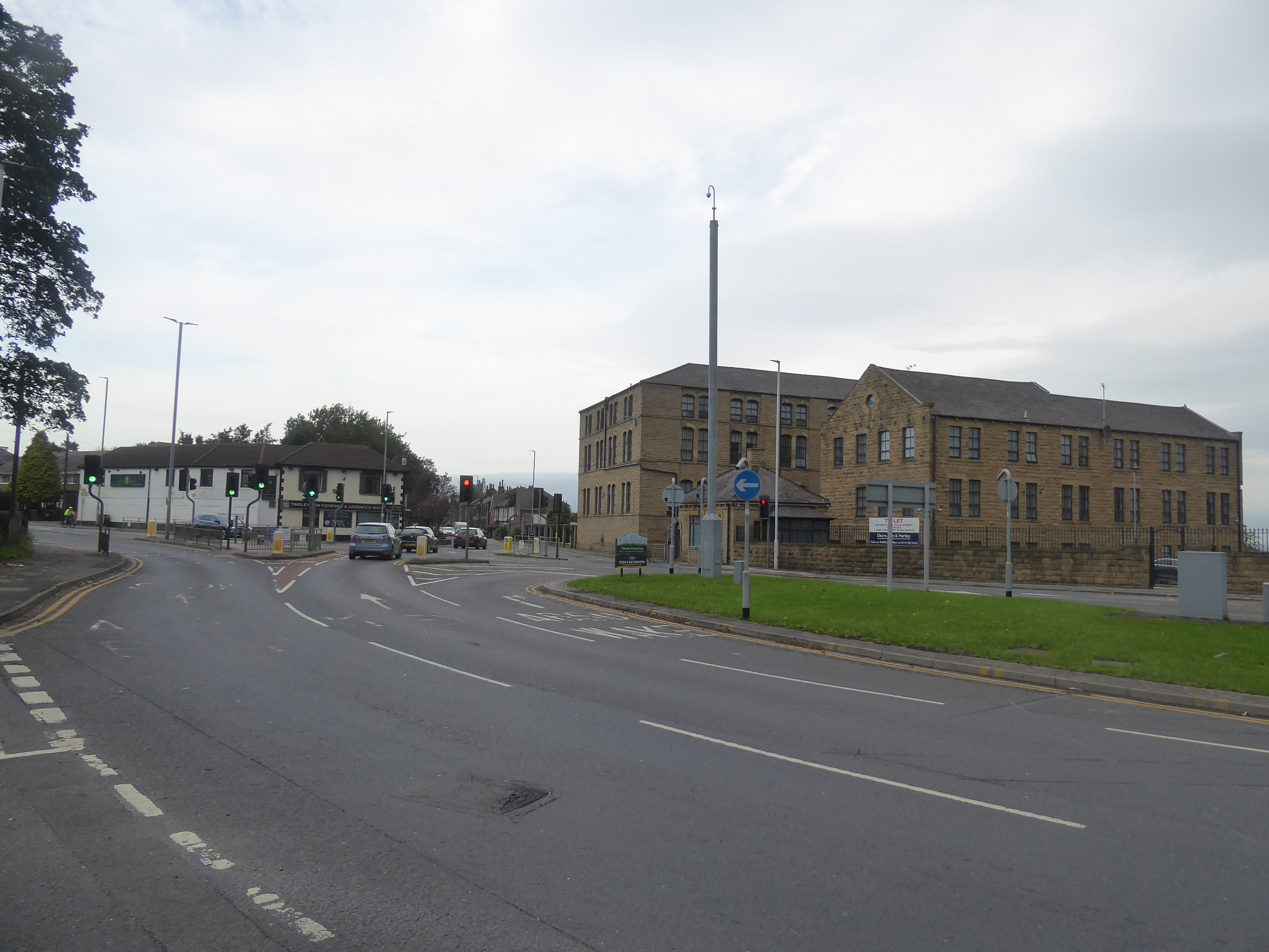
Friday features little more than a jolly over to Junction 32 for some shopping needs to be fulfilled, and an excuse to make a first 9and mostly successful) attempt at cooking pulled pork, but Saturday has me the opportunity to walk while Mum has some church meeting minuting business to attend to, and having parental taxi privileges means that I can aim at the most awkward of destinations on my Shuffling the Tiers list, and we might have a walk in the park together at the other end of the day if I can get going early enough, getting us to another 9am jump-off at Morley station to set us a course southbound, away from the sight of more scaffold erections than installation of brickwork on the elevator towers, and off up the steps flight to Albert Road, pondering just how many original routes there might be left out of this end of town. It's certainly a stretch for originality that we make as Clough Street leads us to the east entrance of Levisham Park, which is briefly crossed to the south entrance onto the B6123 Middleton Road, and thence downhill via Middleton Grove among the council houses and the curious little circuses before meeting the ginnel that leads down to the old Wide Lane, which is crossed over to meet Bluetin Park, which does have a name, apparently, and thence its along and over Magpie Lane to the ginnel that leads to the Glen Road playing fields and on to the footpath up through the neighbouring estate and on past the allotments and on to Elmfield Road. Emerge onto Bridge Street, and trot down to the Tingley Bar - Mills corner, and our route finding gets a whole lot more predictable as the A650 Britannia Road is crossed to meet the trajectory down the suburban projection of the A6029 Rein Road, leading us over the M62 motorway and onto the adjacent path that was first trekked on our circuit tour in 2013, looking a whole lot different as it fringes the local quarries theses days, with trees and undergrowth now abounding as we decline, down to the passage over Woodkirk Beck and rise on towards the site of Woodkirk station and the sports clubs.
 |
| Development continues at Morley Station. |
 |
| Levisham Park, Morley. |
 |
| Glen Road Playing Fields, Morley. |
 |
| Tingley Bar, and Tingley Mills. |
 |
| Woodkirk Beck, and its upstream overgrowth. |
Pass down to cross the A653 Dewsbury Road as we pick up the Leeds Country Way route, sending us through the yard of St Mary's Woodkirk and into the fields once more as we we trace a way down the fall of the beck and down by the field boundaries, away from the cattle and the footfalls of the 2012 passage as we come down to the B6124 Hey Beck Lane, which is tangled with as we seek a way ahead, into one of the blank spaces on my local map, somehow barren of footfalls in a dozen seasons of trekking, first penetrated along the driveway leading to some of the scattered farmstead of Hey Beck itself. It look like it ought to be farm tracks the whole way across these undulating fields, but its ancientness seems lessened by a field path or two among the eastwards down-falling streams as we rise in sight of the Gawthorpe water tower, past then end of Dogloitch Wood and getting confirmation that the track that comes down from the farmstead at Chidswell certainly isn't publicly accessible, though this odd little space between the surroundings of greater Morley, Dewsbury and Ossett does seem popular with the local dog walkers, out and about despite the projected sunny day having not yet appeared. Roll into Gawthorpe alongside Highfields school, landing us on the High Street which we track down to the Maypole and the Shoulder of Mutton inn before we tangle with our previous southbound route in these parts, as we join Swithenbank Street to pass over the A638 to meet Ossett Street Side, and a new path among the council houses along Swithenbank Avenue as the spire of Holy Trinity church teases itself over the rooftops as we come down towards Wood Street and the spill out onto the old Dewsbury Road, which is tracked along by the Tesco Express and the Red Lion inn at Paleside.
 |
| St Mary's Woodkirk. |
 |
| The fall of Woodkirk Beck to Hey Beck. |
 |
| Delving into the fields between Morley and Ossett. |
 |
| The view uphill to Gawthorpe Water Tower. |
 |
| The view downstream towards Wakefield. |
 |
| The May Pole and the Shoulder of Mutton, Gawthorpe. |
 |
| Swithenbenk Avenue, Ossett Street Side. |
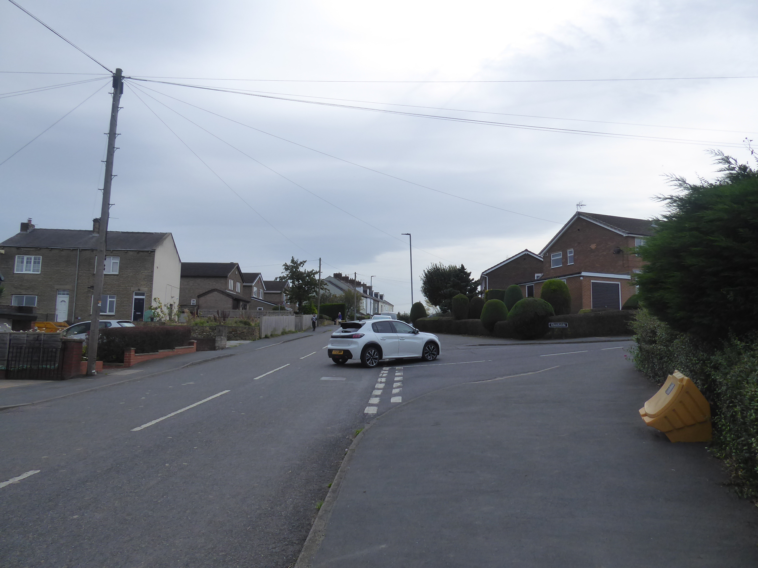
Moving towards the spread of old Ossett, at the edge of the industrial band of factories and showrooms, we meet the top of Dale Street to lead us over to the town centre, up and down he B6129 as it passes The Mews Hotel at its crest and lands by the old chapel at the Church Steet corner before we cross to Prospect Road and pass below the Ossett United football ground and rock up at Ossett bus station, tagging this previous destination into Tier #1, a mere two hours distant from home, before we carry on behind the Town End shops, across Prospect Road again and down Intake Lane to vary up our paths a bit, taking in the very long terrace on its south side before we land in suburbia, beyond the obliterated site of Ossett's railway goods yard, on Sunnydale Park. This leads us to Station Road, by the Southdale playing fields, and the way onwards to South Ossett is a familiar one, as the B6128 gives us the most direct route among the terraces and suburbia on the way down to the Manor Road corner, were we won't be making any esoteric turns to pass Christ Church or the eccentrically clock-towered store off to the west, instead passing into the green space that lies between here and Horbury, with the horizon offering sightlines to Sandal castle and the Thorne's Park motte, and moving then beyond the suburban-rural boundary, past Sowood Farm and between Rock House and the Rugby playing fields. Meeting the Halfway House inn, we move off the main road to track a way that theoretically takes us to the southwest of Horbury, downhill sharply with Matty Marsden Lane to the junction of the old path that falls below the large back gardens of the houses above and down to Jenkin Lane in the middle of the suburban band, with our route rising again around Jenkin House, and thence almost into the town's terraced band before we resume our downhill sidle towards the Calder, with Grove Road leading us out through the suburbs to meet Quarry Hill, making our final footfall on the B6128 before it meets the A642 Southfield Road, which is crossed for our descent to continue down Addingford Road.
 |
| The Dewsbury Road - Dale Street corner, Ossett. |
 |
| Ossett Bus Station. |
 |
| Intake Lane, Ossett, and the lost Goods Yard site. |
 |
| Manor Road, South Ossett. |
 |
| The suburban rural transition, South Ossett. |
 |
| The hidden footpath in Horbury's suburbs. |
 |
| Grove Road, Horbury. |
The last suburban houses with a view settle above this lane, as it drops down, shadowing and then passing over the Calder valley railway line, where we've been before, unsurprisingly, though our alternate route onward is easy enough to find switching back to pass under the top end of the abandoned Horbury West Curve line, and to then meet the Hartley Bank Colliery branch as it turns south, with its bridge still intact as it passes over the River Calder, plausibly the last public crossing over this river that I haven't used before, and a renewed path alongside the embankment leads us down to the towpath of the Calder & Hebble navigation, where we push east again, frustrating the local guard dogs before we cross the Balk Lane bridge. Stop for lunch here, having burned off three hours without stopping, and a refuel is necessary as we have an uphill press to come, up Hartley Bank itself, past the former pit site now landscaped out of existence and the equally lost Royston - Thornhill line that once found a place in this rising valley side, passing the equestrian farm and the array of views to the highpoints on the northern horizon, before we pass the Netherton Cricket Club on its perch and let Balk Lane lead us into New Scarborough, with Blacker Lane and Church Lane taking us past St Andrew's before Netherton lane take us onwards through its eponymous village, up the suburban ribbon past the Sitlington school, the Methodist chapel and the Old Cobbler's Shop. At the Star Inn corner, we break off from the path of our most significant southward trek, to follow South Lane as it leads us through a different part of Netherton, still looking a varied in its vintages as the rest of it, but soon enough taking us out into the countryside, under the shade of trees and in the company of the other walkers who've come out feeling like this will be the last chance of the year for a jaunt dressed down to their shirt sleeves, and having risen some way above the Calder from here, there's an unfamiliar aspect down towards Wakefield to be taken in, when the thick hedges between Star Farm and the Little London terrace allow, down beyond Bullciffe North Wood, which once concealed Victoria Colliery and the ancient tramway and inclines that lead to Caphouse Colliery.
 |
| The Addingford Road bridge, on the Calder Valley Line. |
 |
| The Hartley Bank Colliery Bridge, on the River Calder. |
 |
| Balk Lane Bridge on the Calder & Hebble Navigation. |
 |
| Balk Lane ascending Hartley Bank. |
 |
| St Andrew's church, New Scarborough - Netherton. |
 |
| South Lane, Netherton. |
 |
| South Lane, in its rural idyll. |
No sign of where it passed under this land as far as I can see, but there's some industrial interest to see as we enter the woodlands of Stocks Moor Common, where the remnants of bellpits seem to scar the forest floor, and where we track a way through the undergrowth and off-road cycling tracks, lacking a clearly mapped route but certain of the existence of one as we seek the right of way at its south-eastern corner, with Top Lane soon becoming apparent and leading us uphill, to views back into the lower Calder valley to Horbury and Wakefield, and ahead towards Emley Moor mast, placing us squarely on the Calder-Dearne watershed as we meet the A637 Bar Lane. There's evolving views to be around-abouts as we progress to the southeast, across the terrain we've travelled today and even picking out Morley on the reverse horizon as we follow the road across Bretton Common, and over the A636 Denby Dale Road before rising above Pot House farm and between the woodlands of Brick Bank and Common End plantation before we come into the vicinity of the fields around West Bretton, starting down into the Dearne valley as we can simultaneously look towards Wakefield and Barnsley as they are revealed at either end of Woolley edge as we keep to A637 as it takes around the third side of the village triangle that we haven't seen previously. behind the village hall and bowling club. At the Sycamore Lane corner we meet another previous destination, and West Bretton make the rare move from Tier#3 to Tier #1 as we go by, keeping with the Huddersfield Road as it passes Bretton Lodge, and comes down to the traffic island at the main entrance to the Yorkshire Sculpture Park, where we intend to resolve the day's trek, but not here as our prior contact points are to be found a half mile or so to the south, as we carry on down past the park's eastern boundary wall, by the fields down from the high flank of Woolley Edge, with the M1 making itself apparent as we motor on, for further than seems right, mistaking the Smithy Ridge farm corner for the finish lin before we arrive at The Weston entrance, to tag our thrird destination into Tier #1, and the distant start of the Wakefield Way into Tier #2 as our trip resolves at 2pm, mere seconds ahead of the Parental Taxi's arrival.
 |
| Bellpit remnant, Stock's Moor Common. |
 |
| The Upper Dearne Valley, from Top Lane. |
 |
| The way travelled across the Calder Valley, Bar Lane. |
 |
| Bar Lane between Brick Bank and Common End Plantation. |
 |
| The Village Hall and Bowling Club, West Bretton. |
 |
| Jonathan Borofsky's Molecule Man 1+1+1, at the YSP Entrance. |
 |
| The Weston entrance, YSP - Bretton Park. |
~~~
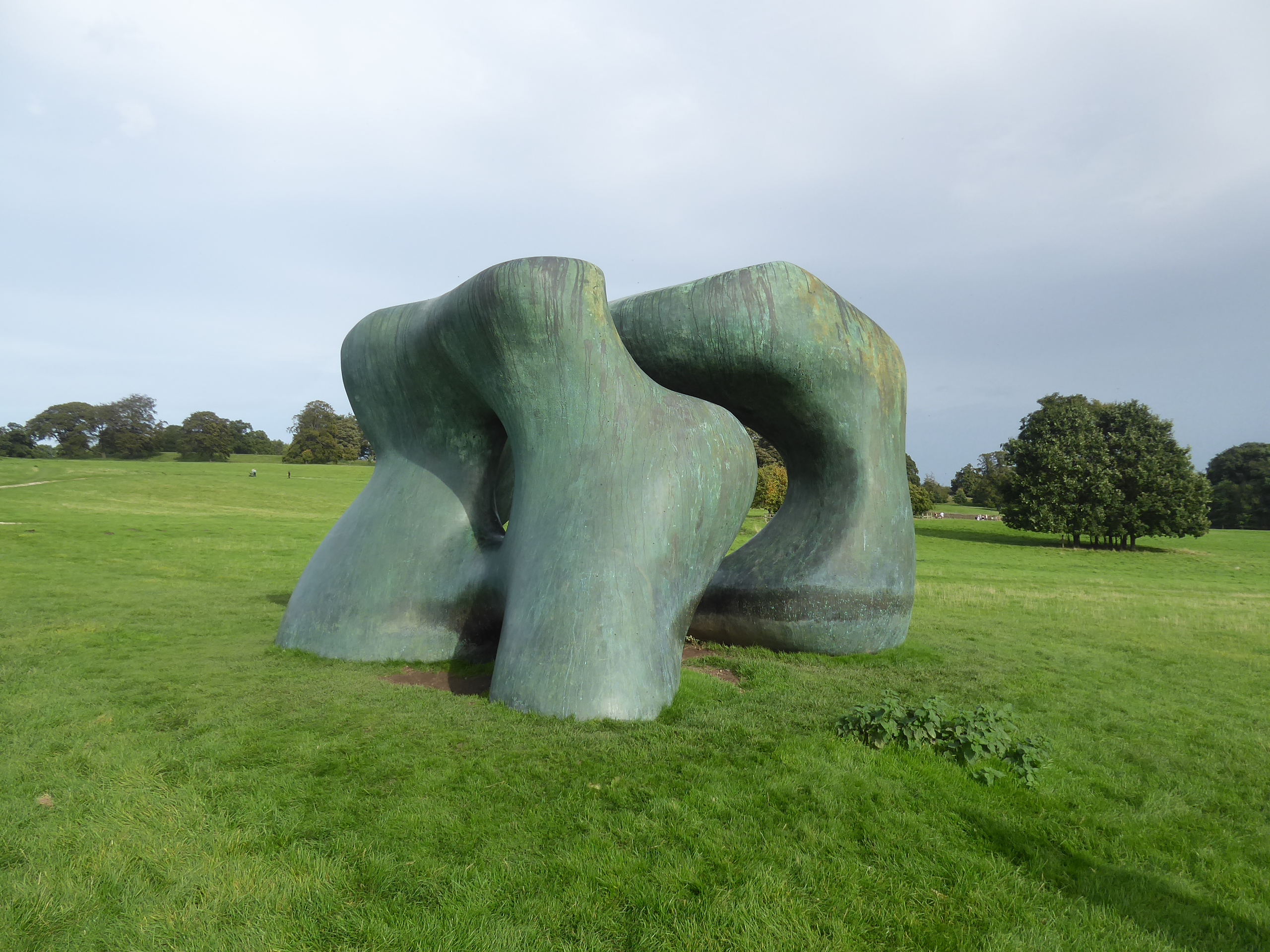
Of course, a pleasant and finally sunny afternoon Autumnal afternoon demands a walk in the park, and I'll crash for a YSP entrance fee for the both of us, and I'd have figured that Mum would be good for a wander around the galleries and a brew in the tearooms, but she's ready for a purposeful stroll into the Country Park, setting a course down to the chapel of St Bartholomew where we can find Leonardo Drew's Number 360 dominating the interior, a wild and kinetic sculpture in shattered wood panels that seem quite overwhelming, if you're willing to look at that way, to be contemplated well before we head back into the open to regard the Henry Moore's in the main parkland, which seem much better when regarded up close, like we do to Two Large Forms and Spindle Piece. Downhill we then head, virtually to the bottom of the Dearne Valley, to enter the Lower Park, to take a gander at the famous pair of Anthony Caro's in the shadow of Bretton Hall, Promenade and Dream City, before Mum can be rather taken by Ai Weiwei's Circle of Animals/Zodiac Heads and I can make a case for Sean Scully's Wall Dale Cubed, as a fan of all things Monumental before we start the drag bag uphill, on the shaded path where many smaller pieces can be seen, with our notable picks being Joao Vasco Paiva's Standard Kitchen and Marialuisa Tadei's Night & Day and Octopus. It's also worth noting all the birdboxes that may be an installation in the Hidden Forest before stop for the necessary revivifying brew at the YSP Learning Centre, before we complete our circuit with a press uphill to the main galleries where the work of Erwin Wurm has a particular focus in the Trap of Truth exhibition, which has a sort of Jeff Koons energy as it sits at the very edge of pop cultural bad taste, though it does raise a smile or too from some of the influences it seems to source, with the Blues Brothers, David Byrne's Big Suit and various early internet gifs being among them to my eyes, a fun little capper to our two hour tour, which Mum enjoyed a lot I'm happy to say (even though an extra mile or two, after the 13 I've already trekked, on my already rock hard calves, could have been a lot easier on me!).
 |
| Robert Indiana's LOVE. |
 |
| Leonardo Drew's Number 360. |
 |
| Henry Moore's Two Large Forms. |
 |
| Anthony Caro's Promenade, and Dream City. |
 |
| Ai Weiwei's Circle of Animals/Zodiac Heads. |
 |
| Sean Scully's Wall Dale Cubed. |
 |
| Joao Vasco Paiva's Standard Kitchen. |
 |
| Marialuisa Tadei's Octopus. |
 |
| Erwin Wurm' Balzac. |
 |
| Erwin Wurm's Big Disobedience. |
 |
| Erwin Wurm's Big Suit. |
 |
| Erwin Wurm's Giants. |
5,000 Miles Cumulative Total: 6193.1 miles
2023 Total: 270.9 miles
Up Country Total: 5,701.3 miles
Solo Total: 5850.5 miles
5,000 in my 40s Total: 4793 miles
Destinations Moved from Tier 2 to Tier 1: Ossett, Bretton Park
Destinations Moved from Tier 3 to Tier 1: West Bretton
Destinations Moved from Tier 3 to Tier 2: Wintersett
Trails moved from Tier 3 to Tier 2: 2
Next Up: Heading towards the Aire Valley again, before Autumn bites down.


No comments:
Post a Comment