18.5 miles, via Haslingden Grane, Pickup Bank, Hoddlesden, Darwen, Sunnyhurst Wood, Roddlesworth Reservoirs, Withnell, Brinscall, Wheelton & Whittle-Le-Woods.
First rest day of my jollies features catching the Tour of Britain cycle race, and the Roman remains in Ribchester, as well as me feeling deeply tired after Sunday's excursion, but I'm going to have myself prepped for a big day as the plan for Tuesday is one of those routes in which I might well have over-reached myself, such is my desire to cross Lancashire in only three days of walking. Inspire my parents to get me out early and down the A680 for a start at the main crossroads in Haslingden at 9.20am, departing down Warner Street and Grane Road, immediately noticing that we are going downhill, a good start when you know there's a lot of uphill to come, passing below the A56 and the former L&Y line that ran up the valley between Ramsbottom and Accrington. Grane Road continues, rising into the Valley of Haslingden Grane, past cemetery and the Holden Arms, where I break off from the road to meet the path over the dam of Holden Wood Reservoir, following the path up towards Tenements farm and then rising over the rough grass to the elevated path which will lead us up the valleys side. A decent surface and clear waymarking of the Rossendale Way means easy going as we rise above Ogden Reservoir, with the steep slopes up to Musbury Heights off to our south, and sight of the windfarm on Oswaldtwistle Moor to the north, continuing above Calf Hey Reservoir which seems to be a popular spot for joggers and dog walkers. Slip into the woods and traverse a couple of stream crossing before getting a confusing moment as we start to rise up the valley head as the path has been moved from its location on my map. The clear route is the correct one though, leading through stickiness at a clough crossing and around some romantically ruined farmsteads before a grassy rise takes us up to Edgerton Moss and the remnants of quarrying, where I manage to completely lose the correct path.
Wednesday, 9 September 2015

Monday, 7 September 2015
Todmorden to Haslingden 06/09/15
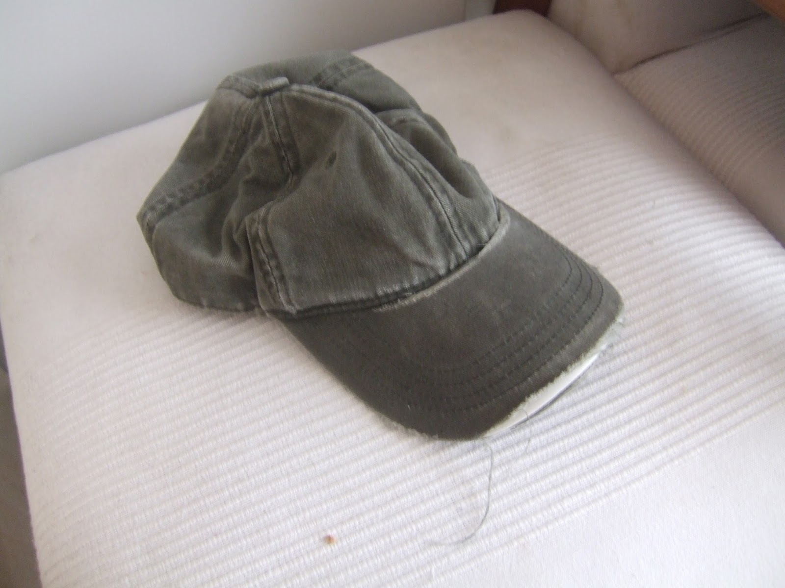 |
| My Faithful Companion of 5+ years, Dead but not yet Buried. |
11.4 miles, via Todmorden Moor, Bacup, Rossendale & Rawtenstall.
Monday, 31 August 2015
Moorthorpe to Pontefract 30/08/15
13.6 miles, via South Kirkby Colliery, Upton, Badsworth, Low Ackworth, East Hardwick, Darrington & Baghill.
August Bank Holiday weekend comes around, but only one day of walking can come from it as I really needed the lie-in on Saturday morning, and the Monday drops from the schedule because the weather looks like utter garbage, again, so the Sunday is the only good day of the weekend, with the restricted transportation options spoiling my original plan, but a small amount of tinkering means it's virtually walkable in reverse. So early trains ahoy for a ride out to Moorthorpe, the other station on the other line in the South Kirkby - South Elmsall conurbation, and it's a 9.25am start once I've gotten away from the confusing mess of ramps and footbridges, heading west along Barnsley Road to the Carr Lane corner and find lot more late 20th century suburbia in the vicinity than I had expected, having anticipated many more colliery terraces in the lands which surrounded the South Kirkby site. Graze the edge of the main sit by the landscaped tip, and meet the path that leads beneath both of the railway lines again, taking care to stay on the correct surface this time, and the ongoing route north will spend a most of its distance shadowing the latter of these lines, and calling it by its original name of the Swinton & Knottingley Joint Railway makes a lot more sense than its contemporary name of the 'Dearne Valley Line'. What I thought would be a walk along a field track turns out to be a long trek through a lot more landscaped colliery workings, making the South Kirkby site easily as extensive as the one at Frickley, and it's a popular track with the dog walkers too, a large green space to keep Upton separate from South Elmsall and Kirkby. The arrival by the A6201, post-dating my map, forces me into a bit of guessing to pick the right path into Upton, and once past the old house by the former Hull & Barnsley railway, this coal town reveals itself to be almost entirely suburbia in this quarter, the only notable old buildings be the rough stone Old Shop on the High Street corner, and the farmhouse on Field Lane at the crest of Beacon Hill. The notable feature, visible for miles, is the water tower, concrete and funnel shaped, but an extra trip over toward it seems unnecessary as it hides behind the houses for most of the trip through the village, only showing up well once the walk down the other side of the hill starts. By that point however, attention goes forwards to the vista to the north, Badsworth looking picturesque among the harvesting fields, and Pontefract on its hillsides appearing off in the distance, giving the deceptive impression of us already being close to the day's end.
August Bank Holiday weekend comes around, but only one day of walking can come from it as I really needed the lie-in on Saturday morning, and the Monday drops from the schedule because the weather looks like utter garbage, again, so the Sunday is the only good day of the weekend, with the restricted transportation options spoiling my original plan, but a small amount of tinkering means it's virtually walkable in reverse. So early trains ahoy for a ride out to Moorthorpe, the other station on the other line in the South Kirkby - South Elmsall conurbation, and it's a 9.25am start once I've gotten away from the confusing mess of ramps and footbridges, heading west along Barnsley Road to the Carr Lane corner and find lot more late 20th century suburbia in the vicinity than I had expected, having anticipated many more colliery terraces in the lands which surrounded the South Kirkby site. Graze the edge of the main sit by the landscaped tip, and meet the path that leads beneath both of the railway lines again, taking care to stay on the correct surface this time, and the ongoing route north will spend a most of its distance shadowing the latter of these lines, and calling it by its original name of the Swinton & Knottingley Joint Railway makes a lot more sense than its contemporary name of the 'Dearne Valley Line'. What I thought would be a walk along a field track turns out to be a long trek through a lot more landscaped colliery workings, making the South Kirkby site easily as extensive as the one at Frickley, and it's a popular track with the dog walkers too, a large green space to keep Upton separate from South Elmsall and Kirkby. The arrival by the A6201, post-dating my map, forces me into a bit of guessing to pick the right path into Upton, and once past the old house by the former Hull & Barnsley railway, this coal town reveals itself to be almost entirely suburbia in this quarter, the only notable old buildings be the rough stone Old Shop on the High Street corner, and the farmhouse on Field Lane at the crest of Beacon Hill. The notable feature, visible for miles, is the water tower, concrete and funnel shaped, but an extra trip over toward it seems unnecessary as it hides behind the houses for most of the trip through the village, only showing up well once the walk down the other side of the hill starts. By that point however, attention goes forwards to the vista to the north, Badsworth looking picturesque among the harvesting fields, and Pontefract on its hillsides appearing off in the distance, giving the deceptive impression of us already being close to the day's end.
Sunday, 23 August 2015
Normanton to Barnsley 22/08/15
14.4 miles, via Goose Hill, Crofton, Anglers Country Park, Cold Hiendley, Royston Junction, Athersley & the Dearne Valley.
Three years on from making my initial discoveries of the lost railways of West Yorkshire, by brain has finally started to make sense of the confused tangle of lines that developed across the Wakefield and South Yorkshire boundary, and with the 2015 season in its final third, it's time to start putting them down before the days start getting short again. Not that I'm managing to get going at speed, hopping off the train at Normanton station at 10am, hoping that the early mornings rains have had a chance to pass, and making the long way off the station by the hugely long footbridge, away from the ridiculously large single platform that had been intended as the major junction of George Hudson's railway empire in the 1840s. There's not a lot of vintage buildings to be found in the immediate vicinity, but I note that the new apartments on Railway Terrace at least attempt to ape the style of the original station buildings, and I soon meet my track out of town, along Wakefield Road, with mostly council flats for company, though the Roman Catholic church of St John the Baptist and the primitive Methodist Chapel both have a style to attract attention. Goosehill Road has a ginnel at its end to lead me into the countryside, sending me on a field walk to the private road leading to the Welbeck reclamation and recycling site which is gradually filling up the opencast pits which once mined coal along the banks of the Calder, and I'm coming this way to get a look at the site of Goose Hill Junction, and I'm sure that they won't mind me trespassing on the old industrial tracks to get there. I've talked about the old North Midland Mainline before, (1840-1985 for those keeping track) and tracing the section from Goose Hill to Oakenshaw is a trek which cannot be done a track level as it is so thoroughly overgrown, and so a path needs to follow paths that shadow it, passing over the bridges at Goose Hill, and shadowing it on the footpath from Cross Hills farm to Warmfield Road, where a peer from the high bridge will reveal that a lagoon has developed at track level, large enough to go boating on. Shadow again down to the A655, where trees obscure any view down into the cutting, and the main road's footway is paced down to the cluster of buildings at the edge of Heath Common before field walking to an old footbridge over the formation, where the only decent look down to the trackbed can be obtained. Odd that it could be so overgrown after having been closed only 30 years, and that Wakefield MDC hasn't been able to gain access to it, I'd imagine that this is one line that might be on the future slate for revival as an international heavy freight line.
Three years on from making my initial discoveries of the lost railways of West Yorkshire, by brain has finally started to make sense of the confused tangle of lines that developed across the Wakefield and South Yorkshire boundary, and with the 2015 season in its final third, it's time to start putting them down before the days start getting short again. Not that I'm managing to get going at speed, hopping off the train at Normanton station at 10am, hoping that the early mornings rains have had a chance to pass, and making the long way off the station by the hugely long footbridge, away from the ridiculously large single platform that had been intended as the major junction of George Hudson's railway empire in the 1840s. There's not a lot of vintage buildings to be found in the immediate vicinity, but I note that the new apartments on Railway Terrace at least attempt to ape the style of the original station buildings, and I soon meet my track out of town, along Wakefield Road, with mostly council flats for company, though the Roman Catholic church of St John the Baptist and the primitive Methodist Chapel both have a style to attract attention. Goosehill Road has a ginnel at its end to lead me into the countryside, sending me on a field walk to the private road leading to the Welbeck reclamation and recycling site which is gradually filling up the opencast pits which once mined coal along the banks of the Calder, and I'm coming this way to get a look at the site of Goose Hill Junction, and I'm sure that they won't mind me trespassing on the old industrial tracks to get there. I've talked about the old North Midland Mainline before, (1840-1985 for those keeping track) and tracing the section from Goose Hill to Oakenshaw is a trek which cannot be done a track level as it is so thoroughly overgrown, and so a path needs to follow paths that shadow it, passing over the bridges at Goose Hill, and shadowing it on the footpath from Cross Hills farm to Warmfield Road, where a peer from the high bridge will reveal that a lagoon has developed at track level, large enough to go boating on. Shadow again down to the A655, where trees obscure any view down into the cutting, and the main road's footway is paced down to the cluster of buildings at the edge of Heath Common before field walking to an old footbridge over the formation, where the only decent look down to the trackbed can be obtained. Odd that it could be so overgrown after having been closed only 30 years, and that Wakefield MDC hasn't been able to gain access to it, I'd imagine that this is one line that might be on the future slate for revival as an international heavy freight line.
Sunday, 16 August 2015
Wakefield to South Elmsall 15/08/15
15.9 miles, via Belle Vue, Heath Common, Sharlston, Foulby, Nostell Colliery, Fitzwilliam, Brackenhill, Hemsworth & South Kirkby Colliery.
Having gotten 75 miles of the Wakefield Way under my feet, I start to feel like I have seen most of what that that district has to offer, but a look at the map will show things up very differently, lots of blank spaces that would have me thinking 'I will go there!', a la Joseph Conrad, and so a trail to the southeast is planned from the city to the remotest corner, which experience shows isn't that remote at all. Hop off the train at Wakefield Westgate at 9.25am, and make steps down Mulberry Way, the station having retreated from its namesake road, and the last time I wandered up Westgate was in 1999 on a works leaving do, and it hasn't changed much since then, a once proud mix of banks and mid-sized department stores that is now entirely made up of clubs and bars, the lack of revellers does render it prettier of course. Find a fresh route down to the Calder by detouring through the Ridings shopping centre, finding that the pedestrian way does not shadow the old rout of Southgate, and emerge to continue south on George Street and Thornhill Street through a district that seems like it slipped through time to meet Ings Lane and pass under the railway bridges before crossing the Calder on the Doncaster Road bridge, passing the Hepworth and the Waterfront developments, to continue along the A638 through the terraces of Belle Vue, a district best known as the home of Wakefield Trinity Wildcats, the Rugby League team so good they nick-named them twice. Pass under the Wakey - Ponte line, and across the old course of the Barnsley Canal, to finding our path into the relatively unknown, joining the A655 as it rises over Heath Common, the extensive patch of wild ground that has endured so close to the city, offering some good views back as it rises, before breaking off by the pub and farmsteads at the top of Hell Lane (really), and along stretch of road walking follows. The immediate point of interest is the bridge over the North Midland mainline, the section completely withdrawn from use in the 1980a and over grown with trees in less than 30 years, and the continuing lane does not live up to its name either, giving us cool and shady sections to enjoy with minimal interruptions from traffic as it rises to the fields outside New Sharlston, once home to Sharlston Main colliery, only recently wiped from the map, and now home to a group of terrace just a bit too far removed from Sharlston common, with half a winding wheel displayed by the roadside to illustrate the passage of heavy industry from this landscape.
Having gotten 75 miles of the Wakefield Way under my feet, I start to feel like I have seen most of what that that district has to offer, but a look at the map will show things up very differently, lots of blank spaces that would have me thinking 'I will go there!', a la Joseph Conrad, and so a trail to the southeast is planned from the city to the remotest corner, which experience shows isn't that remote at all. Hop off the train at Wakefield Westgate at 9.25am, and make steps down Mulberry Way, the station having retreated from its namesake road, and the last time I wandered up Westgate was in 1999 on a works leaving do, and it hasn't changed much since then, a once proud mix of banks and mid-sized department stores that is now entirely made up of clubs and bars, the lack of revellers does render it prettier of course. Find a fresh route down to the Calder by detouring through the Ridings shopping centre, finding that the pedestrian way does not shadow the old rout of Southgate, and emerge to continue south on George Street and Thornhill Street through a district that seems like it slipped through time to meet Ings Lane and pass under the railway bridges before crossing the Calder on the Doncaster Road bridge, passing the Hepworth and the Waterfront developments, to continue along the A638 through the terraces of Belle Vue, a district best known as the home of Wakefield Trinity Wildcats, the Rugby League team so good they nick-named them twice. Pass under the Wakey - Ponte line, and across the old course of the Barnsley Canal, to finding our path into the relatively unknown, joining the A655 as it rises over Heath Common, the extensive patch of wild ground that has endured so close to the city, offering some good views back as it rises, before breaking off by the pub and farmsteads at the top of Hell Lane (really), and along stretch of road walking follows. The immediate point of interest is the bridge over the North Midland mainline, the section completely withdrawn from use in the 1980a and over grown with trees in less than 30 years, and the continuing lane does not live up to its name either, giving us cool and shady sections to enjoy with minimal interruptions from traffic as it rises to the fields outside New Sharlston, once home to Sharlston Main colliery, only recently wiped from the map, and now home to a group of terrace just a bit too far removed from Sharlston common, with half a winding wheel displayed by the roadside to illustrate the passage of heavy industry from this landscape.
Sunday, 9 August 2015
Halifax to Todmorden 08/08/15
14.1 miles, via Savile Park, Sowerby Bridge, Sowerby, Boulder Clough, Mytholmroyd, Erringden Grange, Eastwood & Cross Stone.
A weekend drops out because of the challenges of Summer working, but now we have another bright day for the trail to the Irish Sea, maybe the most benign weather I have ever encountered in Calderdale, and let's face it, it's been a while since I ventured into this quarter on foot, nearly two years since my high moor explorations and even longer since I started walking it laterally, so 9.25am in the sunshine is our start time, and this is gonna be a long one as the district knows how to bring the challenges even when not venturing to moorland altitude. Setting out along Church Street and Prescott Street has Halifax bringing me more surprises in its styling, the warehouses still standing proud in the Hebble valley, and building such as the County courts and the swimming pool suggesting an enduring civic pride that I might not have expected, and my route of choice along Savile Road is a long parade of proud Victorian town houses and apartment buildings, many falling into the compass of the Calderdale Royal Infirmary these days. Altogether, I've probably picked the best and prettiest axis through this town, and it continues as our path swings down through the terraces that border onto Savile Park, the town's major open space, sitting above the river valley after the first uphill drag of the day and filling up for the local carnival as we pass. My trail leads to the A646 crossing an into the woods around a forgotten graveyard to get an up close look at Wainhouse Tower, the 84m tall tower/folly/chimney of 1874 that is a standard candle for these parts and on that I have never encountered up close, worth a look to see just how eccentric the late Victorian industrialists could be. Descents then follow, with views into Calderdale from Wakefield Gate, slipping among the terraces on Upper Washer Lane and then steep drop down to the A6026 follows Washer lane as I ponder exactly where the break between Halifax and Sowerby Bridge might actually be. Canal Road crosses me over both Canal and Calder, naturally, with leafiness and industry enduring at the riverside along Holme Lane, which brings me up on the railway station, almost unexpectedly, and slip beneath it via that deceptively heighted bridge. Station Road is the familiar corner of the town for me, and it is soon departed as the roads diverge on their different tracks to the south, with us taking Sowerby New Road for a long steady ascent out of the town, soon rising above Calderdale for some fine views west towards Luddenden Dean and Midgeley Moor, whilst suburban growth sits on the upper side of the road, providing an aspect worth purchasing.
A weekend drops out because of the challenges of Summer working, but now we have another bright day for the trail to the Irish Sea, maybe the most benign weather I have ever encountered in Calderdale, and let's face it, it's been a while since I ventured into this quarter on foot, nearly two years since my high moor explorations and even longer since I started walking it laterally, so 9.25am in the sunshine is our start time, and this is gonna be a long one as the district knows how to bring the challenges even when not venturing to moorland altitude. Setting out along Church Street and Prescott Street has Halifax bringing me more surprises in its styling, the warehouses still standing proud in the Hebble valley, and building such as the County courts and the swimming pool suggesting an enduring civic pride that I might not have expected, and my route of choice along Savile Road is a long parade of proud Victorian town houses and apartment buildings, many falling into the compass of the Calderdale Royal Infirmary these days. Altogether, I've probably picked the best and prettiest axis through this town, and it continues as our path swings down through the terraces that border onto Savile Park, the town's major open space, sitting above the river valley after the first uphill drag of the day and filling up for the local carnival as we pass. My trail leads to the A646 crossing an into the woods around a forgotten graveyard to get an up close look at Wainhouse Tower, the 84m tall tower/folly/chimney of 1874 that is a standard candle for these parts and on that I have never encountered up close, worth a look to see just how eccentric the late Victorian industrialists could be. Descents then follow, with views into Calderdale from Wakefield Gate, slipping among the terraces on Upper Washer Lane and then steep drop down to the A6026 follows Washer lane as I ponder exactly where the break between Halifax and Sowerby Bridge might actually be. Canal Road crosses me over both Canal and Calder, naturally, with leafiness and industry enduring at the riverside along Holme Lane, which brings me up on the railway station, almost unexpectedly, and slip beneath it via that deceptively heighted bridge. Station Road is the familiar corner of the town for me, and it is soon departed as the roads diverge on their different tracks to the south, with us taking Sowerby New Road for a long steady ascent out of the town, soon rising above Calderdale for some fine views west towards Luddenden Dean and Midgeley Moor, whilst suburban growth sits on the upper side of the road, providing an aspect worth purchasing.
Sunday, 26 July 2015
Morley to Halifax 25/07/15
13.5 miles, via Gildersome Street, Birstall, Gomersal, Drub, Hunsworth, White Chapel, Scholes, Wyke, Norwood Green, Hipperholme & Shibden.
Despite trail the idea of a trek to the Irish Sea coast at the very start of the season, it has taken quite a while for it to actually come into my plans for the year, with the decision not being made until after the completion of the Wakefield Way, when it should have dropped immediately into my plans on the seafront at Hornsea. So two months on from meeting the North Sea coast, the trail leads in the opposite direction, a bright day coming on as I blaze my second trail in the direction of Halifax, using a completely fresh route to boot, starting out from Queen Street at 9.05am, and cutting west through the Windsor Court shopping parade and Morrisons car park to Corporation Street, and departing the town via the council estate on Wynyard Drive and up Bruntcliffe Road past the cemetery and the secondary school. Off the A643 at the crossroads and onto a familiar track along the A650, past the industrial estate and checking out the few old remnants of the hamlet Gildersome Street that have endured since most of it was obliterated by the construction of Junction 27 of the M62, an intersection so large it takes 10 minutes to traverse it as I follow the A62 to Birstall Retail park. Onwards onto Kirklees after shadowing the regularly taken route to Ikea and Toys R Us, following the roadside through more industrial estates, passing below the abutment of the L&NWR bridge of the former Birstall station on the New Leeds Line, but missing the crossing that I made the last time I came this way, eventually meeting the A643 again, and passing the offices of the solicitors who handled my flat purchase all those years ago before rolling into Birstall town square. This village makes the most notable claim on Joseph Priestley, 18th century natural philosopher and Christian radical, it being the town of his birth with his statute watching the comings and goings in the surrounding streets, all very nicely laid out and appreciated before I press on down Low Lane, to take a detour along Kirkgate and around St Peter's parish church before re-joining the main road again. Hit the long haul up Church Lane, and its a rise I should have seen coming because there are many wrinkles in this landscape, rising out of this valley and on towards Gomersal up on the ridge, a village that I'm still not entirely sure has an actual centre but along the A651 has a prime trio of interesting buildings, the Jacobean Pollard hall, the Red House museum and the Neo-Classical public hall, but seriously, where are the shops?
Despite trail the idea of a trek to the Irish Sea coast at the very start of the season, it has taken quite a while for it to actually come into my plans for the year, with the decision not being made until after the completion of the Wakefield Way, when it should have dropped immediately into my plans on the seafront at Hornsea. So two months on from meeting the North Sea coast, the trail leads in the opposite direction, a bright day coming on as I blaze my second trail in the direction of Halifax, using a completely fresh route to boot, starting out from Queen Street at 9.05am, and cutting west through the Windsor Court shopping parade and Morrisons car park to Corporation Street, and departing the town via the council estate on Wynyard Drive and up Bruntcliffe Road past the cemetery and the secondary school. Off the A643 at the crossroads and onto a familiar track along the A650, past the industrial estate and checking out the few old remnants of the hamlet Gildersome Street that have endured since most of it was obliterated by the construction of Junction 27 of the M62, an intersection so large it takes 10 minutes to traverse it as I follow the A62 to Birstall Retail park. Onwards onto Kirklees after shadowing the regularly taken route to Ikea and Toys R Us, following the roadside through more industrial estates, passing below the abutment of the L&NWR bridge of the former Birstall station on the New Leeds Line, but missing the crossing that I made the last time I came this way, eventually meeting the A643 again, and passing the offices of the solicitors who handled my flat purchase all those years ago before rolling into Birstall town square. This village makes the most notable claim on Joseph Priestley, 18th century natural philosopher and Christian radical, it being the town of his birth with his statute watching the comings and goings in the surrounding streets, all very nicely laid out and appreciated before I press on down Low Lane, to take a detour along Kirkgate and around St Peter's parish church before re-joining the main road again. Hit the long haul up Church Lane, and its a rise I should have seen coming because there are many wrinkles in this landscape, rising out of this valley and on towards Gomersal up on the ridge, a village that I'm still not entirely sure has an actual centre but along the A651 has a prime trio of interesting buildings, the Jacobean Pollard hall, the Red House museum and the Neo-Classical public hall, but seriously, where are the shops?
Subscribe to:
Posts (Atom)